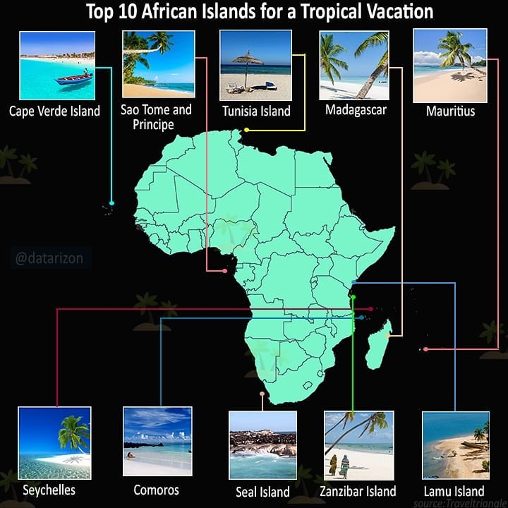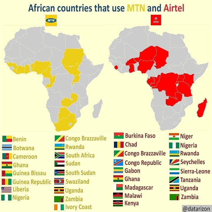
A researcher defined Cartography as the art and science of graphically representing a geographical area, usually on a flat surface such as a map or chart. But my general definition is Cartography is the art and science that opens ways for map creativity. Nikki Rosato says "A map is a symbol of living, breathing, moving body- the land is just as alive as we are"
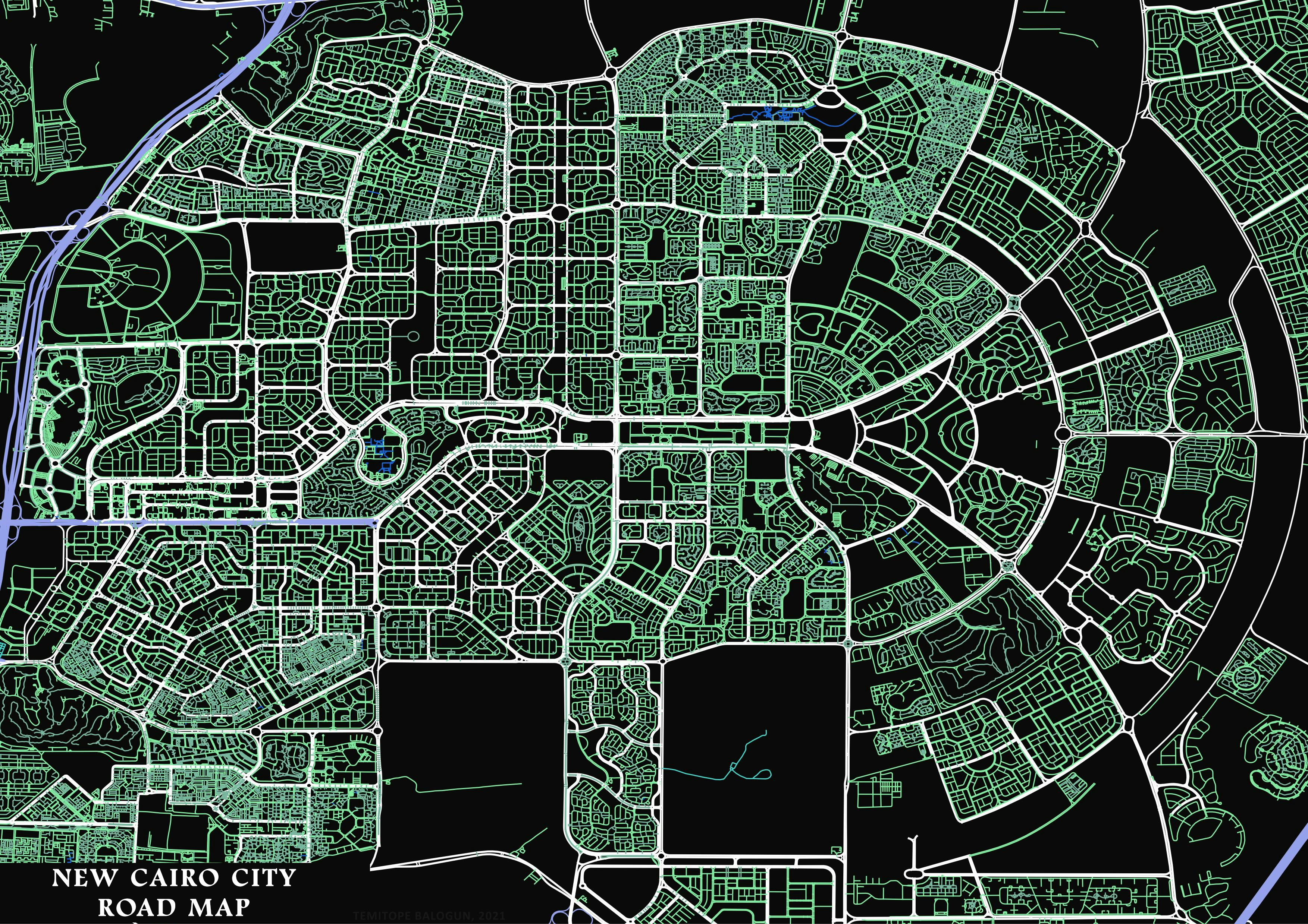
About New Cairo City(Shapefile used)
According to Wikipedia, is an Egyptian city covering an area of about 30,000 hectares (70,000 acres) on the southeastern edge of Cairo Governorate, 25 kilometres (15 mi) from Maadi. New Cairo is one of the new cities which have been built in and around Cairo to alleviate the congestion in downtown Cairo. It was established in the year 2000 by presidential decree number 191.
Methodology
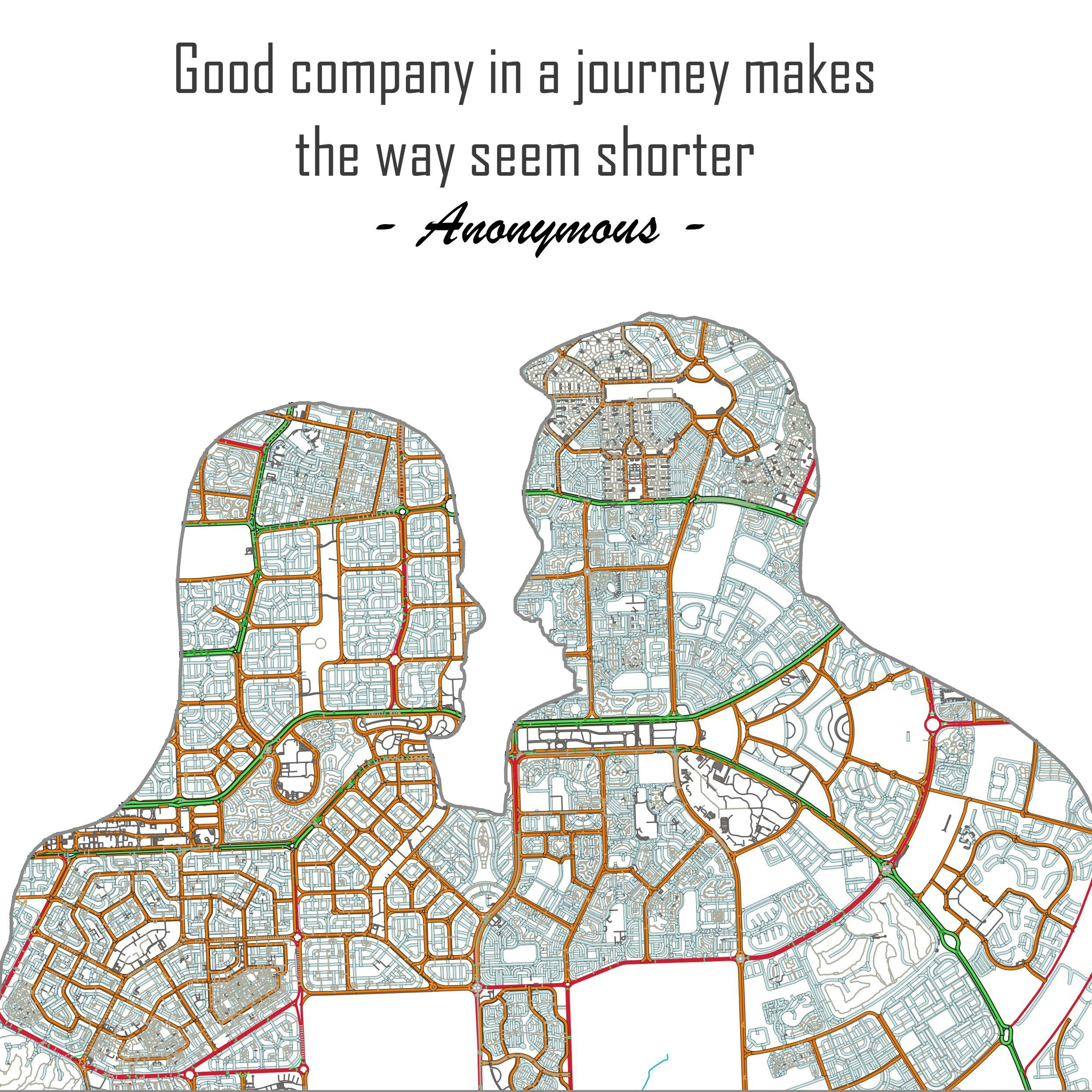
Firstly, A graphic Image of couples facing each other was downloaded and imported into ArcGIS Desktop Environment. The picture of the couples was traced out(not digitized) using drawing tool called polygon. Then, Road shapefile of Egypt was downloaded from Geofabrik and imported into the ArcGIS environment , the shapefile of Egypt road was changed from geographic coordinate system to a Projected coordinate system.
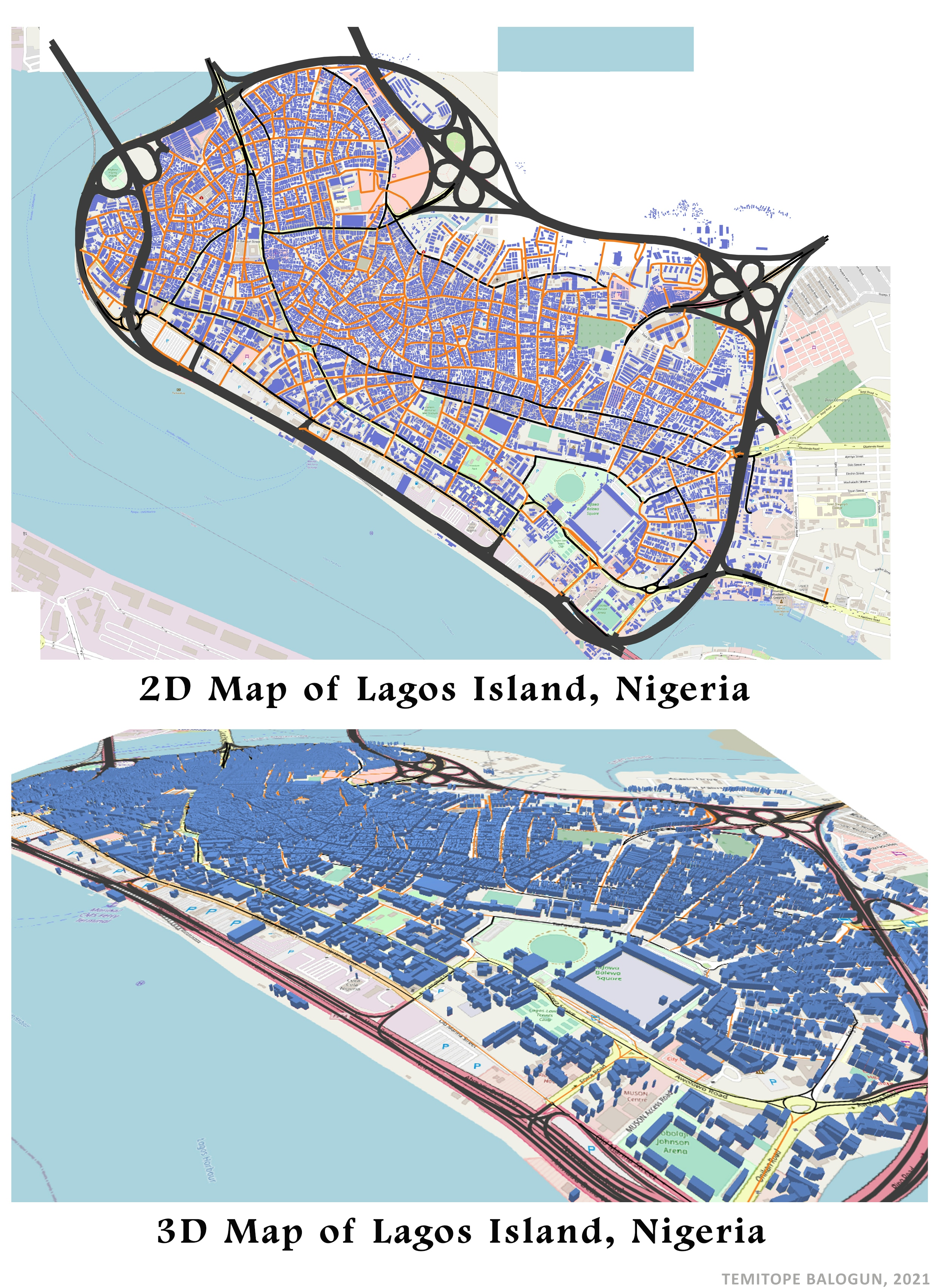
After conversion from GCS to PCS, The already traced graphic Polygon of the couples was adjusted to the location of New Cairo City. It was enlarged to cover a large area on the New Cairo road.. After the adjustment, the graphic polygon was converted to shapefile. and New Cairo City was clipped out from the entire Egypt Road shapefile using the already polygon shapefile. because New Cairo city road is well patterned. After clipping, the clipped road and the polygon shapefile was imported into QGIS.(I love to use QGIS for visualization) and the symbology of the road shapefile and the polygon shapefile was modified(change of color, increase of road width and so on). After the modification, it was visualized in Layout view then checked online for a suitable quote(quote about road, journey and relationship) for the visualization. You can create yours using your favorite city road shapefile.
Inspiration
Nikki Rosato created cut road map using paper cut. I created the cut road map using ArcGIS and QGIS
You can as well check my instagram and twitter page :@datarizonfor more of my works.