
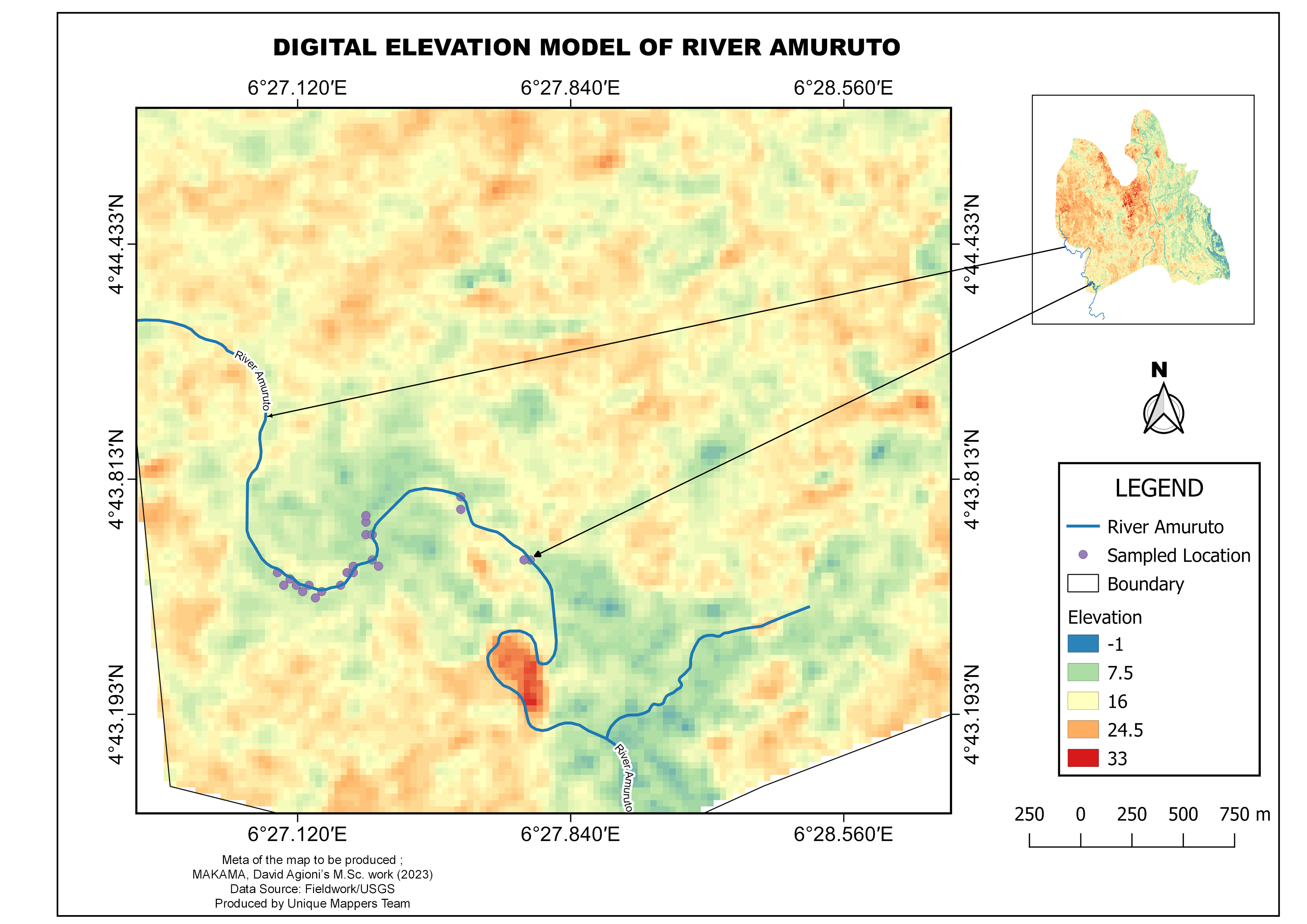
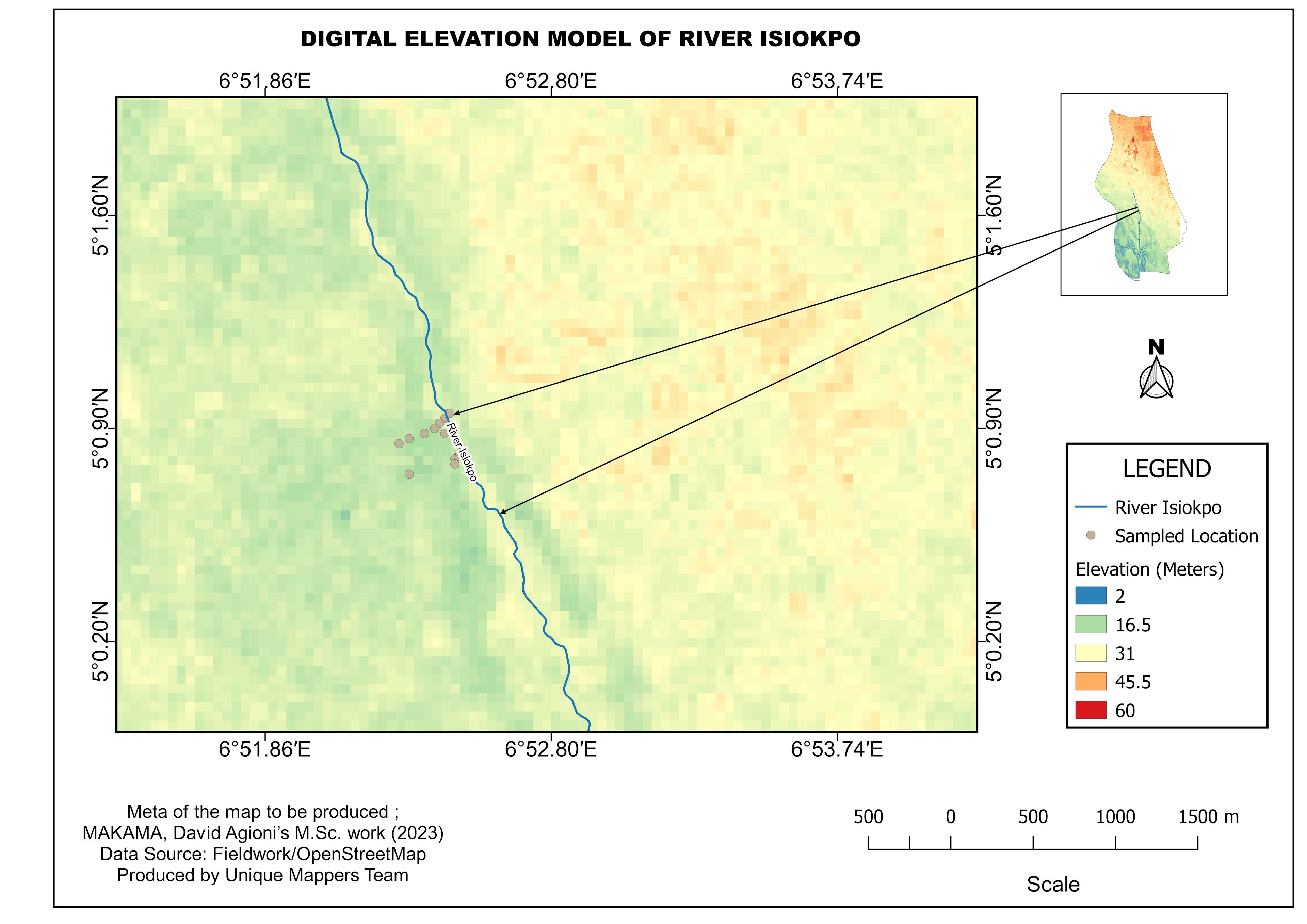
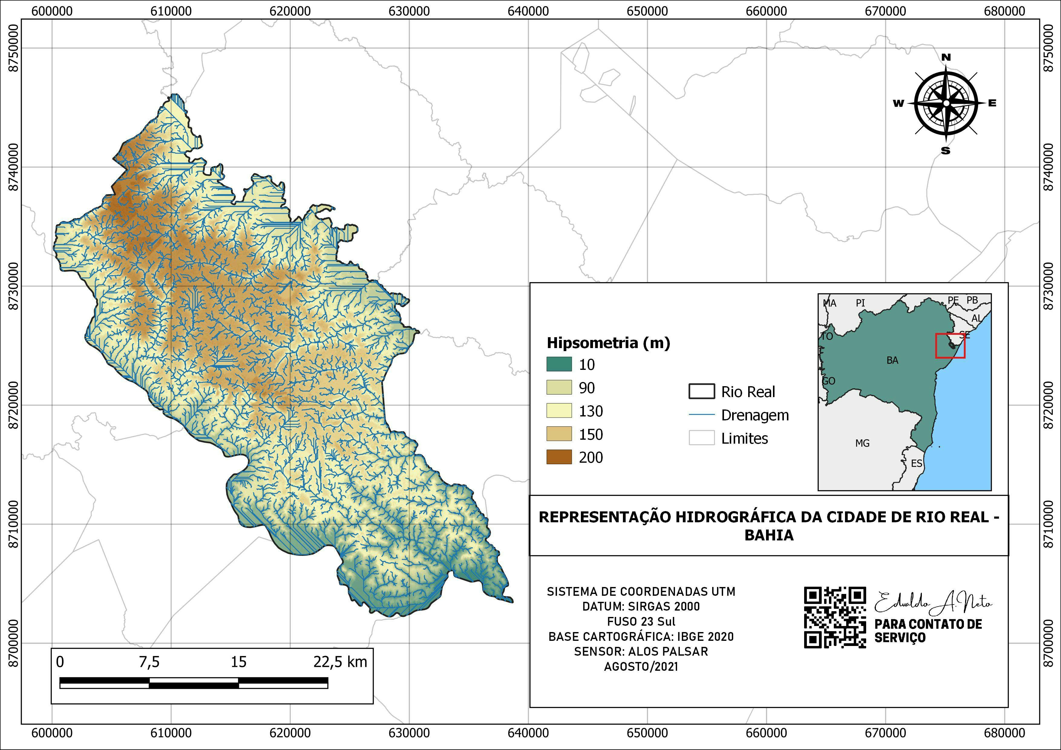
Coordinates of sample points along the flooded Amuruto River, DEM data was download from USGS, Vector data was download from HOT Tool database.
DEM of River Amuruto
Tools used
HOT Tasking ManagerQGISUSGS Earth Explorer
Plug-ins used
DEMRaster
tags
#QGIS #HIPSOMETRIA #HIPSOMETRY #SpatialNode
More by Akor, Daniel Enechojo

You might also like


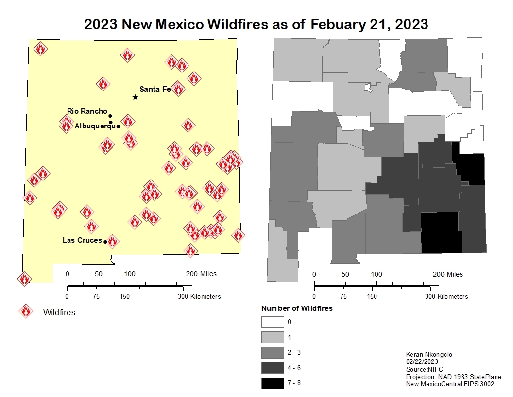
.svg "Keran Nkongolo")

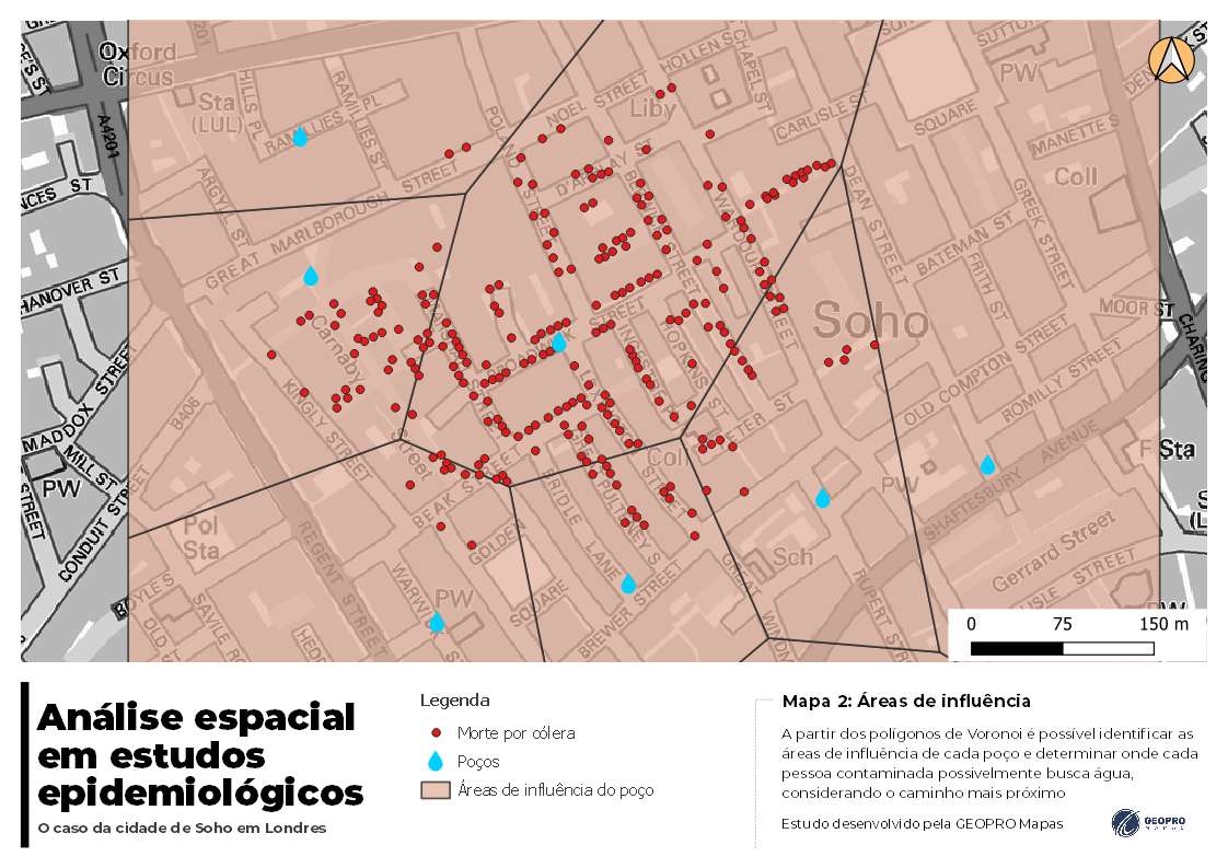
_645201.jpg&w=48&q=40 "Eguagie-suyi Precious")


Join the community!
We're a place where geospatial professionals showcase their works and discover opportunities.