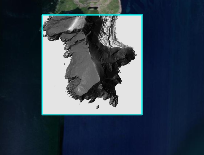
Norway offers really great elevation data at https://hoydedata.no/LaserInnsyn/, which I took as an opportunity to make a small project in ArcGIS Pro. The study area is the southern tip of the Lofoten Islands.
For this purpose I exported the area in ArcGIS Pro as a layout and to cut my data afterwards I wrote a small Python script, which creates a line layer. This layer contains a polyline, that delimits the previously selected area.
I then trimmed the 1m LIDAR DEM data using the polyline. The DEM data was then used to create a hillshade.


_9083060.png&w=3840&q=100)