
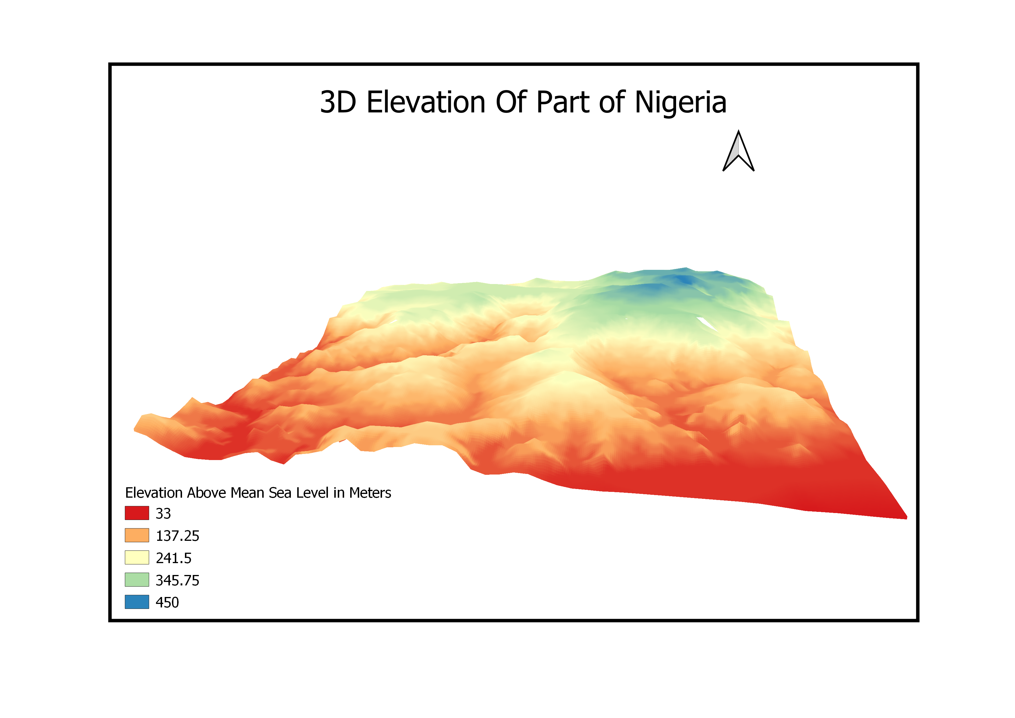
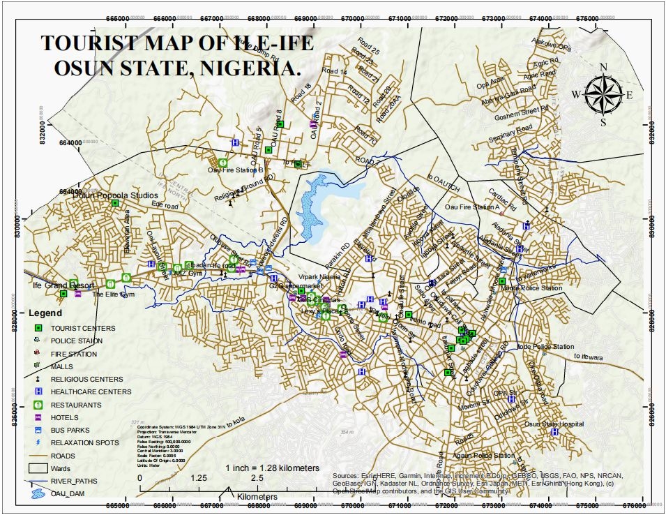
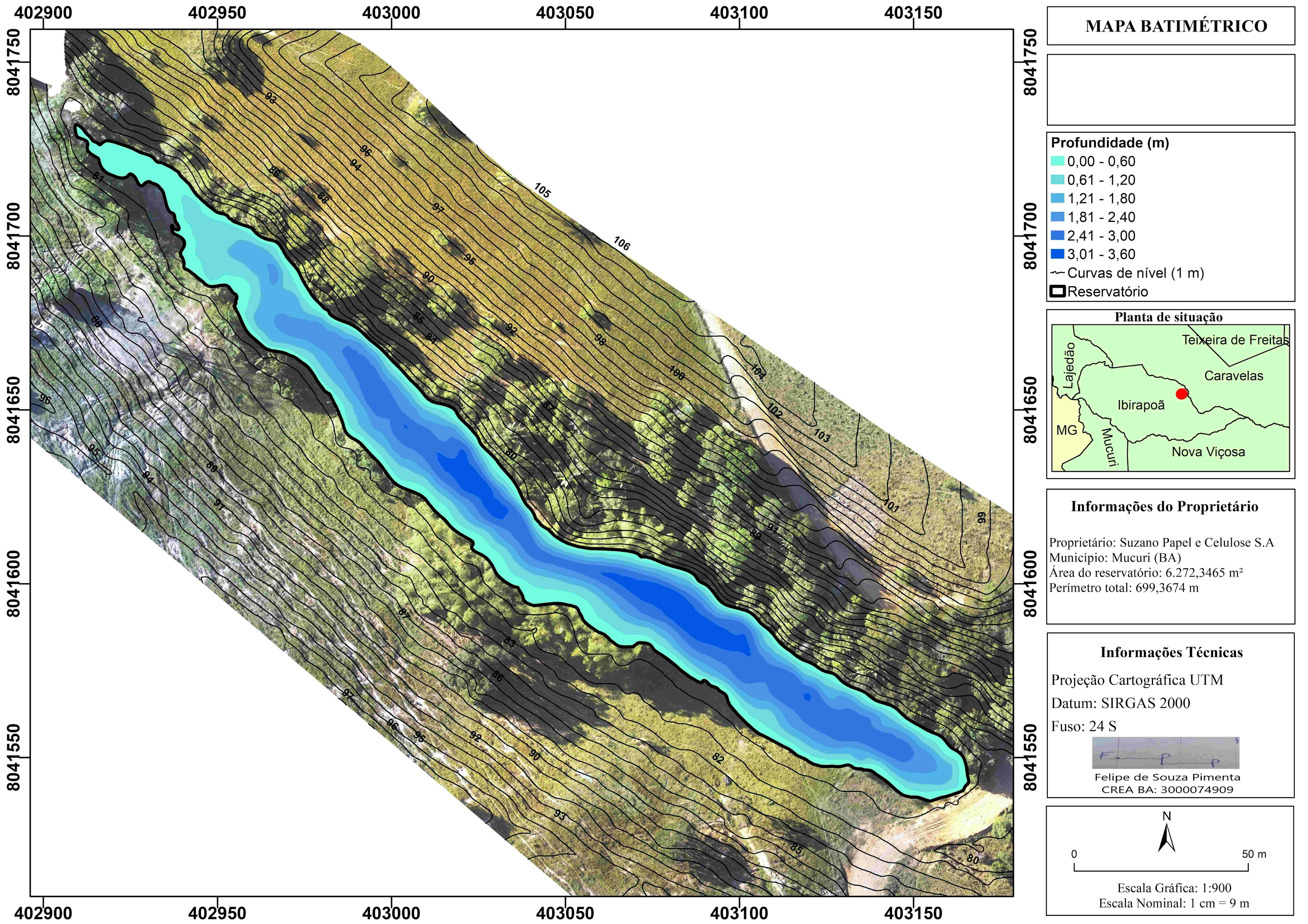
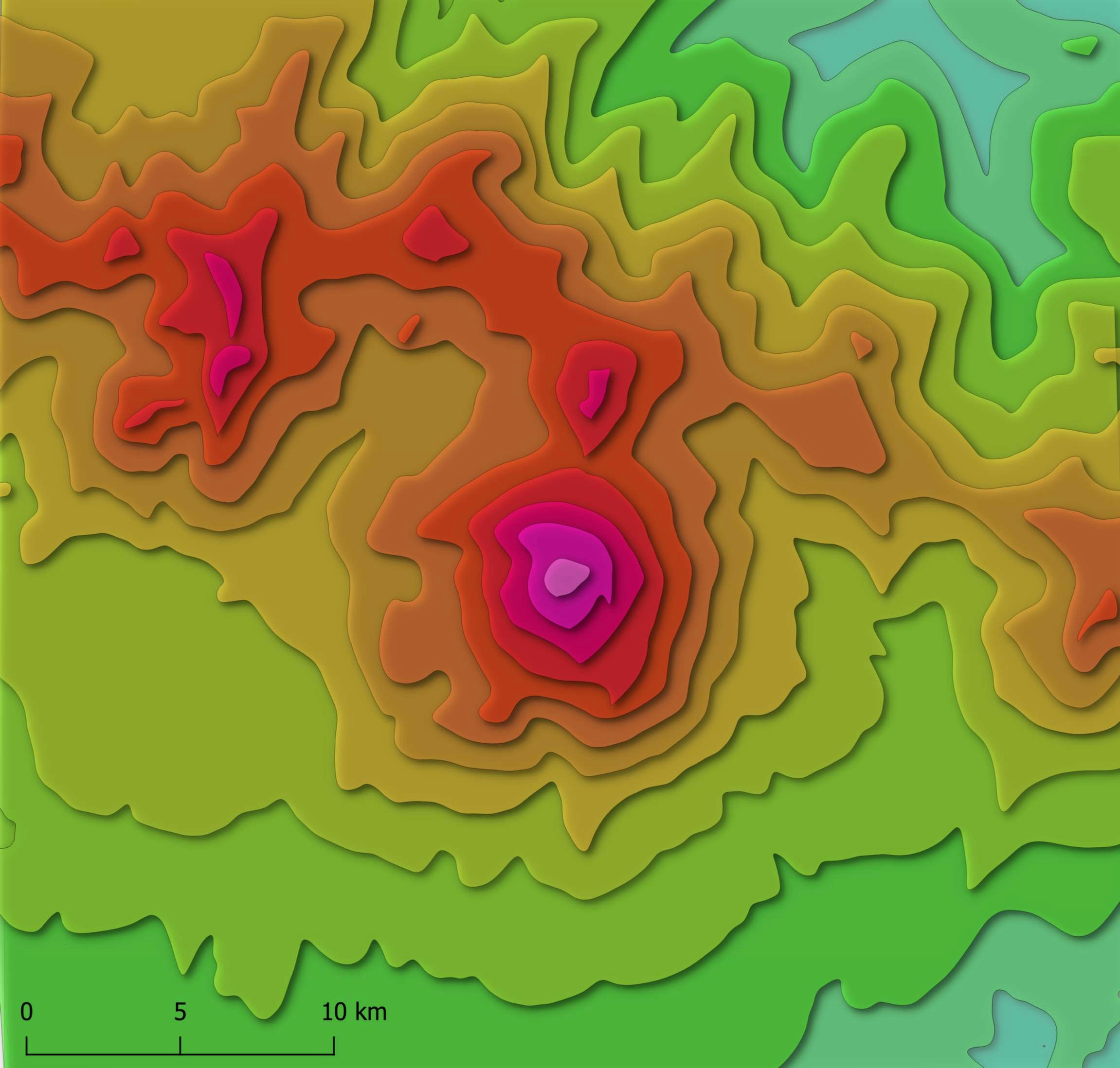
This project shows the Terrain elevation of a part of Nigeria.
Elevation Model
Tools used
QGIS
Plug-ins used
QGIS
tags
Digital Elevation ModelQGIStopographic map
More by Oswald Onimhawo
You might also like


Join the community!
We're a place where geospatial professionals showcase their works and discover opportunities.