
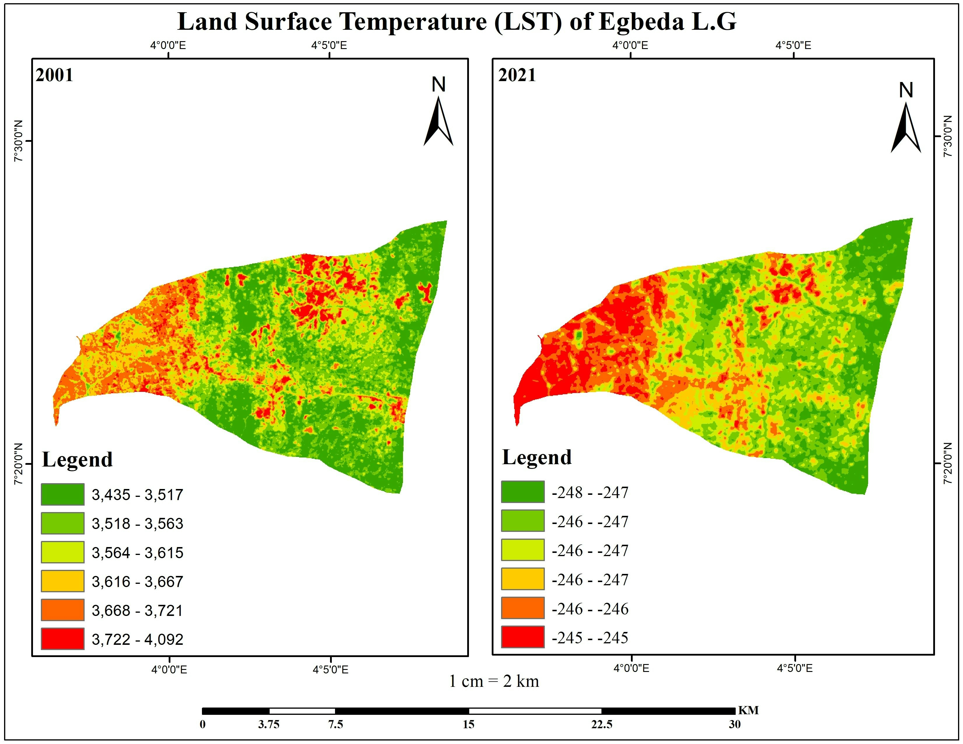
This map displays the Land Surface Temperature (LST) of Egbeda L.G over a 20-year interval. This temporal analysis offers valuable insights into the evolving thermal characteristics of the studied area, providing a basis for further investigation and informed decision-making in land management.
LAND SURFACE TEMPERATURE OF EGBEDA L.G
Plug-ins used
ArcMapND
tags
ArcMapGeospatialland coverSAGA GISSpatial analyst
You might also like


_2461995.png&w=48&q=40 "Carmem Lúcia Ribeiro da Costa Soares")


Join the community!
We're a place where geospatial professionals showcase their works and discover opportunities.