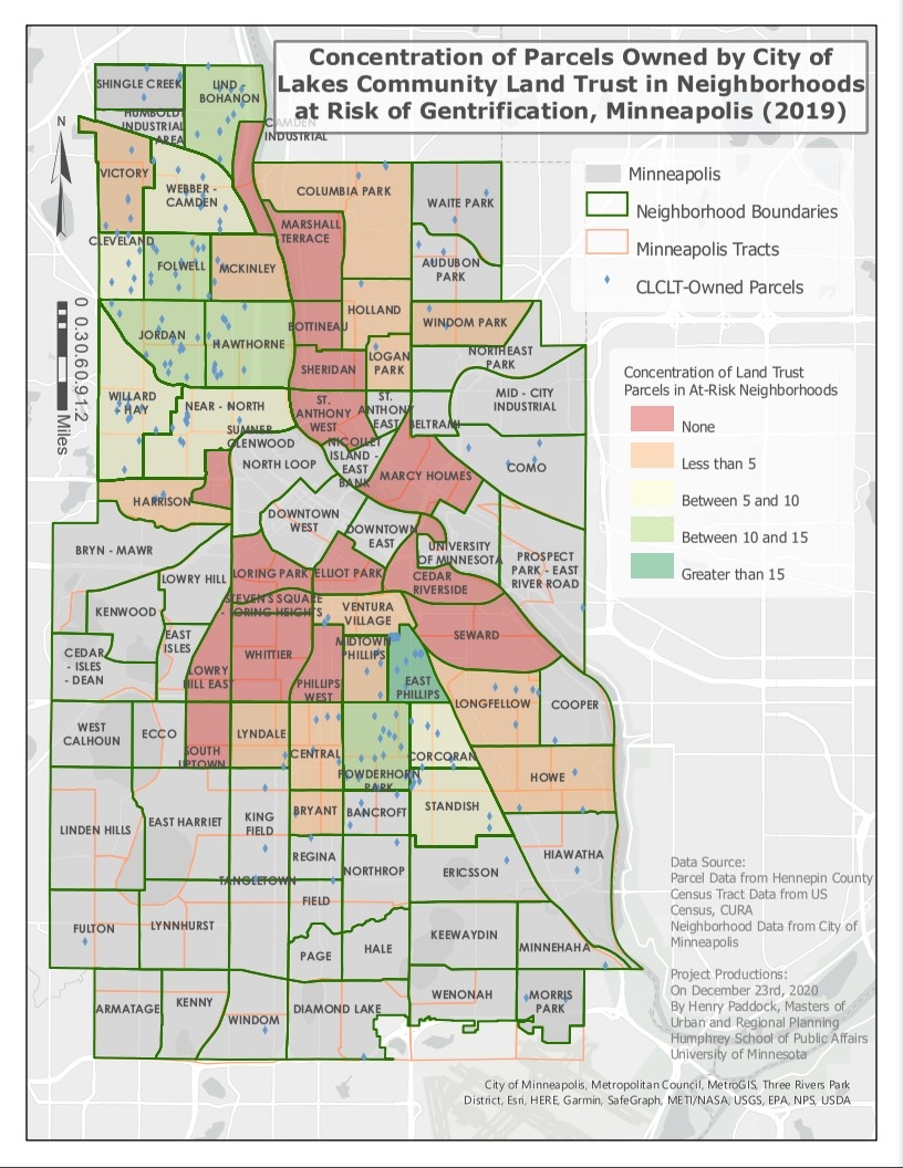
I worked to show the spatial concentration of affordable community land trust parcels owned by the City of Lakes Land Trust, overlaid with the Center of Urban And Regional Affairs map of gentrifying census tracts, in order to determine which gentrifying neighborhoods are the most served and least served by this type of affordable housing.
With many of my maps, I love using layer transparency to give a more geographic context under choropleth overlays - I also think it looks sleeker!
I was able layer a base map, with census tracts, neighborhood boundaries, within the borders in Minneapolis, while also showing the individual parcel points within this choropleth map.
What I have learned since and what I might change:
I would definitely change the color scheme to be more accessible to colorblind viewers, instead of using a red-green color scale.
I think doing several maps using parcels per neighborhood capita, parcels per neighborhood median income, among other demographics to better understand which neighborhoods might be most in need relative to the current supply of this land trust housing.


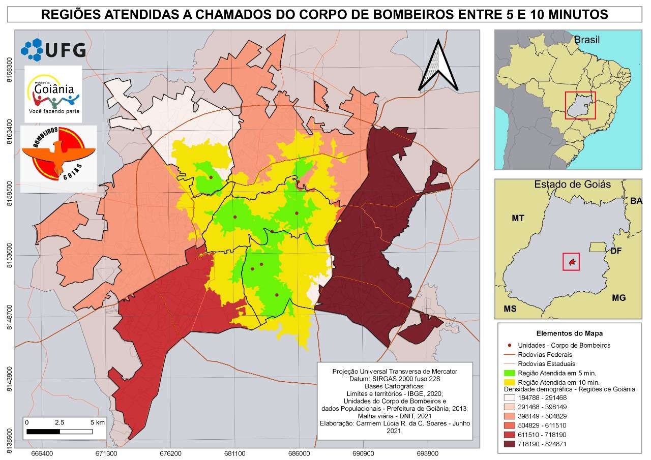
_2461995.png&w=48&q=40 "Carmem Lúcia Ribeiro da Costa Soares")
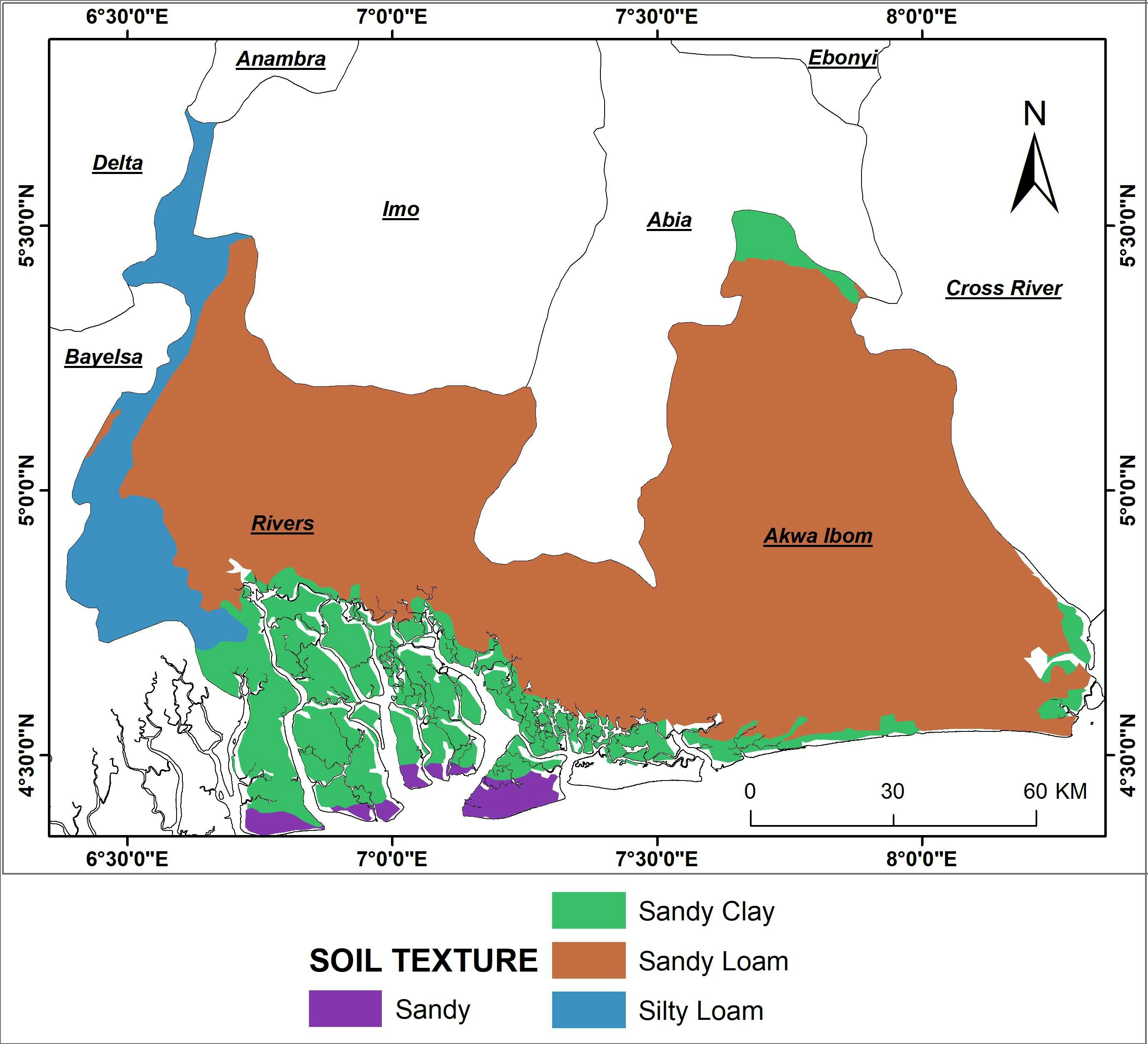

.svg "Keran Nkongolo")