Sourcing for Landsat data
Preprocessing of Landsat images: Radiometric correction, Mosaicking, Gapfilling, Clip
Conversion of Landsat image digital number to Top of Atmosphere Radiance(TOA)
Conversion of TOA to Top of Atmosphere Brightness (BT)
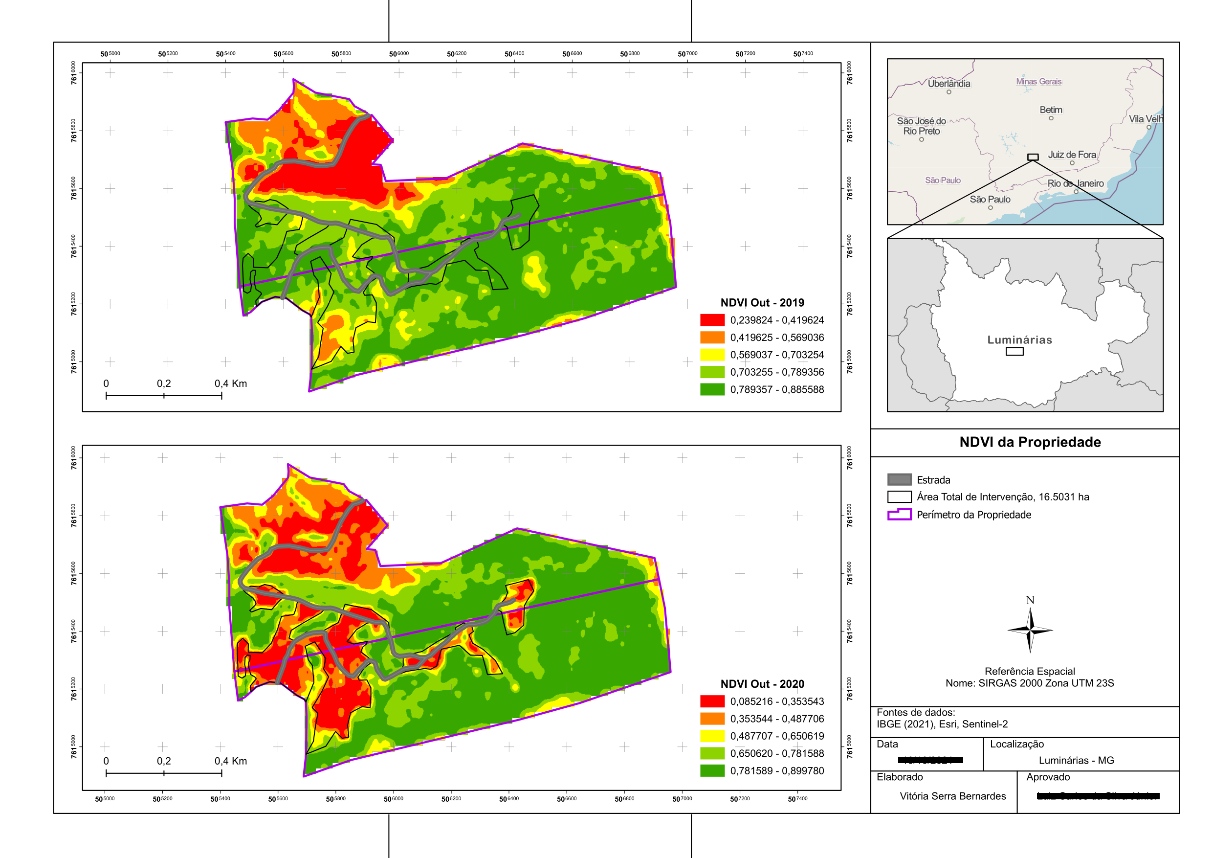
Normalised Difference Vegetation Index (NDVI)
Land Surface Emissivity (LSE)
Generation of Land Surface Temperature (LST)
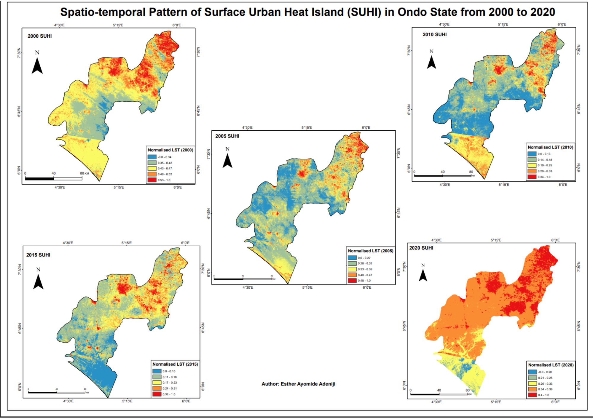
Normalising the LST
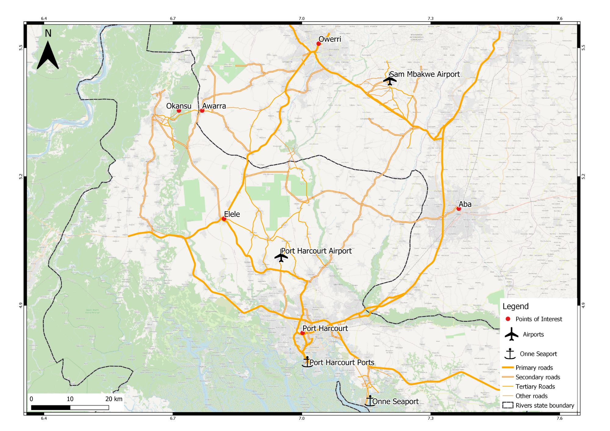
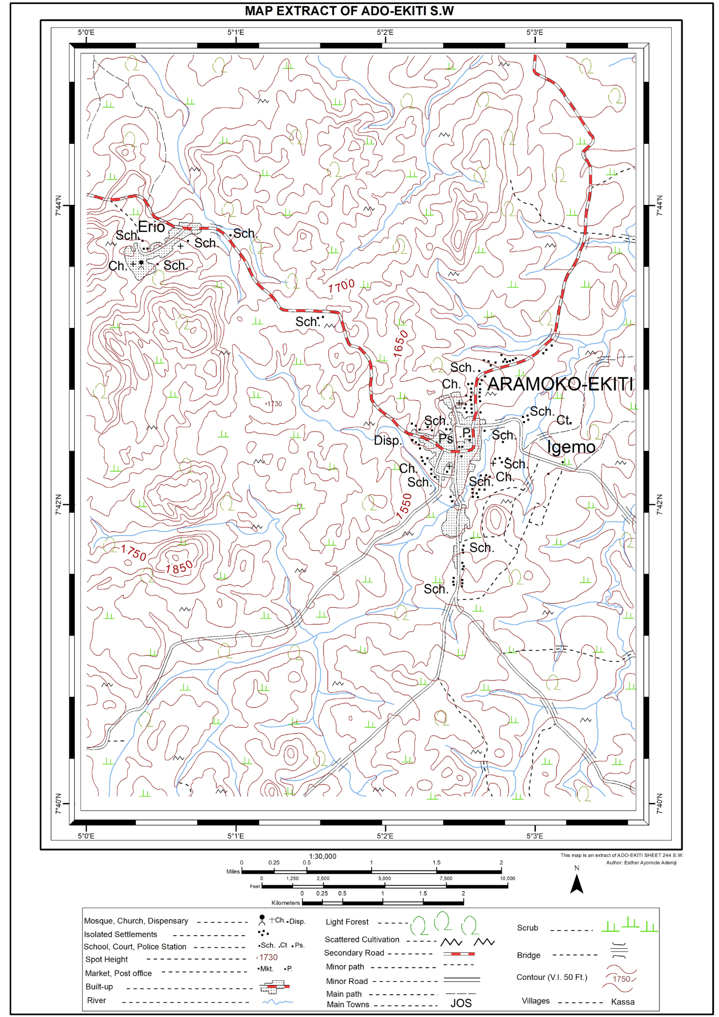
Map Embellishment