Prepared for GIS graduate coursework at Portland State University. Ispired by my CSA (community supported agriculture) farmer's concerns about her farm's future...
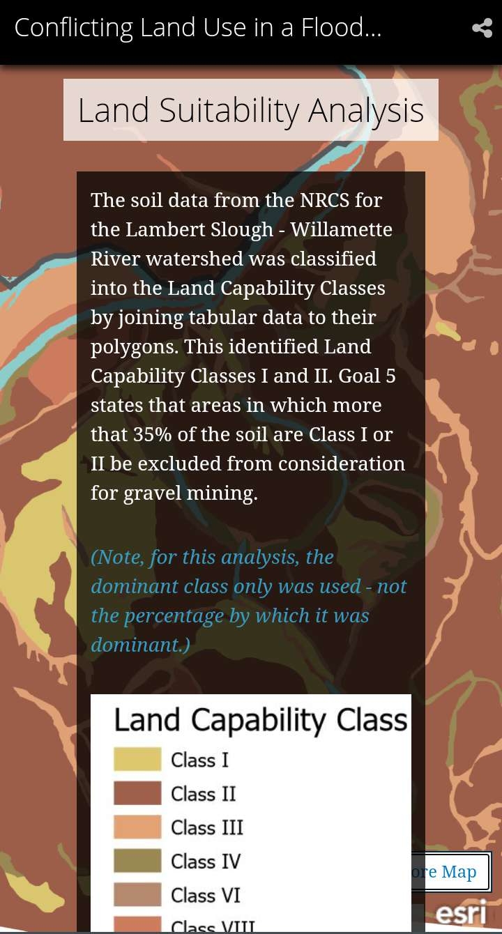
The exercise was to demonstrate competency with Esri's Story Map platform while including spatial analysis. For my analysis, I selected various federal, state, and local GIS sources related to land use. I also used ModelBuilder to assist with my evolving analysis process. The topic arose from conversations with my farmer, in which she expressed concern about the increasing permits for gravel mining in Oregon's EFU lands, and the impact on agriculture.
_645201.jpg&w=48&q=40 "Eguagie-suyi Precious")