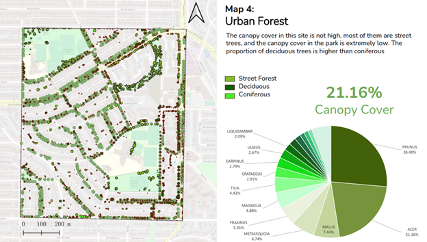
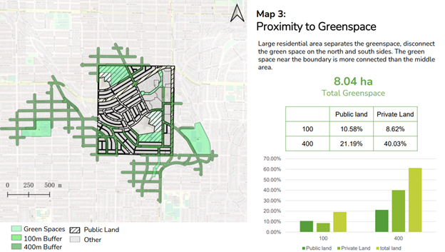
Utilized the City of Vancouver Tree inventory to analyze the percentage of different tree species within the site.
Process: Delineating public land, extracting public canopy from all available canopy, categorizing deciduous and coniferous canopy. Calculating net canopy cover.
Calculating the distribution of different species
Skills: Image Classification, Data Analysis, MS Excel


.svg "Maggie Zou")