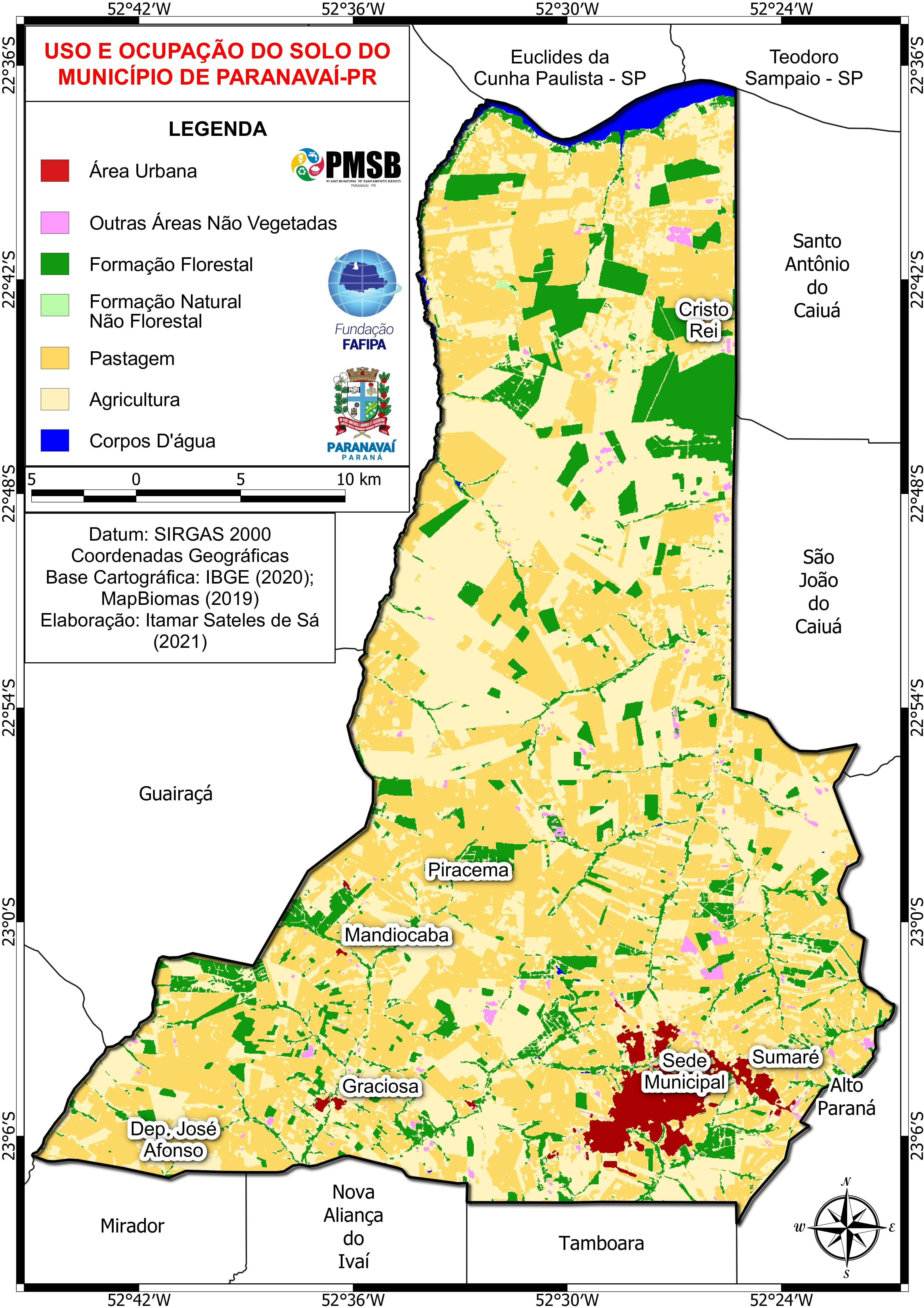
As the capital of the United States, Washington DC is a growing city that many people are moving into. It is known for its rich history and historic landmarks. Recently we have seen an increase of families moving into the city, which is creating a demand for more buildings and houses to be built. This study is aimed to see the cities urban and suburban growth between 1999 to 2015. My goal is to see a big change in the red color (urban) and green (suburban) and possibly see if other land covers were affected as well. This is important for people to know so we can see how much the city has grown and how much we have lost.
At the end of this study, I realized my hypothesis did not happen. Initially I believed the urban land covers would increase, but instead we see the suburban land covers increase. I can infer that gentrification is happening in these areas. Gentrification is a big issue in DC and this map proves it. There has been minimal urban expansion and more suburbs rising. My change detection chart detects a very drastic increase of suburban pixels. I noticed that the bare soil and grass land covers decreased a bit, which could have been an effect of the increase in suburban ones. But the image shows a noticeable take over of urban areas to suburban.