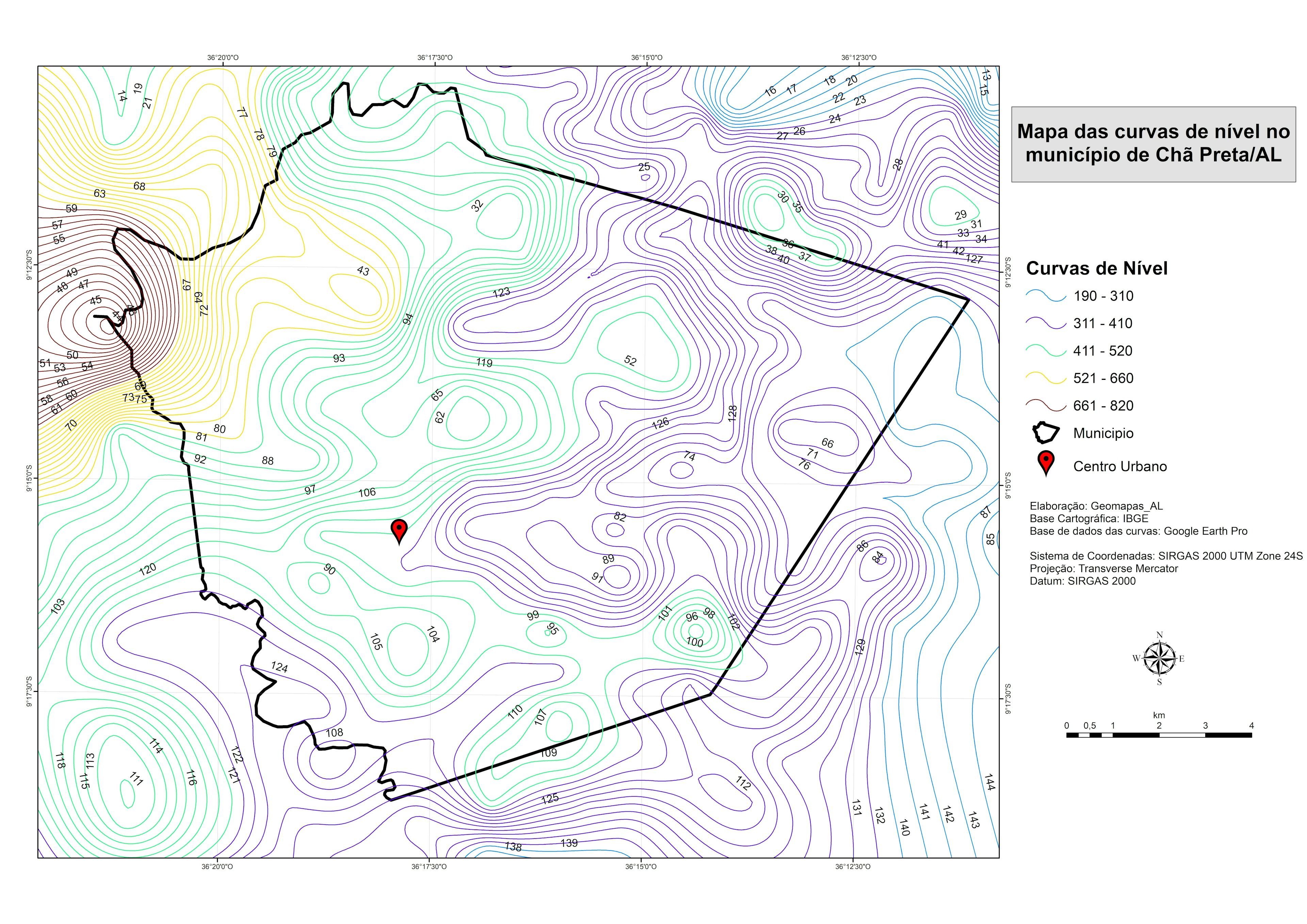
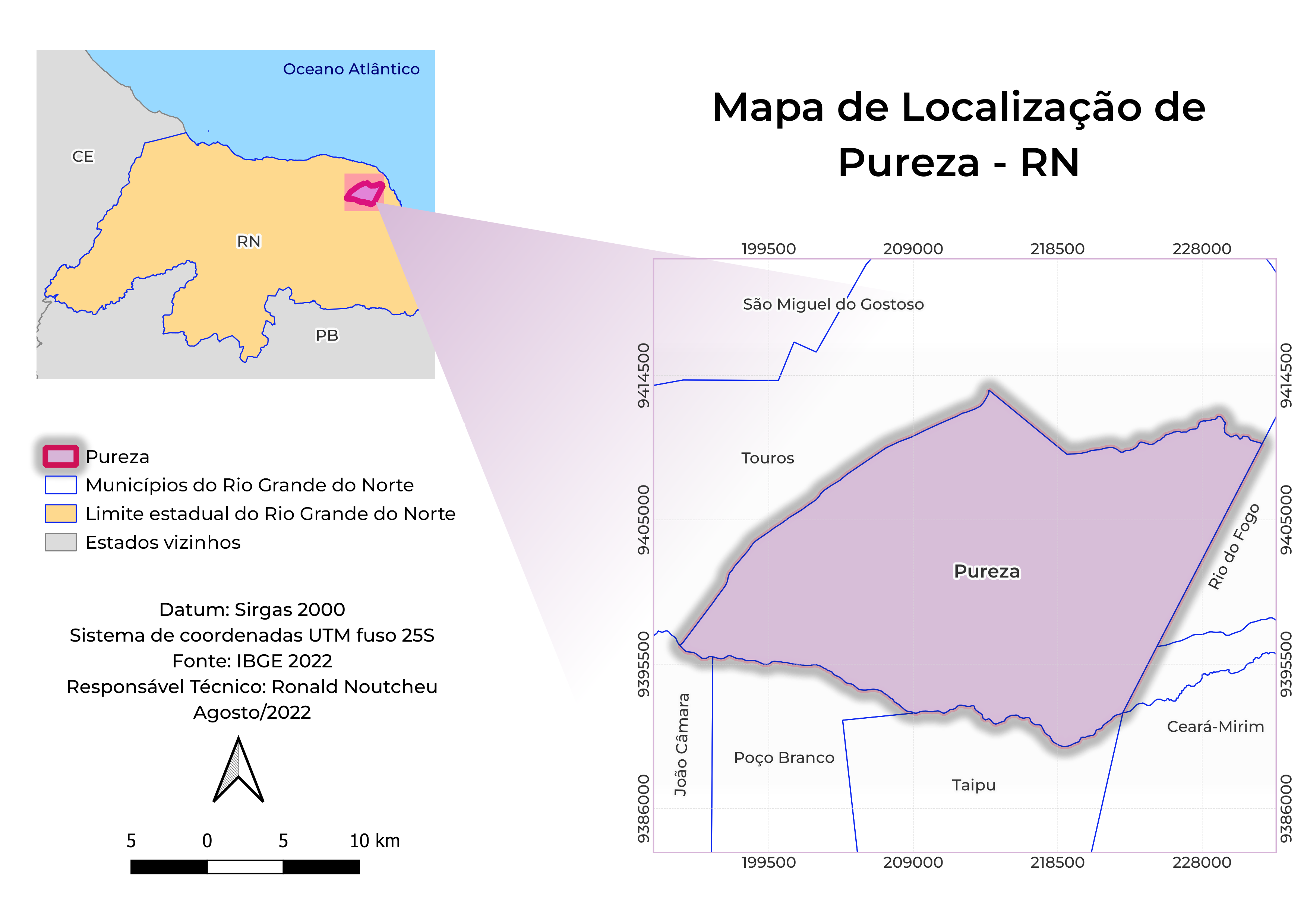
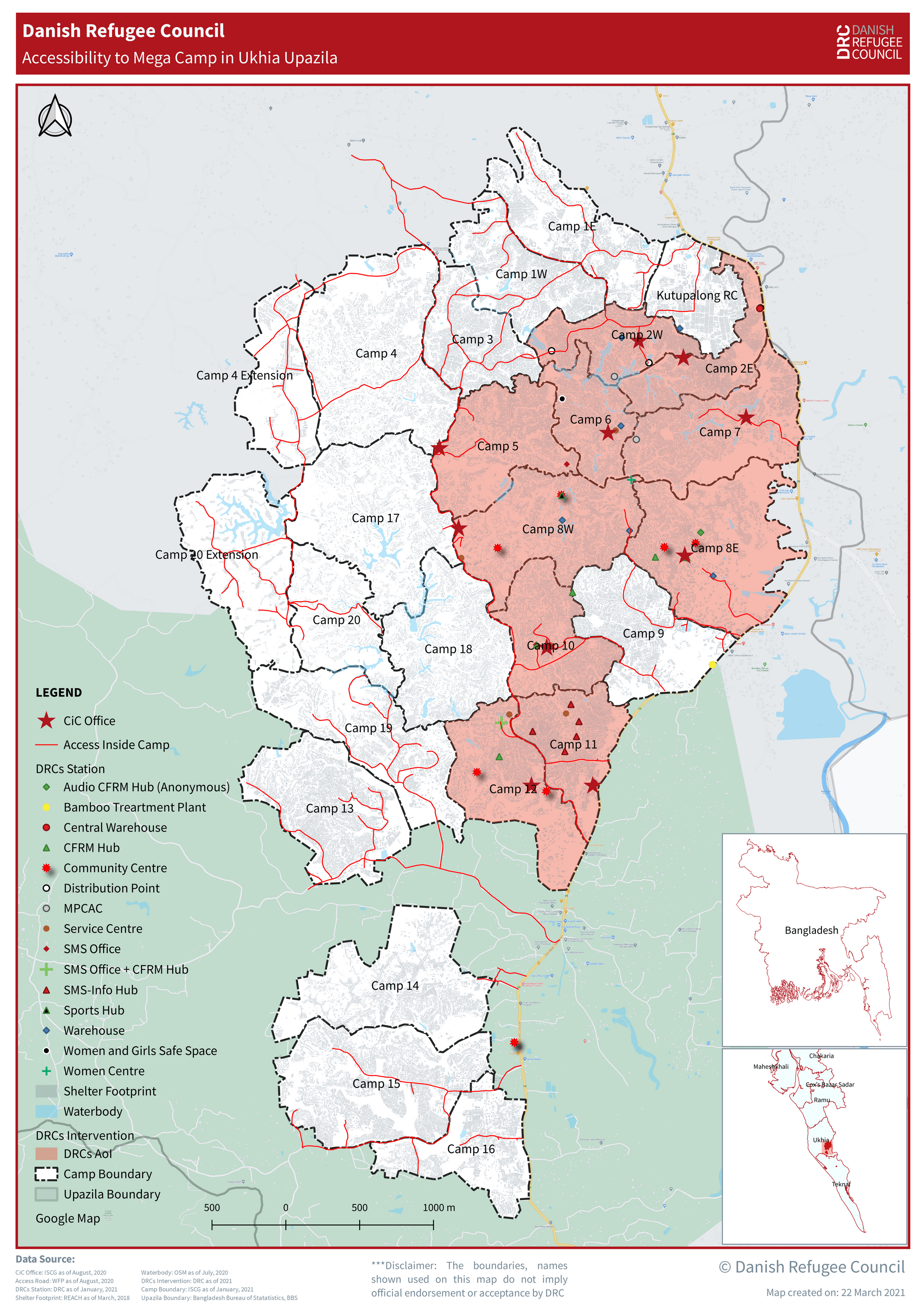
Declividade no município de Cã Preta/AL

Tools used
ArcMap
tags
ArcMapMapserver
You might also like


_2461995.png&w=48&q=40 "Carmem Lúcia Ribeiro da Costa Soares")


Join the community!
We're a place where geospatial professionals showcase their works and discover opportunities.
Declividade no município de Cã Preta/AL
You might also like
We're a place where geospatial professionals showcase their works and discover opportunities.