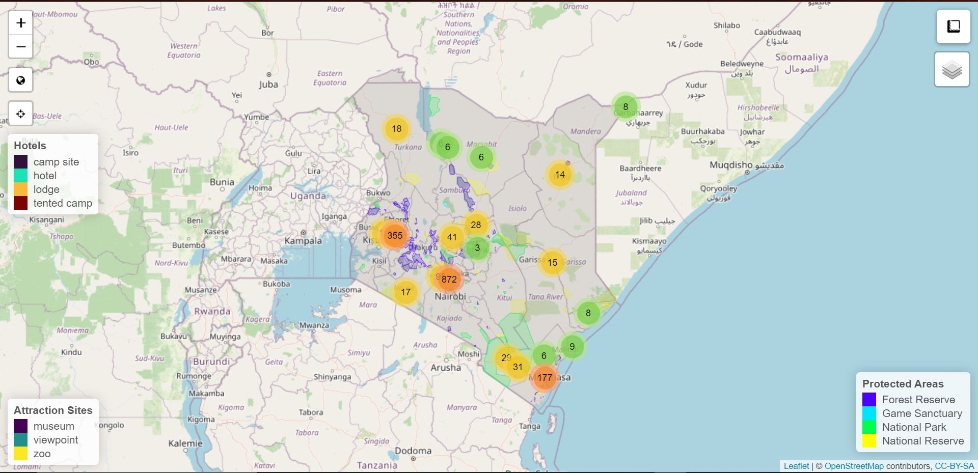
A small demonstration of the use of fetching data from an Environment Agency API using a python script that is set to run when QGIS is opened. Allowing for quick and easy obversions to be made.
Code available here: https://github.com/ConnorMerrell/Rainrall-Spatial-Data
https://environment.data.gov.uk/flood-monitoring/doc/tidegauge
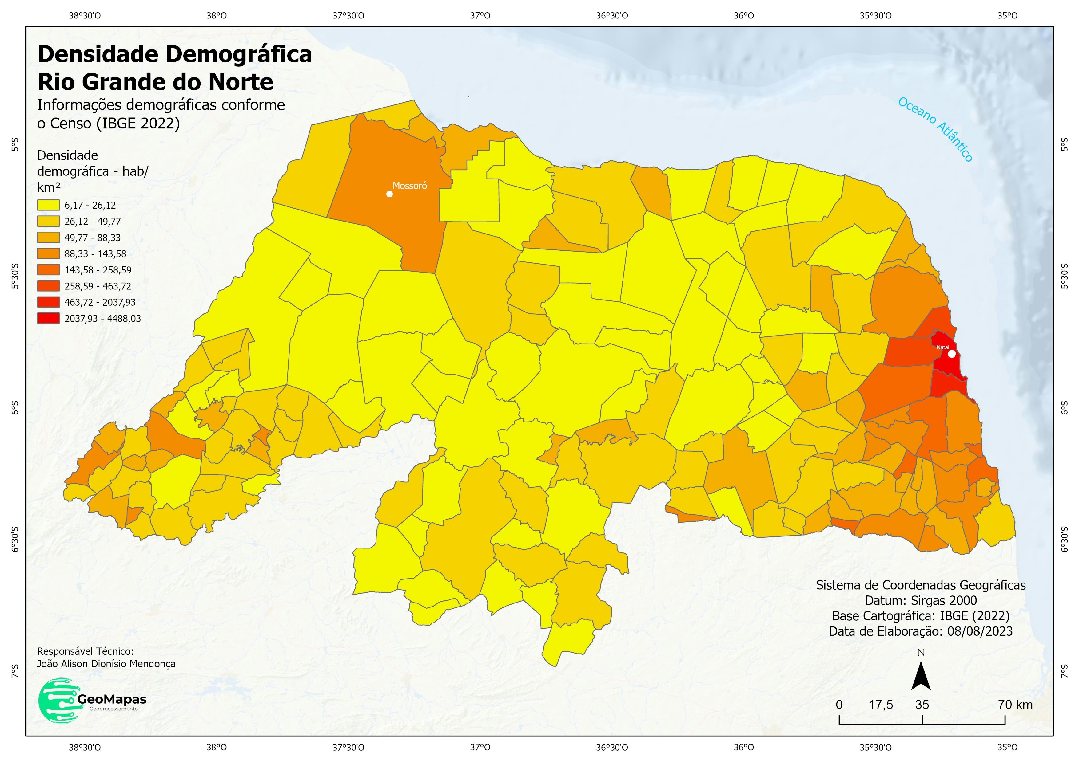
Source: Office for National Statistics licensed under the Open Government Licence v.3.0
This uses Environment Agency rainfall data from the real-time data API (Beta)
Contains OS data © Crown copyright and database right 2023