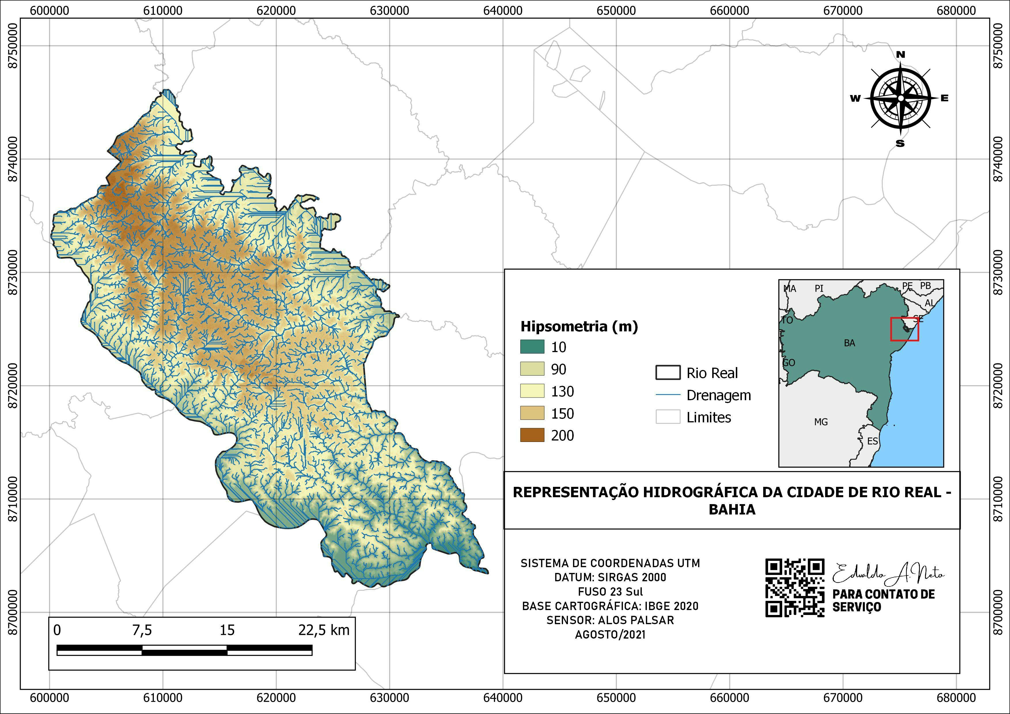
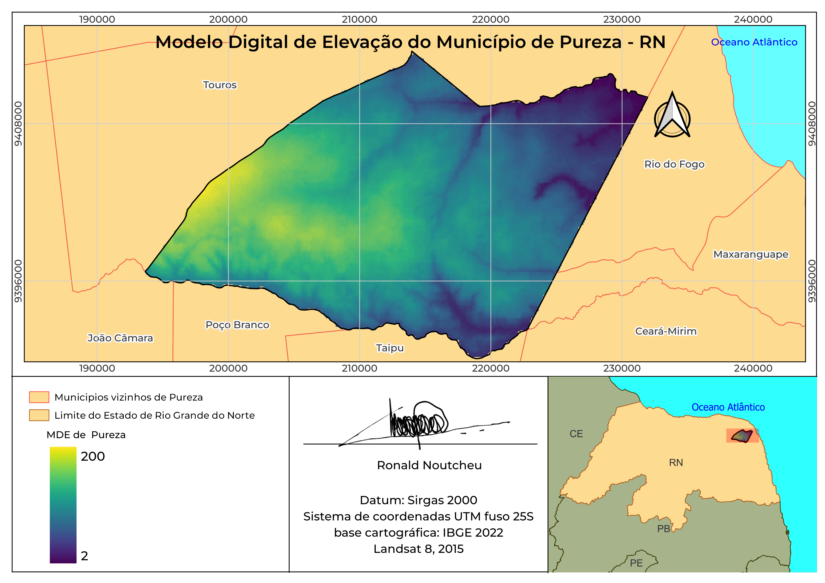
HIPSOMETRIA DE TOMAR DO GERU - SE

Tools used
QGIS
Plug-ins used
QGIS
More by Edvaldo Alves Neto
You might also like


Join the community!
We're a place where geospatial professionals showcase their works and discover opportunities.
HIPSOMETRIA DE TOMAR DO GERU - SE
More by Edvaldo Alves Neto
You might also like
We're a place where geospatial professionals showcase their works and discover opportunities.