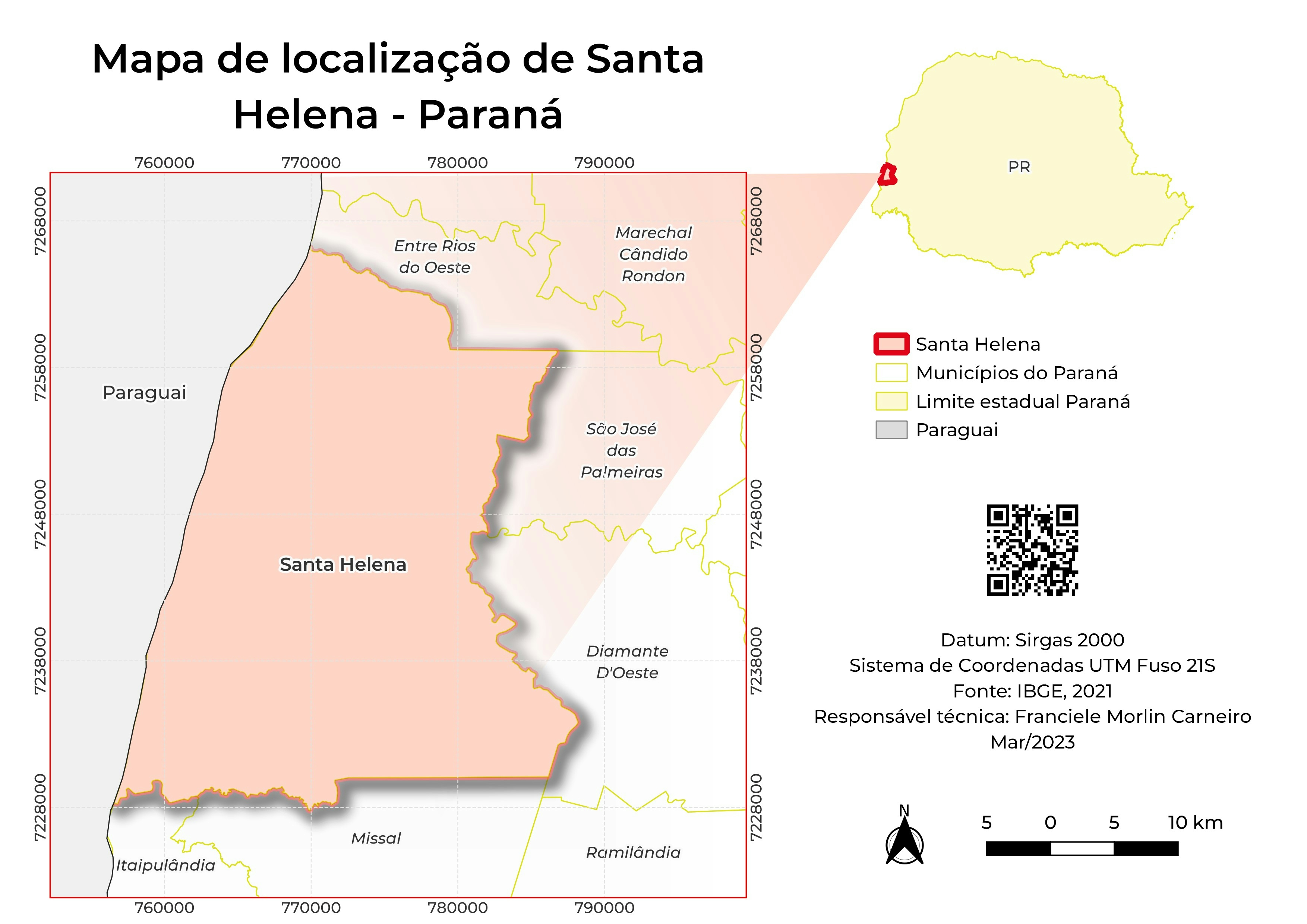
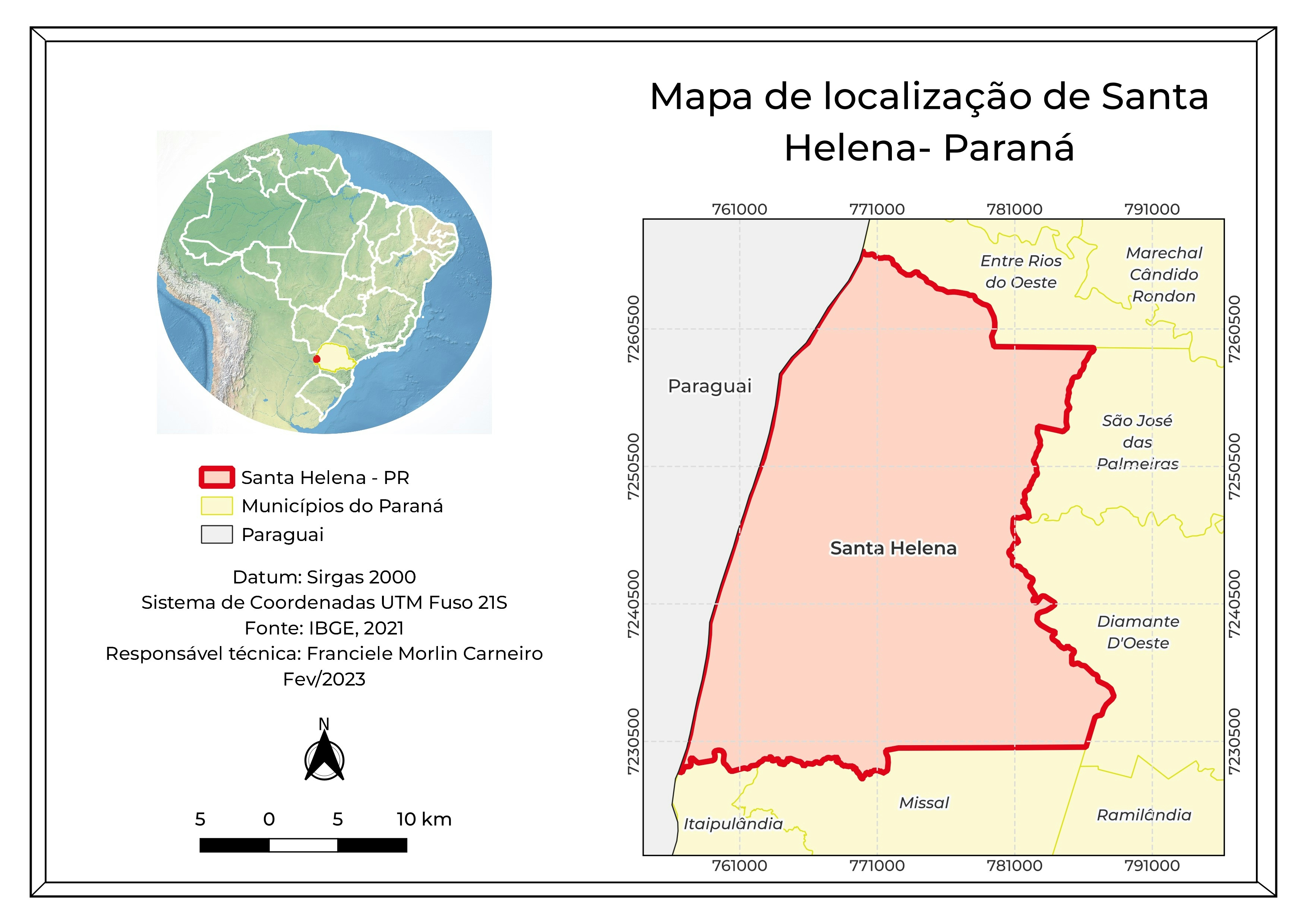
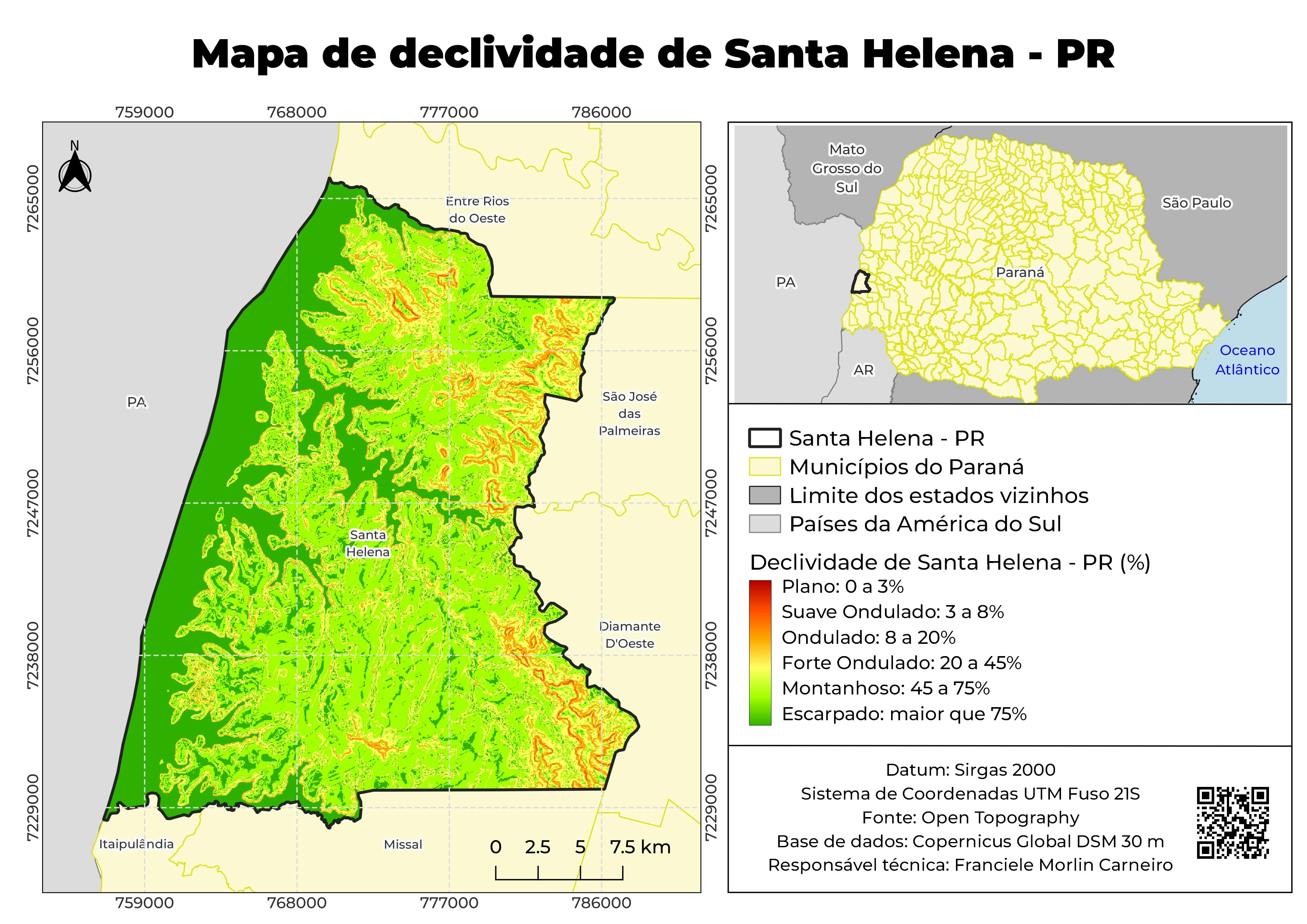
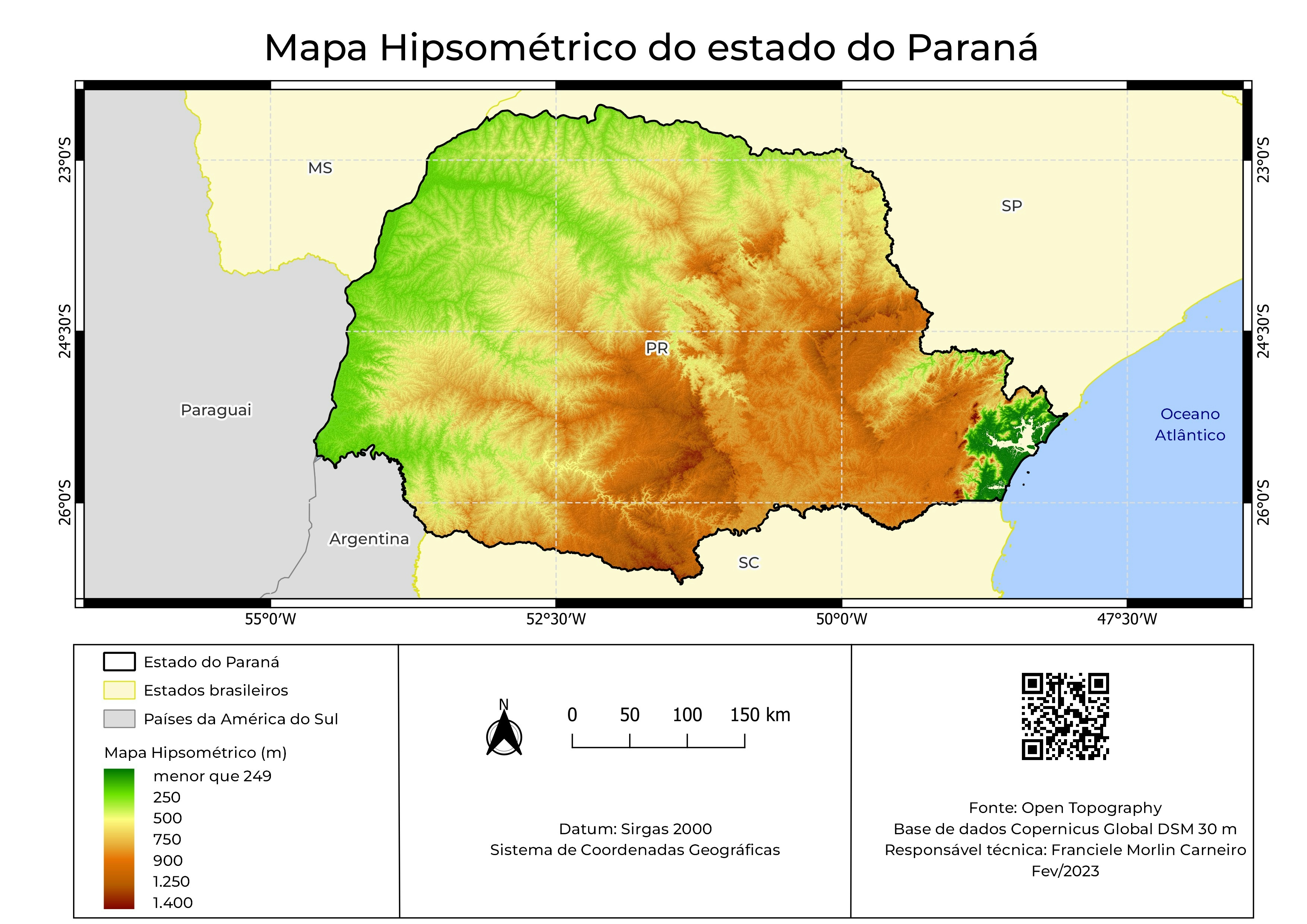
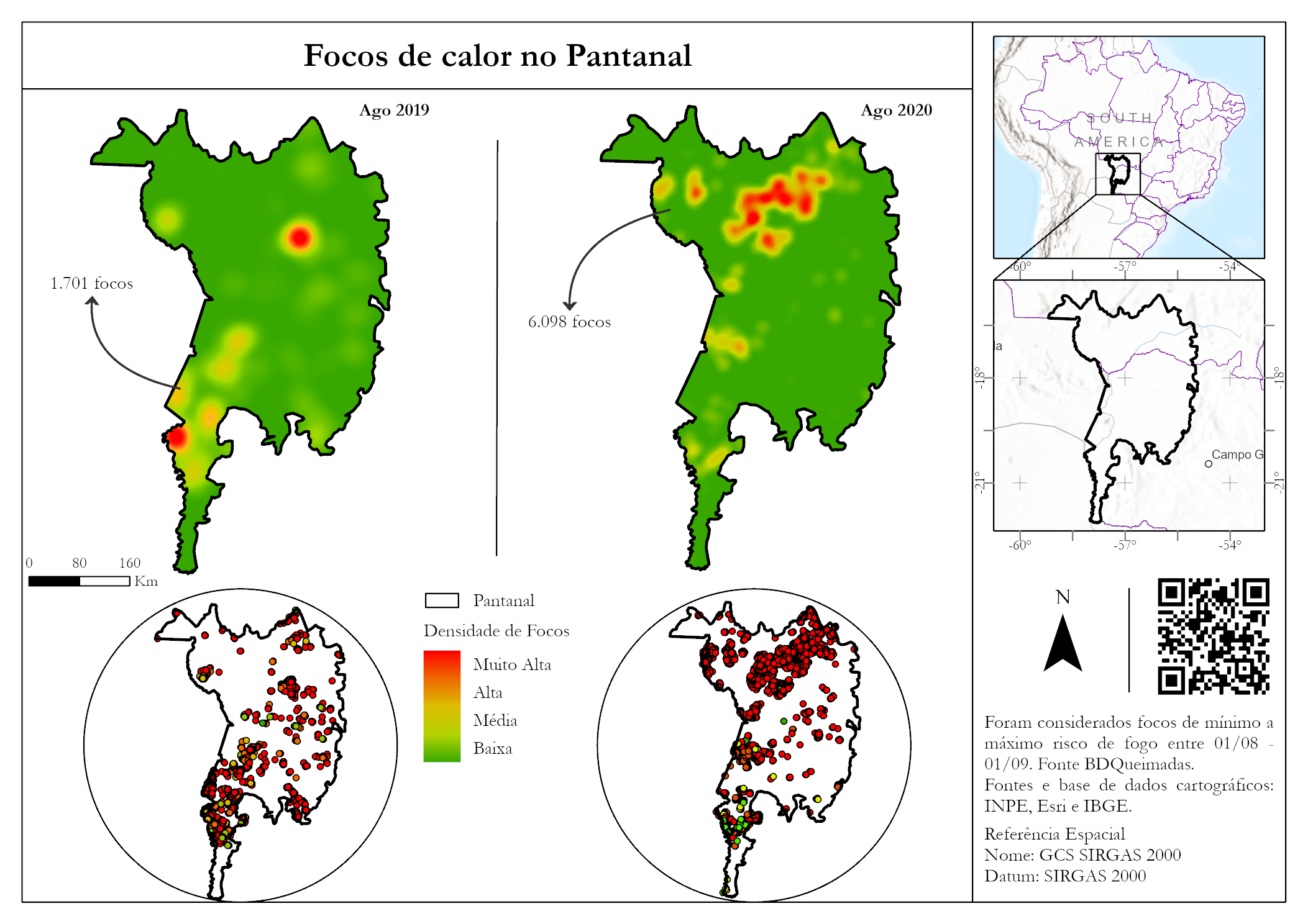
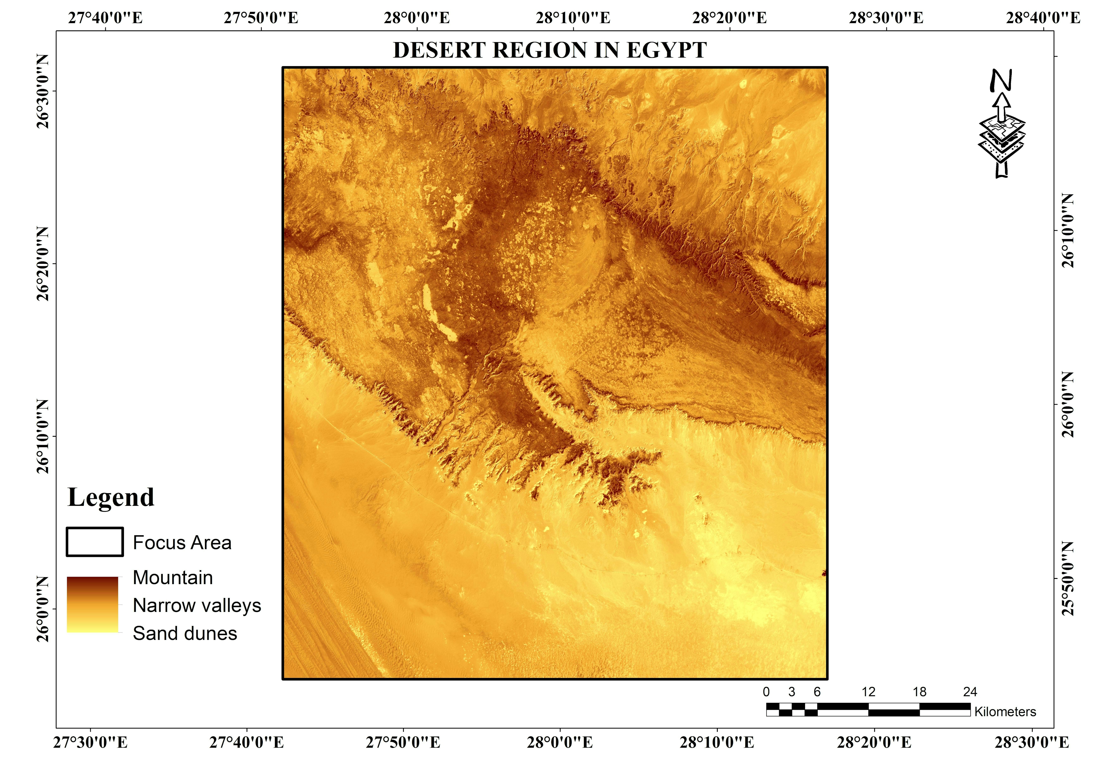
Sign up or log in to your Spatialnode account.

Takes less than a few seconds.

Location map n#2

Franciele Morlin Carneiro
Franciele Morlin Carneiro•

March 12, 2023

Location map n#2

Location map n#2


Tools used

I used QGIS

Plug-ins used

QGIS

tags

geoprocessamentoLocation map

More by Franciele Morlin Carneiro

Advanced map: hypsometric map
21
​Location map n#1​
​Location map n#1​
14
Thematic map n#2
Thematic map n#2
19
Location map n#3
Location map n#3
7
Thematic map n#3
Thematic map n#3
7
Thematic map n#1
Thematic map n#1
6
Advanced map: slope map
10
Advanced map: Vintage map
8
Advanced map
Advanced map
7

You might also like

GW & Jeff. Forest Planning Assessment
Bryan Smalley
GW & Jeff. Forest Planning Assessment
Bryan Smalley
7
ESRI Spatial Data Science Certification
Oladeji Muhammed
ESRI Spatial Data Science Certification
Oladeji Muhammed
60
Advanced map (analytical) - Slope
Fabrício H. Oda
Advanced map (analytical) - Slope
Fabrício H. Oda
5
Awka, Anambra State digtised
Chikaodili Deng
Awka, Anambra State digtised
Chikaodili Deng
3
Registered Voters Per State
Afolabi Victor Ayodeji
Registered Voters Per State
Afolabi Victor Ayodeji
125
Built-up areas in Nigeria.
Bamidele Daniel Ohinoyi
Built-up areas in Nigeria.
Bamidele Daniel Ohinoyi
89
Micro Habitat
Marvin Ayeh
Micro Habitat
Marvin Ayeh
14
City of Fife Annexation History
Rhonda Parrish, GISP
City of Fife Annexation History
Rhonda Parrish, GISP
11
Missouri Wells
Keran Nkongolo
Missouri Wells
Keran NkongoloPro
14
Los Alcornocales Natural Park
Marcelo Aguilera
Los Alcornocales Natural Park
Marcelo Aguilera
554
Beaufort County Flood Risk
Veronica Tully
Beaufort County Flood Risk
Veronica TullyPro
3
Object Based Classification
Colin Minielly
Object Based Classification
Colin Minielly
17

Join the community!

We're a place where geospatial professionals showcase their works and discover opportunities.

Sign Up for free