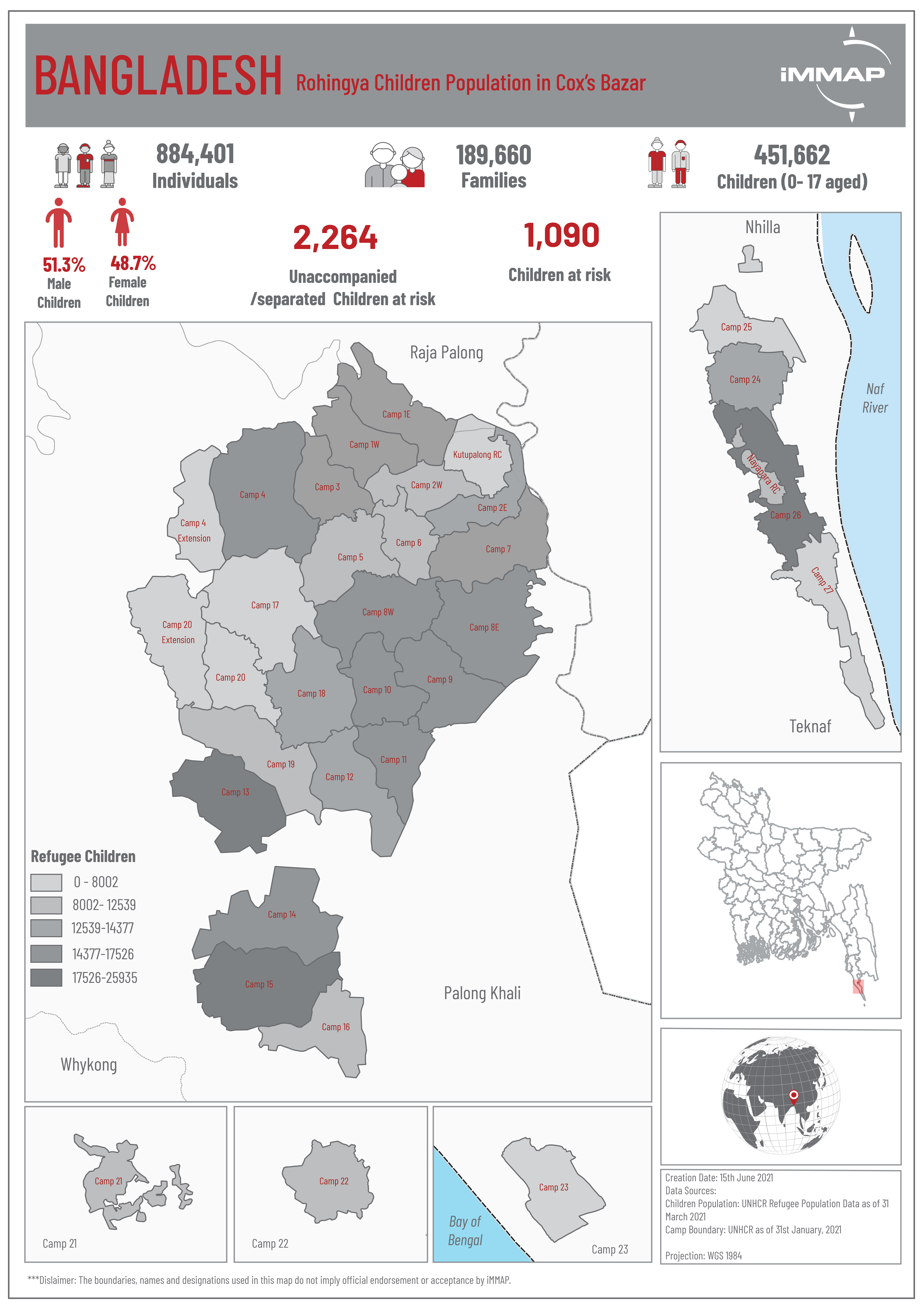
Map created: 15th June 2021
Data Source:
Children Population: UNHCR Data as of 31st March 2021
Camp Boundary: UNHCR as of 31st January 2021
Projection: WGS 1984
The boundaries, names, and designations used in this map do not imply official endorsement or acceptance by iMMAP