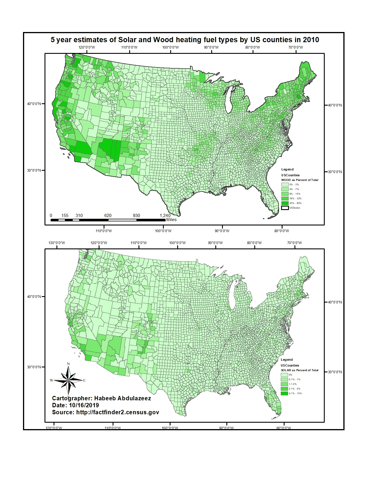
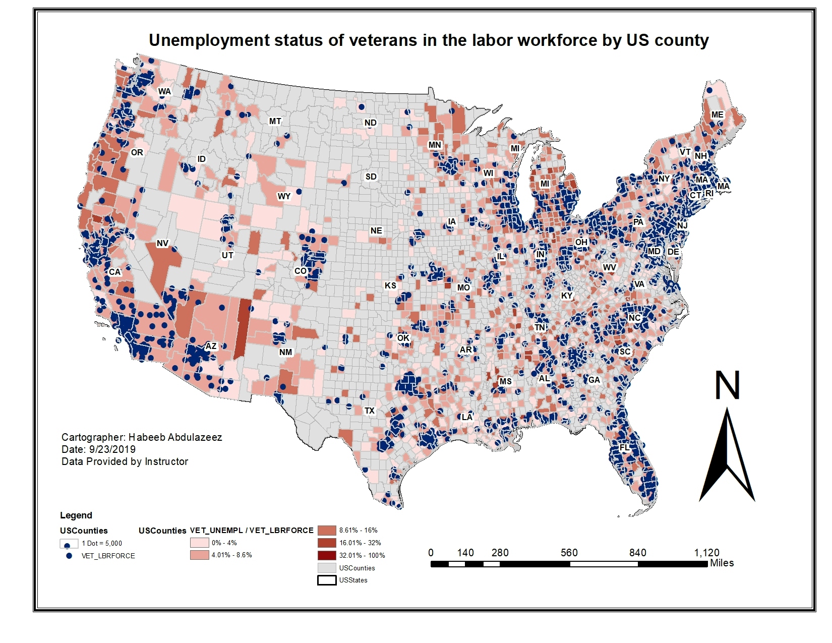
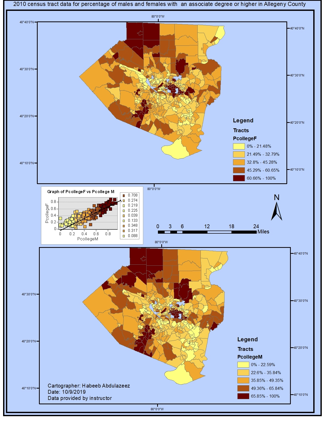
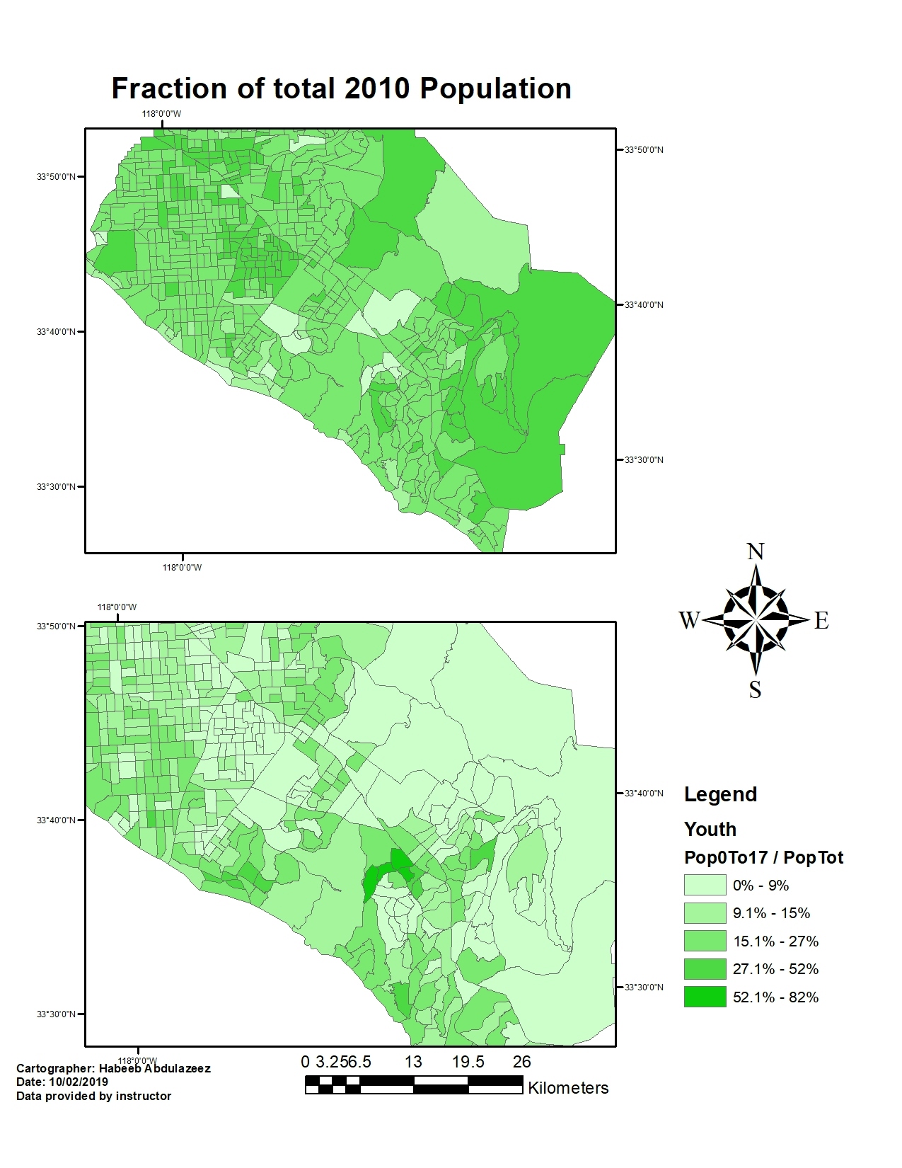
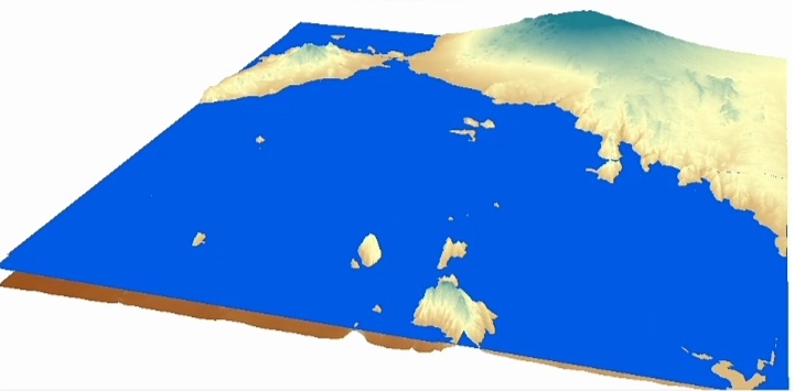
Study region for Colorado counties


Tools used
ArcMap
Plug-ins used
ArcMapEsri
tags
Esri
More by Habeeb Abdulazeez
You might also like


 He")

Join the community!
We're a place where geospatial professionals showcase their works and discover opportunities.
Study region for Colorado counties
More by Habeeb Abdulazeez
You might also like
We're a place where geospatial professionals showcase their works and discover opportunities.