Sign up or log in to your Spatialnode account.

Takes less than a few seconds.

Topografia de Mato Grosso, BR

Aguinaldo José de Oliveira
Aguinaldo José de Oliveira•

February 05, 2023

Topografia de Mato Grosso, BR

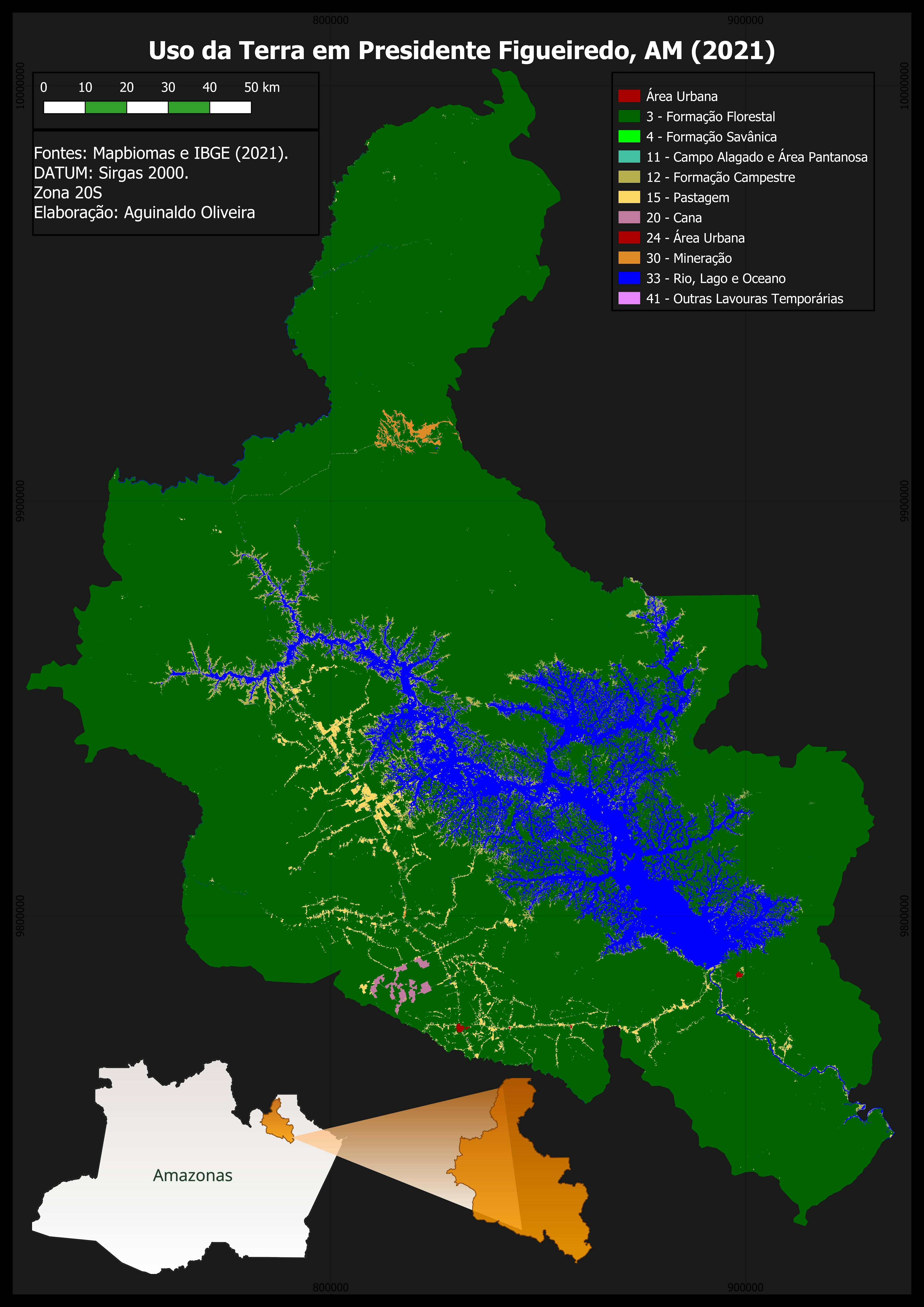
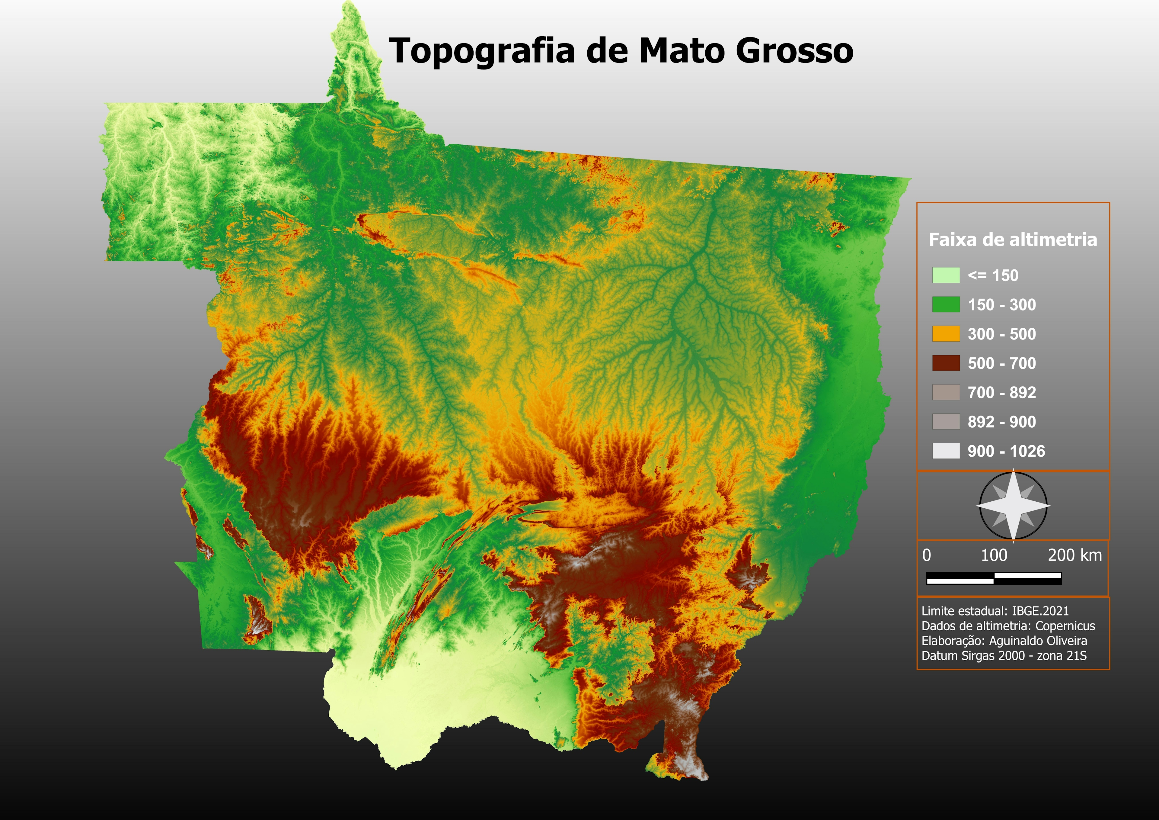
Topografia de Mato Grosso.

Base: Copernicus MDE


Tools used

QGIS

Plug-ins used

no plugins

tags

MATO GROSSO, RELEVO, TOPOGRAFIA, altimetria

More by Aguinaldo José de Oliveira

Uso da Terra Presidente Figueiredo, AM
13
Un. Conservação, Indígenas e Quilombos.
19

You might also like

Elevation Map Switzerland | Imhof Style
Viola Schweiger
Elevation Map Switzerland | Imhof Style
Viola Schweiger
115
Arkansas Population Change
Nick Linell
Arkansas Population Change
Nick LinellPro
10
Iceland
Kareen Bröker
Iceland
Kareen Bröker
51
GW & Jeff. Forest Planning Assessment
Bryan Smalley
GW & Jeff. Forest Planning Assessment
Bryan Smalley
5
Commuter Modal Share in Oxford
William Ray
Commuter Modal Share in Oxford
William Ray
118
MAP OF FARM OVERLAID ON CLASSIFIED IMAGE
Edidiong Ekrikpo
MAP OF FARM OVERLAID ON CLASSIFIED IMAGE
Edidiong Ekrikpo
7
Alto Tietê e Vertente Atlântica
Gilberto Correia dos Santos
Alto Tietê e Vertente Atlântica
Gilberto Correia...
27
Middle School Mapping Club Projects
Naomi Yates
Middle School Mapping Club Projects
Naomi Yates
20
Distribuição de creches Rio de Janeiro
Luis Renato Joaquim
Distribuição de creches Rio de Janeiro
Luis Renato Joaquim
103
Crimes Violentos Letais Intencionais
Renata Maciel
Crimes Violentos Letais Intencionais
Renata Maciel
18
Normalized Difference Vegetation Index
Motunrayo Adeyemi
Normalized Difference Vegetation Index
Motunrayo Adeyemi
31
North Dakota Corn For Grain
Keran Nkongolo
North Dakota Corn For Grain
Keran NkongoloPro
7

Join the community!

We're a place where geospatial professionals showcase their works and discover opportunities.

Sign Up for free