
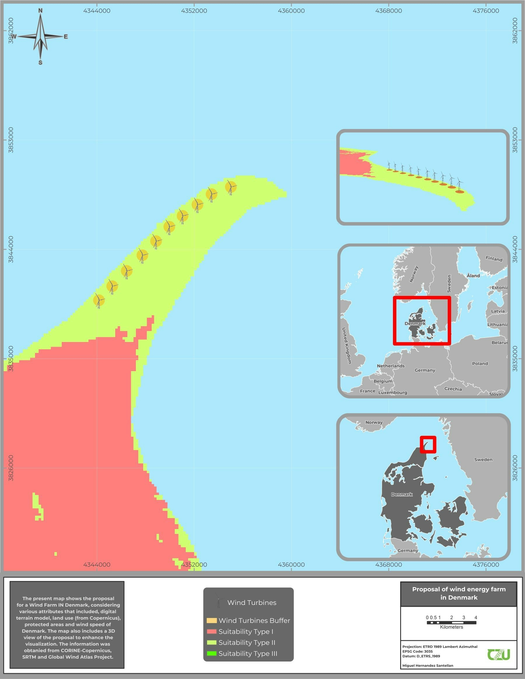
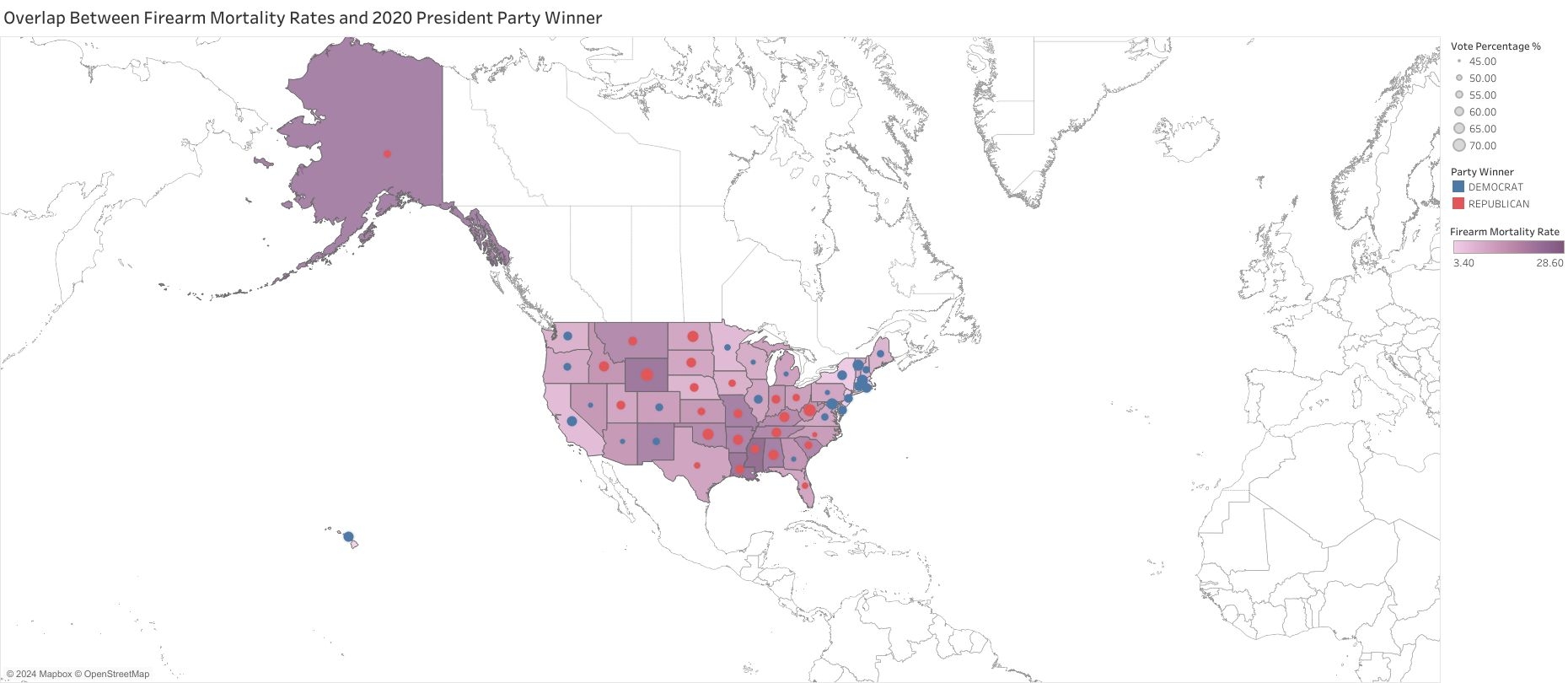
A map was created as a university project. The proposal considered land use, terrain, suitability (according to the wind speed), and protected areas. A 3D visualization was included in the map.
Wind energy farm proposal in Denmark
Plug-ins used
bufferRasterSpatial analyst
tags
3DCZUDenmarkSpatial AnalysisWind
More by Miguel Santellan


You might also like


Join the community!
We're a place where geospatial professionals showcase their works and discover opportunities.