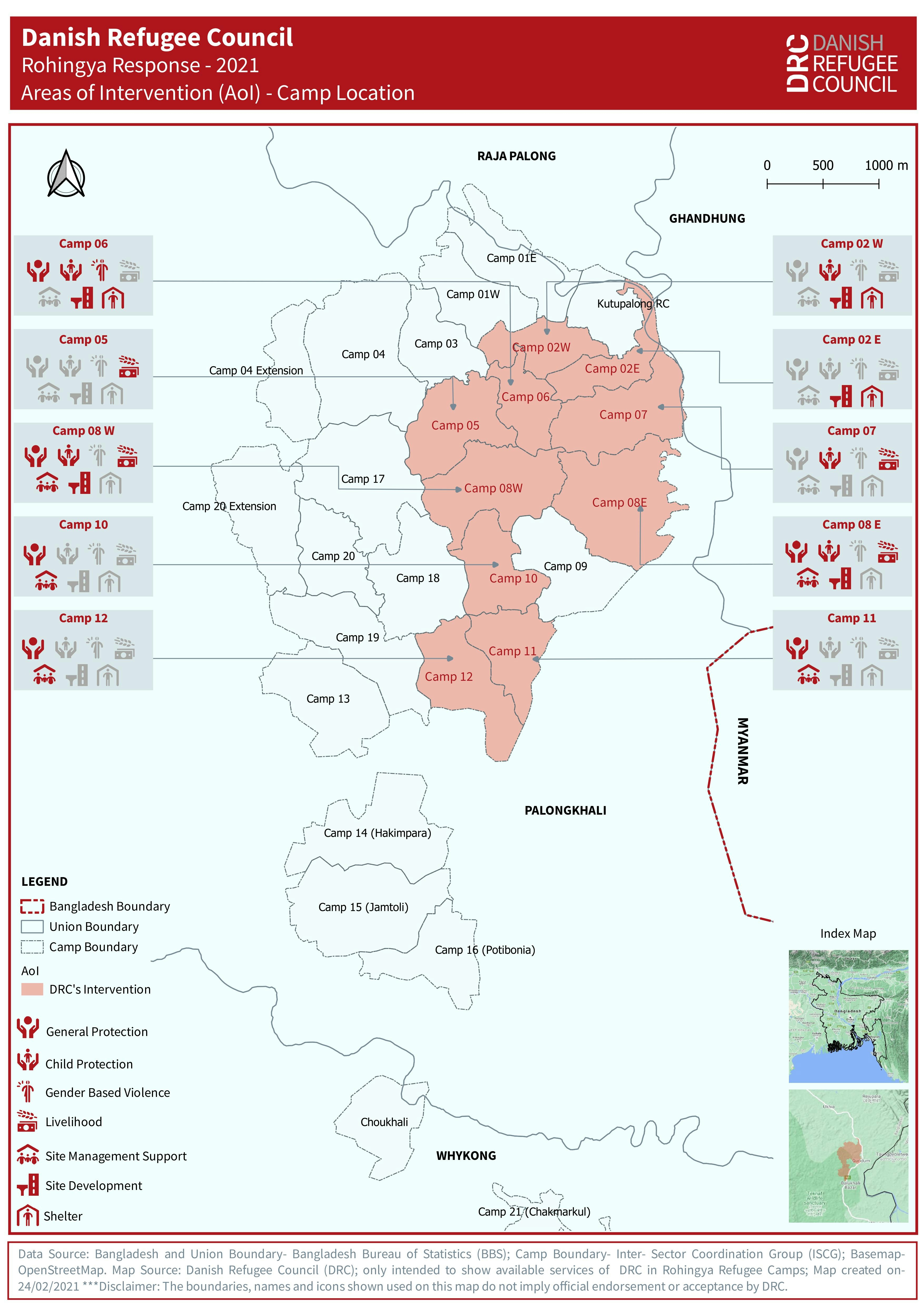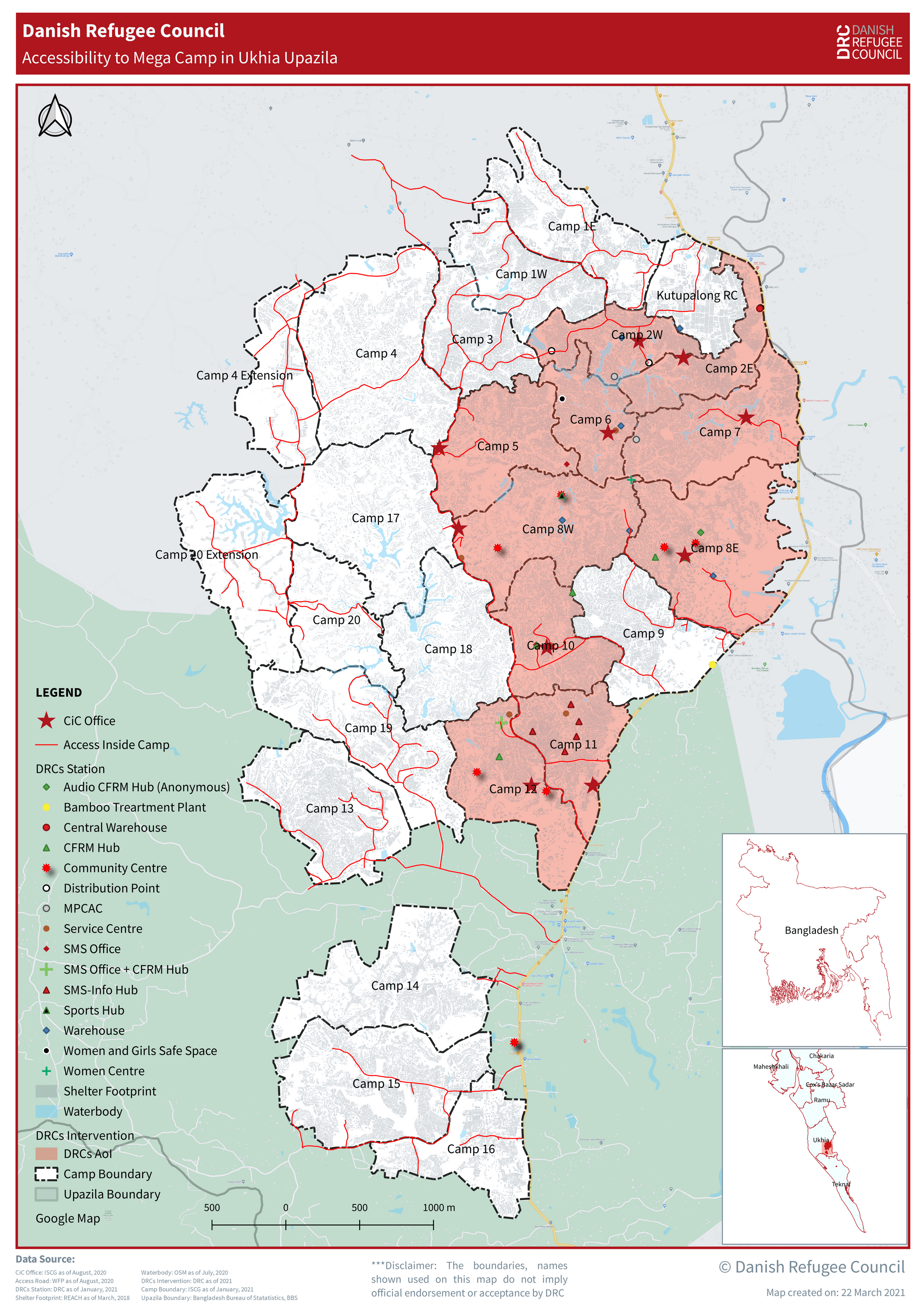
Data Source:
Bangladesh and Union Boundary- Bangladesh Bureau of Statistics (BBS);
Camp Boundary- UNHCR; BasemapOpenStreetMap.
Map Source: Danish Refugee Council (DRC); only intended to show the access of DRC services in Rohingya Refugee Camps;
Map created on-24/02/2021
Projection: WGS 1984
***Disclaimer: The boundaries, names, and icons shown used on this map do not imply official endorsement or acceptance by DRC.