
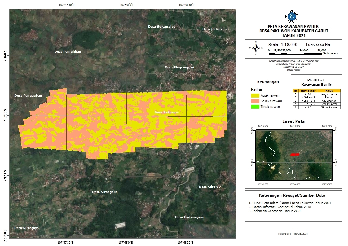
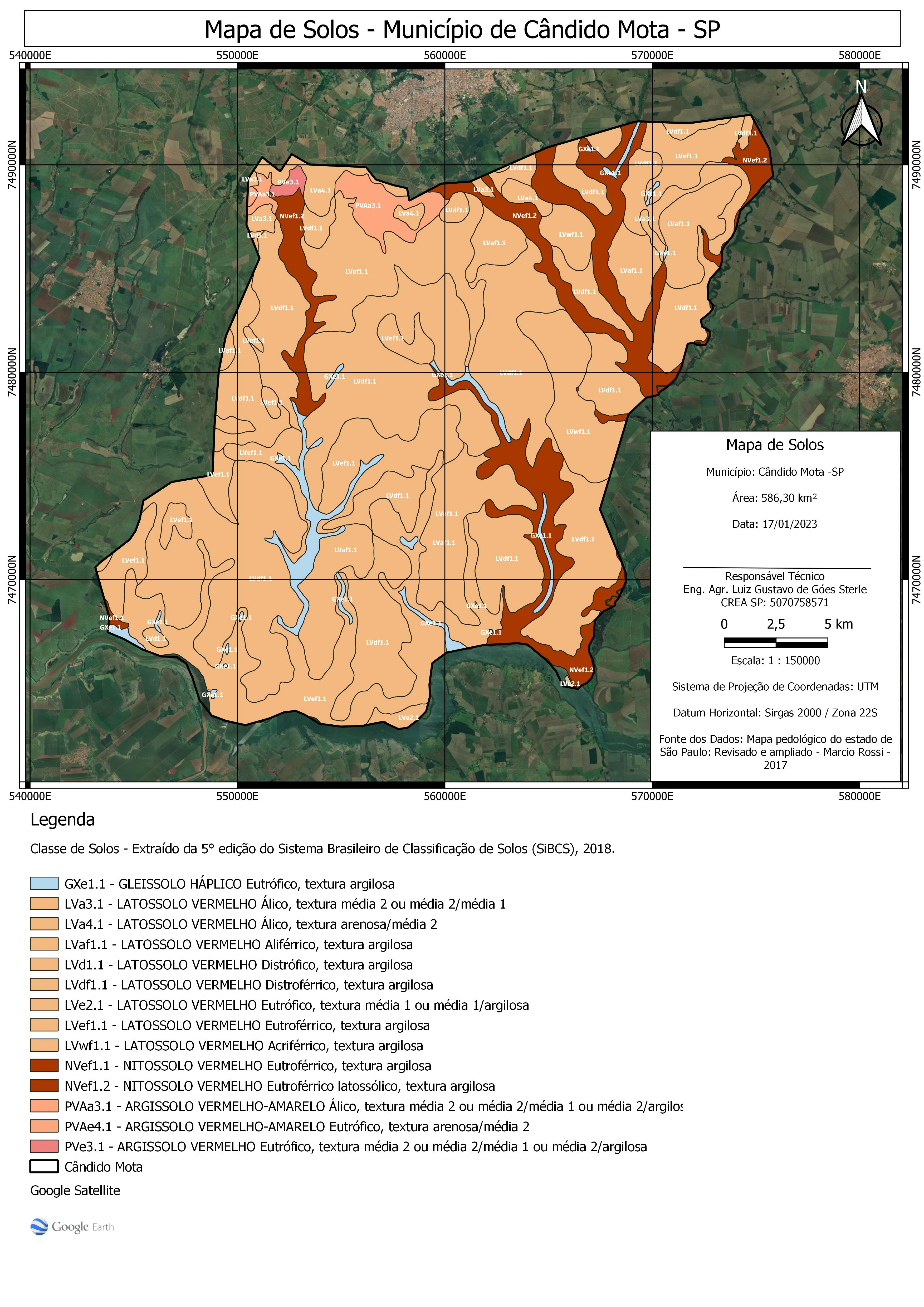
Map making is done by considering 6 parameters which are weighted for each parameter. The parameters used are altitude, land slope, river density, soil type, land use, and rainfall. The more influential, the greater parameter weight.
Flood Hazard
Tools used
ArcMapMicrosoft Excel
Plug-ins used
indonesia-geospasial
tags
Flood HazardSpatial analyst
More by Ilham Muhammad Shuhada


You might also like


Join the community!
We're a place where geospatial professionals showcase their works and discover opportunities.