
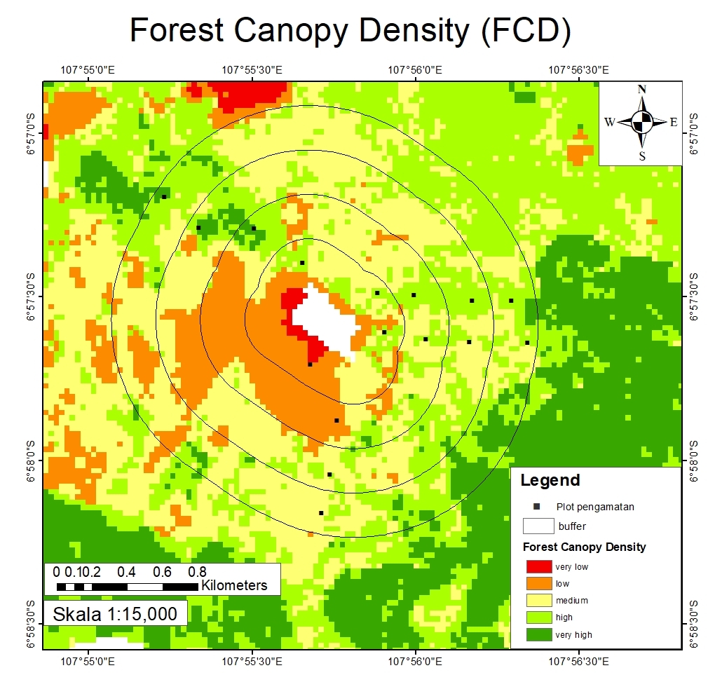
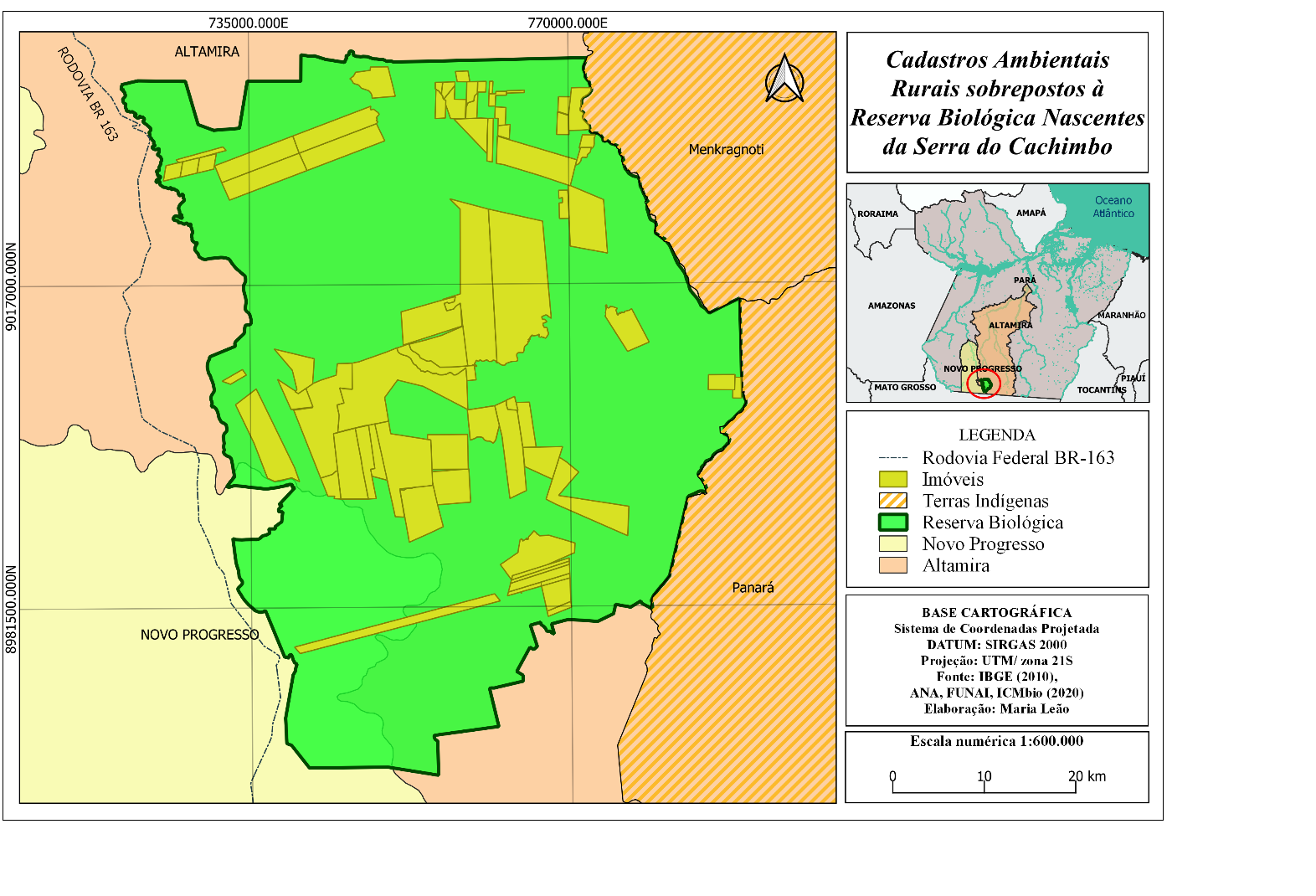
This model considers 4 different variables namely AVI (Advanced Vegetation Index) , BI (Bare Soil Index) , SI (Shadow Index), and TI (Thermal Index) as a weight in determining the level of vegetation density. AVI and BI variables will be combined to obtain a new variable, namely Vegetation Density (VD) using the Principal Component Analysis (PCA) method, while SI and TI will become the Scaled Shadow Index (SSI). The final stage for determining the FCD model is carried out by integrating the VD and SSI values. Contact me if you are curious about it.
Forest Canopy Density Map
Tools used
ArcMapGoogle Earth Engine(GEE)
Plug-ins used
usgs
tags
forestForest Canopy Densityvegetation density
More by Ilham Muhammad Shuhada


You might also like


Join the community!
We're a place where geospatial professionals showcase their works and discover opportunities.