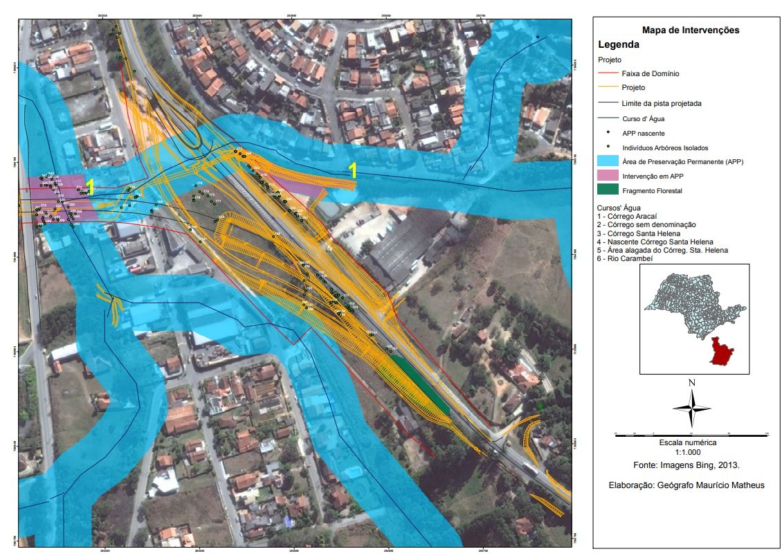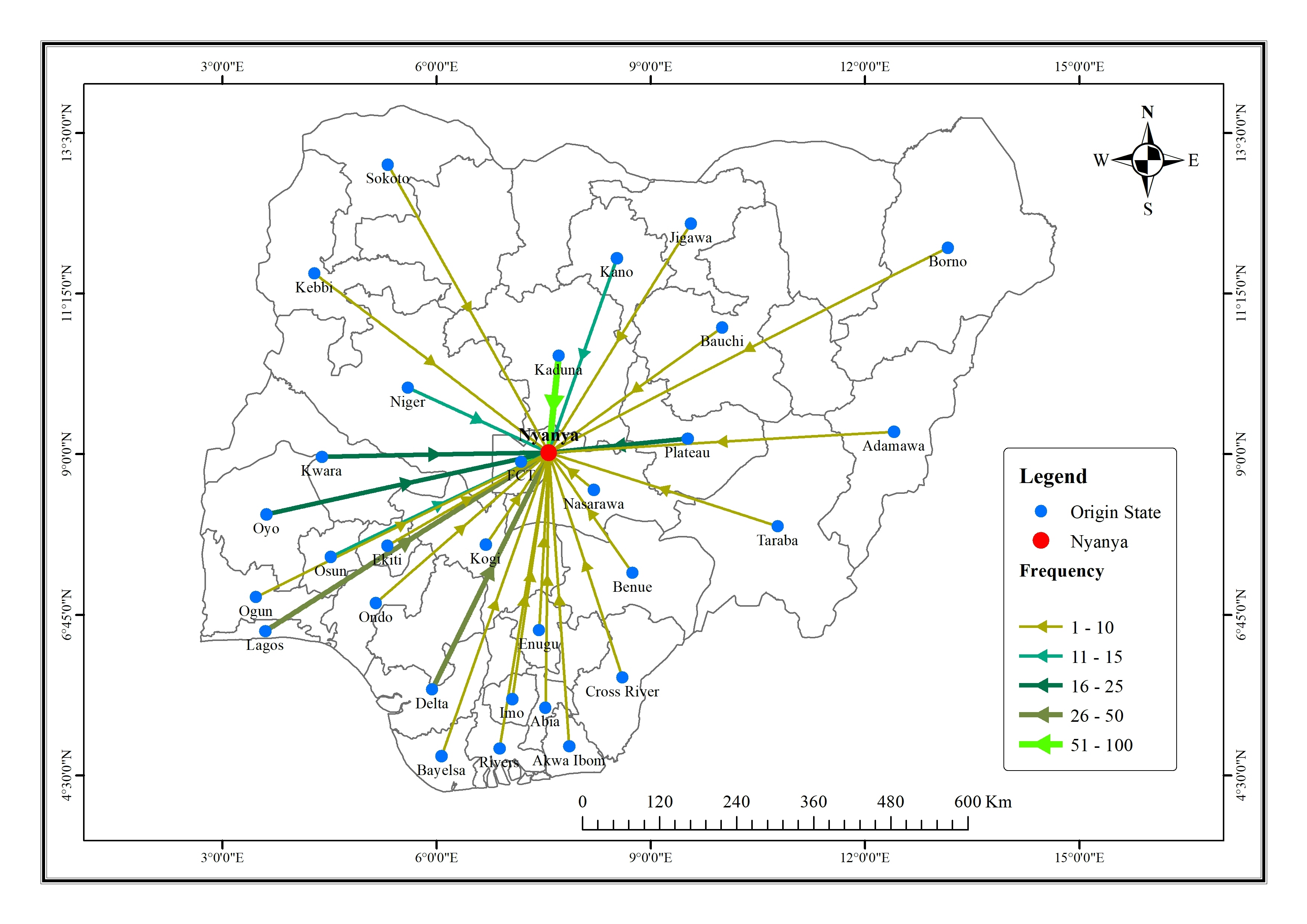
A field survey was conducted to get the origin state of the respondents.
State boundary data was downloaded from OpenStreetMap.
The flow line was developed on QGIS and the map was produced with ArcMap.
FLOW MAP OF PEOPLE INTO NYANYA, FCT
A field survey was conducted to get the origin state of the respondents.
State boundary data was downloaded from OpenStreetMap.
The flow line was developed on QGIS and the map was produced with ArcMap.
More by Damilola Fadipe
You might also like
We're a place where geospatial professionals showcase their works and discover opportunities.