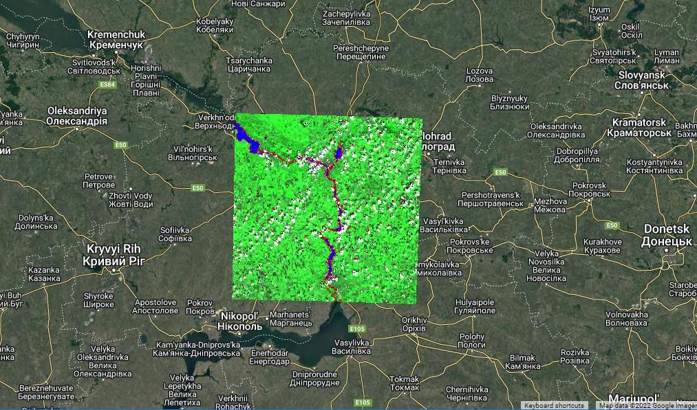

Aim: Systematic introduction to generation of a burn severity map for the assessment of the areas affected by wildfires.
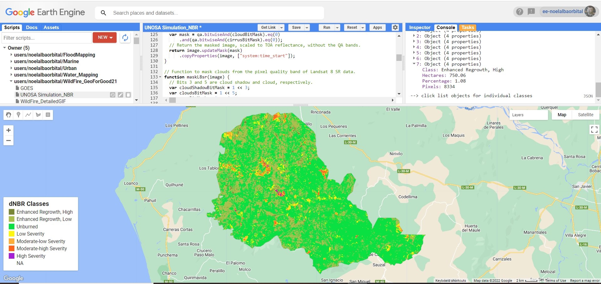
Normalized Burn Ratio (NBR) is used, as it was designed to highlight burned areas and estimate burn severity. It uses near-infrared (NIR) and shortwave-infrared (SWIR) wavelengths. Healthy vegetation before the fire has very high NIR reflectance and a low SWIR response. In contrast, recently burned areas have a low reflectance in the NIR and high reflectance in the SWIR band.
Tutorial link from UNOSA Portal : https://www.un-spider.org/advisory-support/recommended-practices/recommended-practice-burn-severity/burn-severity-earth-engine