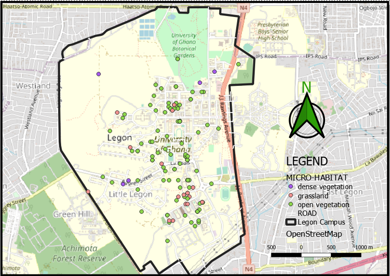
_645201.jpg&w=96&q=50 "Eguagie-suyi Precious")
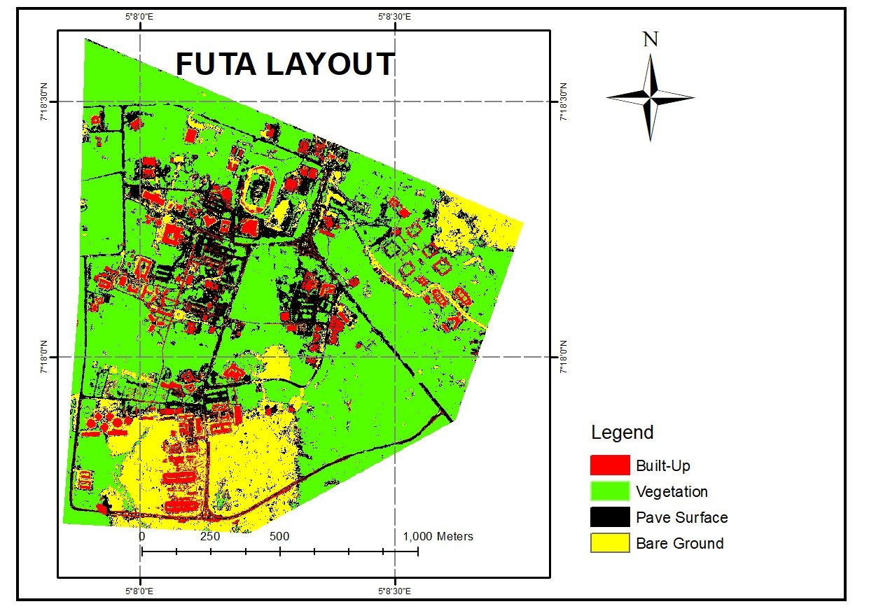
This is a cut-out of FUTA using supervised learning classification on Arcmap to perform spatial analysis to know places covered with built-up, vegetation, bare surface, and paved surface.
Procedure.
Before this detailed information could be achieved a very high-resolution image of 1m was used. This process is different from the conventional 30m resolution data used from Landsat or sentinel imagery. Then a lot of sample data had to be collected to achieve high accuracy, this should be done because in a high-resolution image features might look similar e.g the roof of a house and a paved surface. Then after that, the model is run giving the classification we have on the map above.
With this information, one can deduce the predominant land activities in a particular location with very high accuracy.