
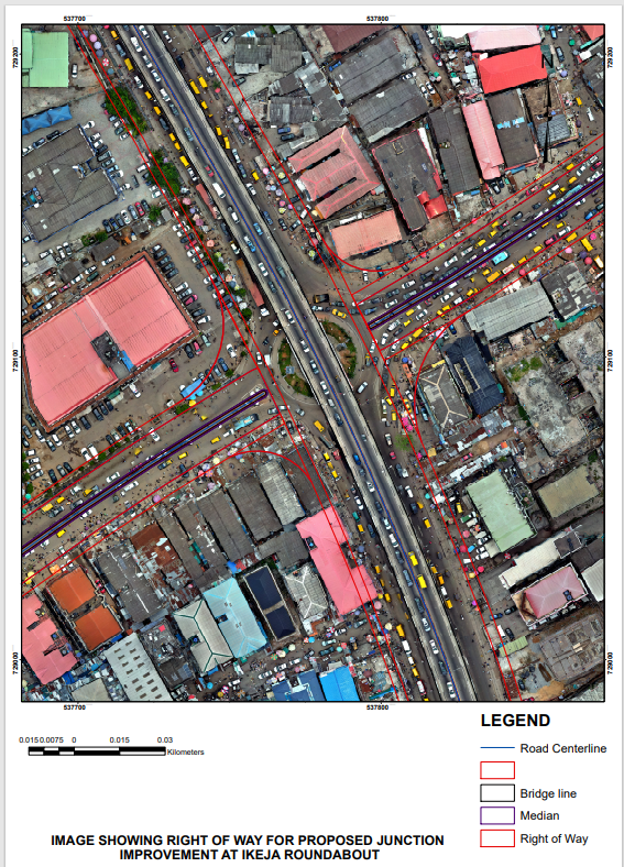
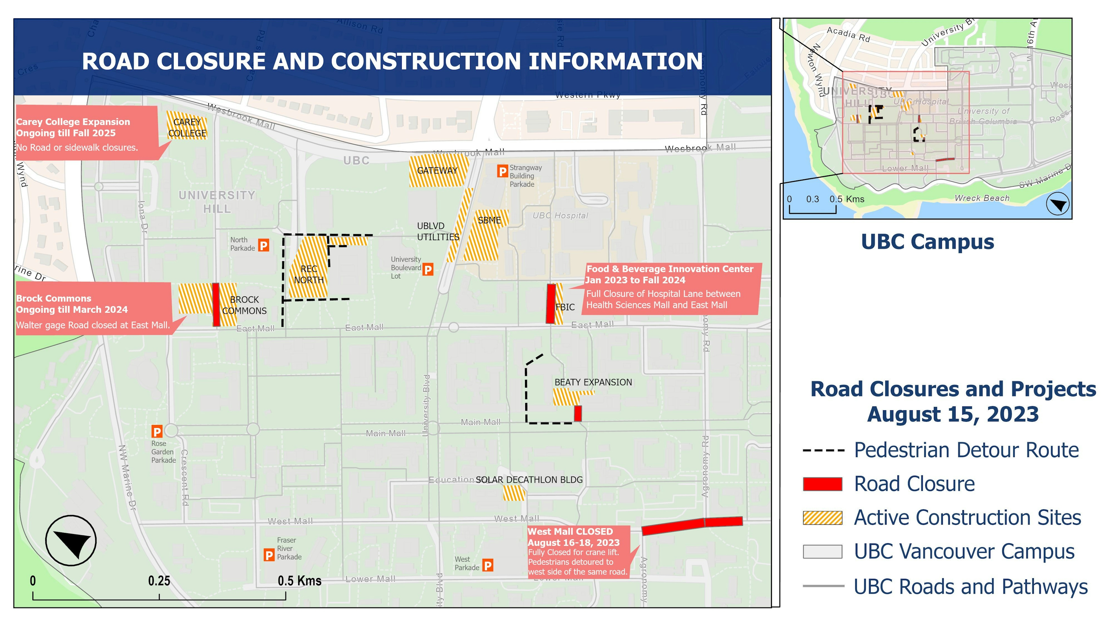
I took the drone footage with the Autel evo II drone. Processing involving mosaicing the drone images was done with Agisoft to generate the orthophoto, after which ArcGIS was used to draw the road alignment and generate the map with proposed dimensions based on Engineering design.
ROAD ALIGNMENT PROJECT
Tools used
AgisoftArcGIS Desktop
Plug-ins used
ArcGISbuffer
tags
ArcMapBuffersbuildingsDroneRightOfWay
You might also like


Join the community!
We're a place where geospatial professionals showcase their works and discover opportunities.