
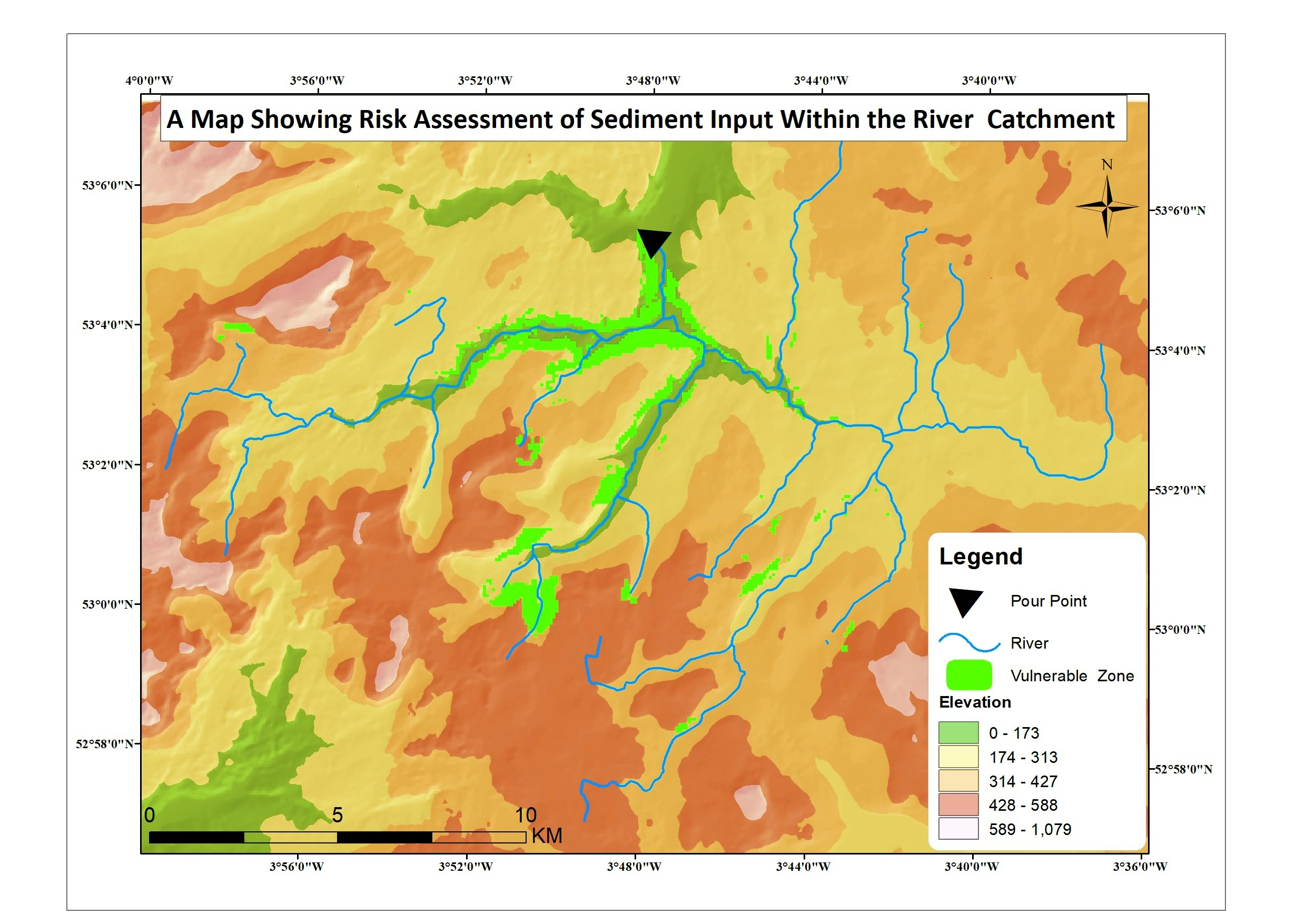
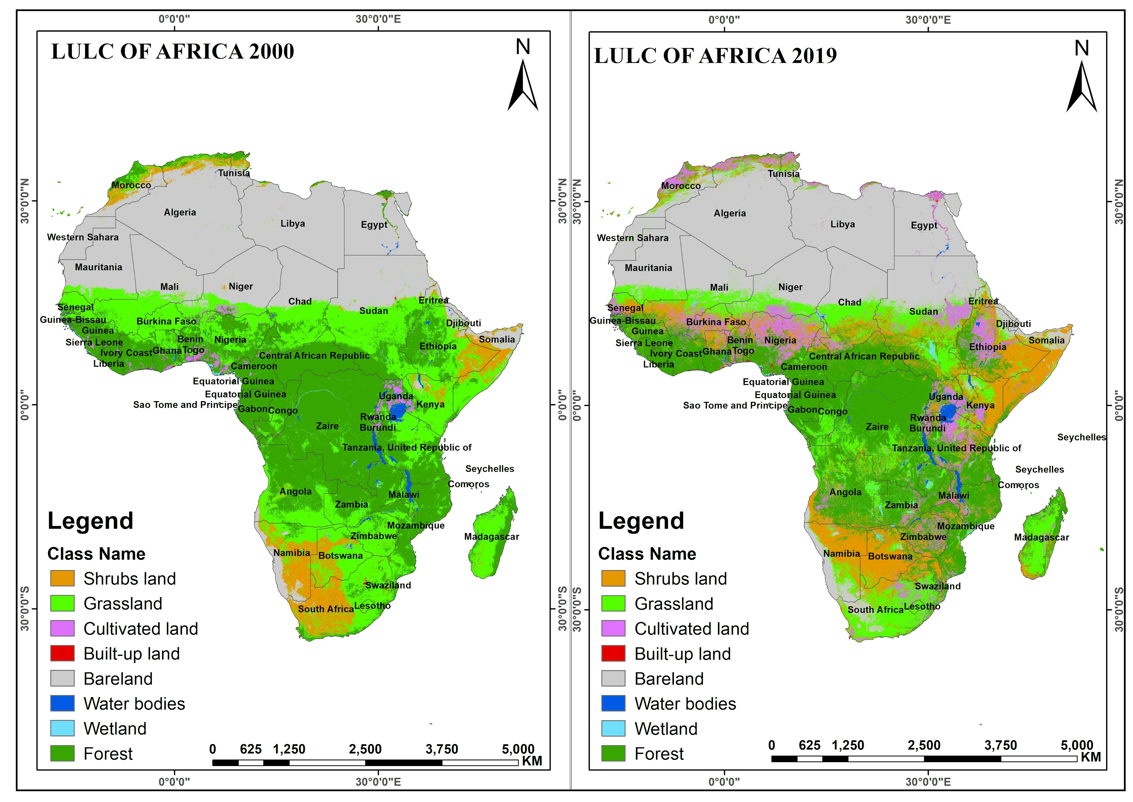
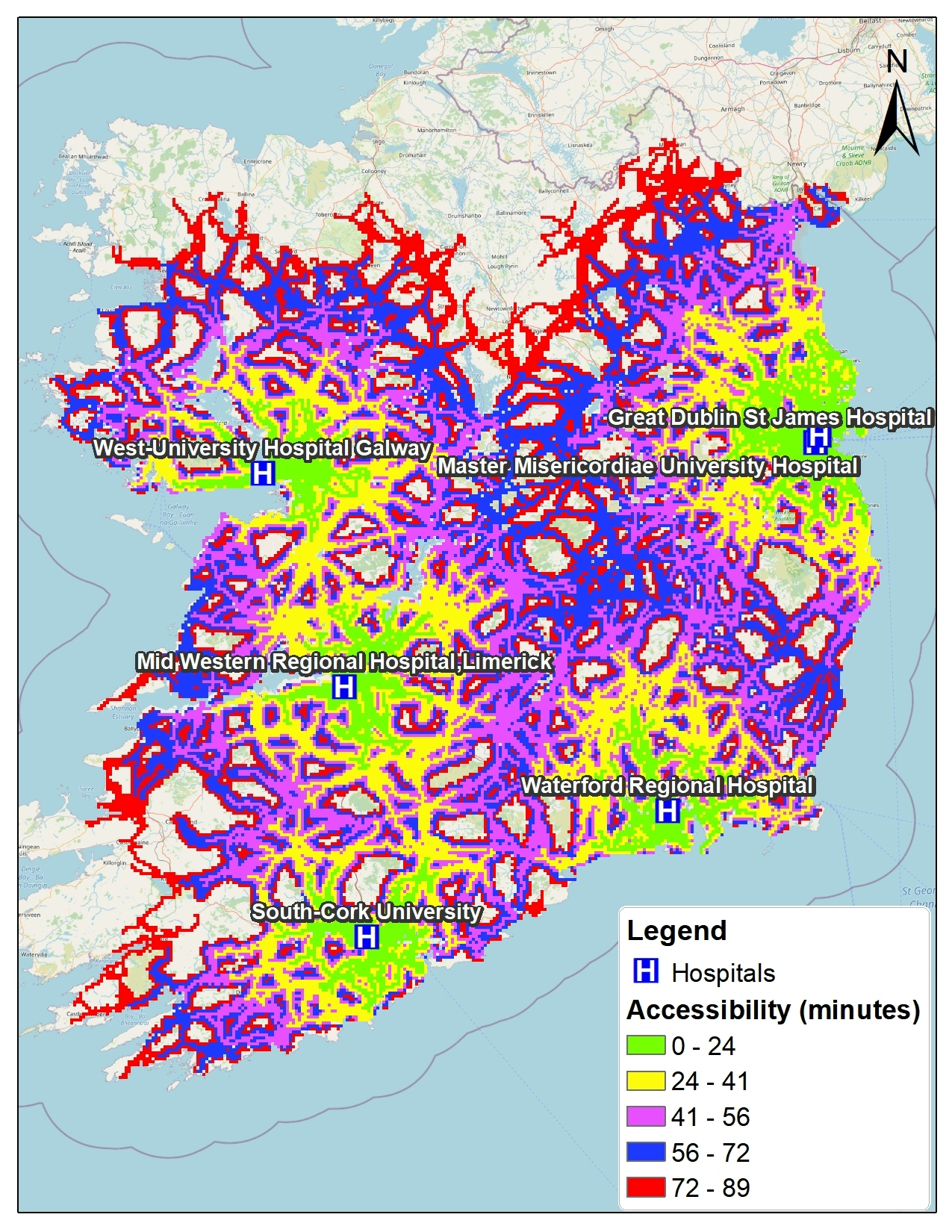
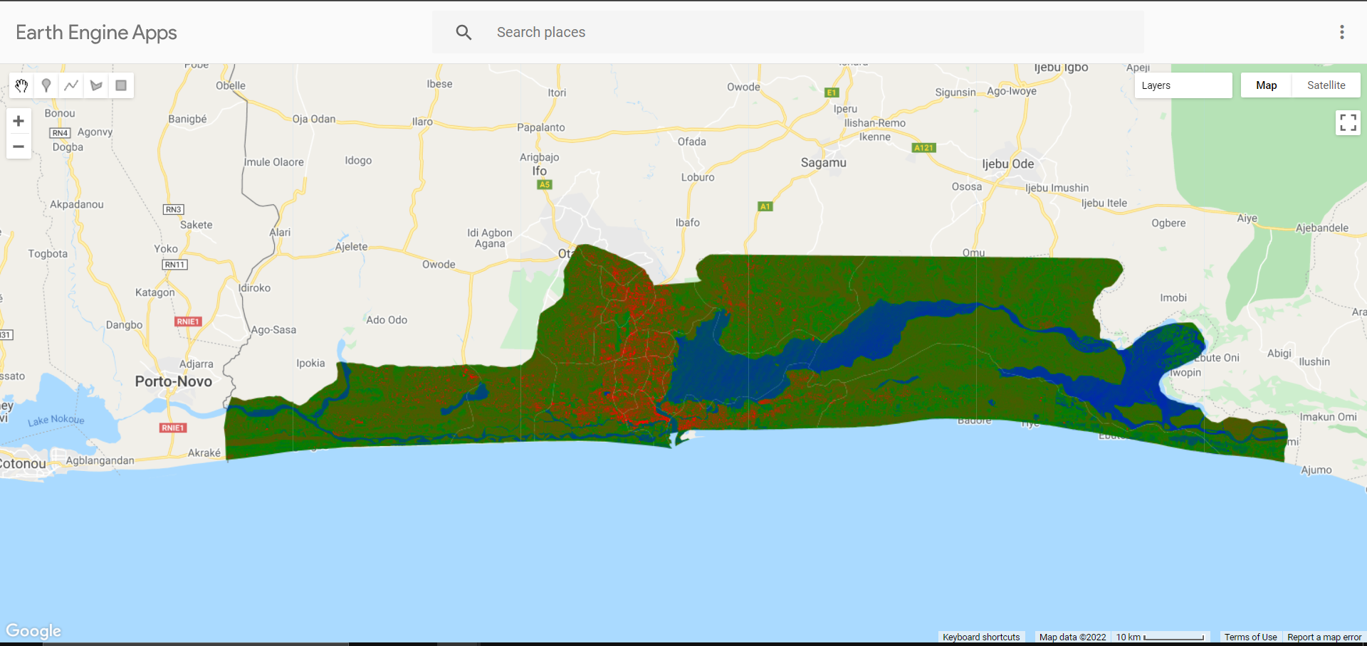
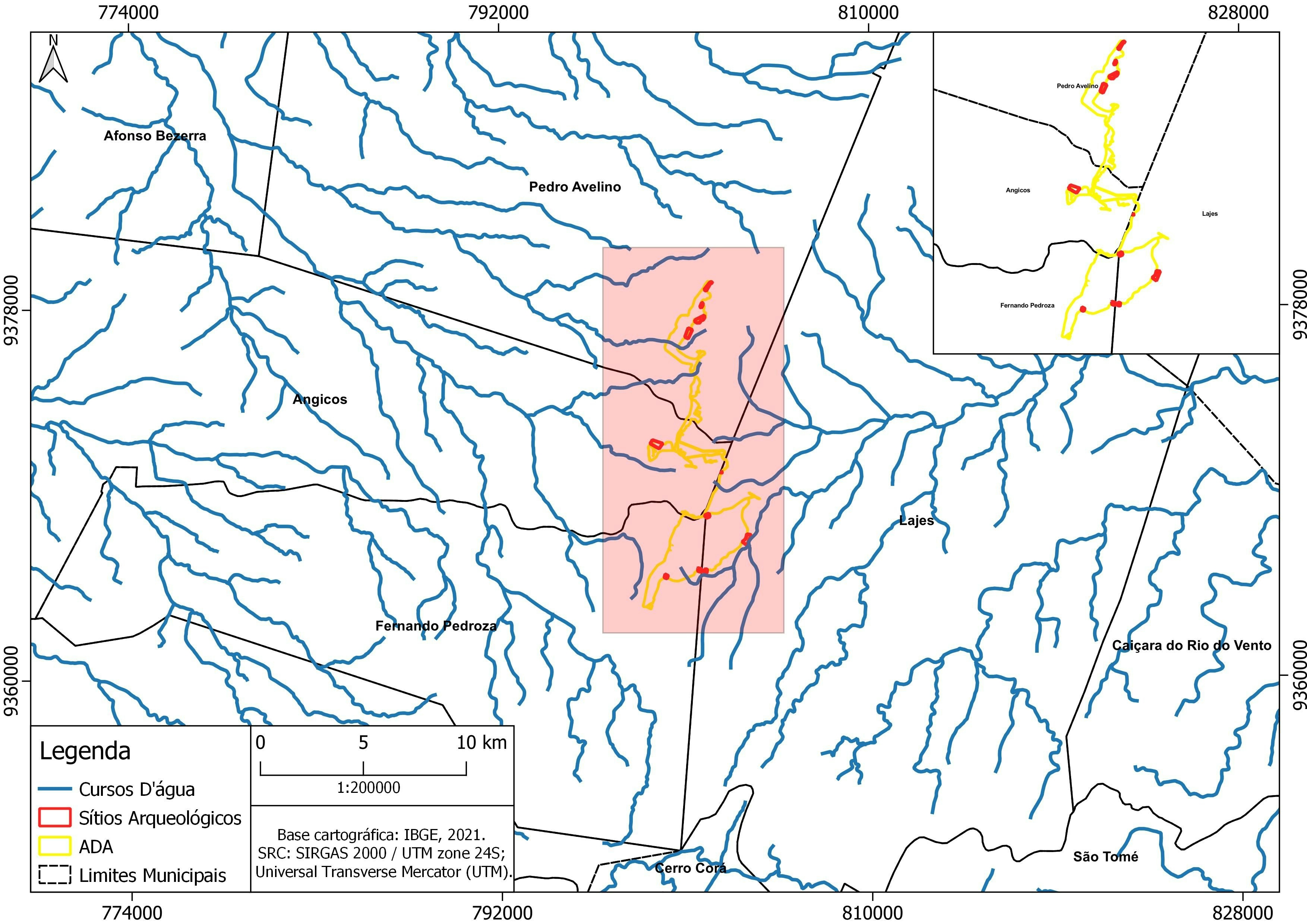
This is risk assessment map created based on water sediment input to understand why fishes are not found in some part of the river, some chemical characteristics of the sediment at different point was examine and the water drop point too was also evaluated to understand if river flow also influence the chemical found.
Risk Assessment Map
Tools used
ArcMap
Plug-ins used
ArcMap
You might also like


Join the community!
We're a place where geospatial professionals showcase their works and discover opportunities.