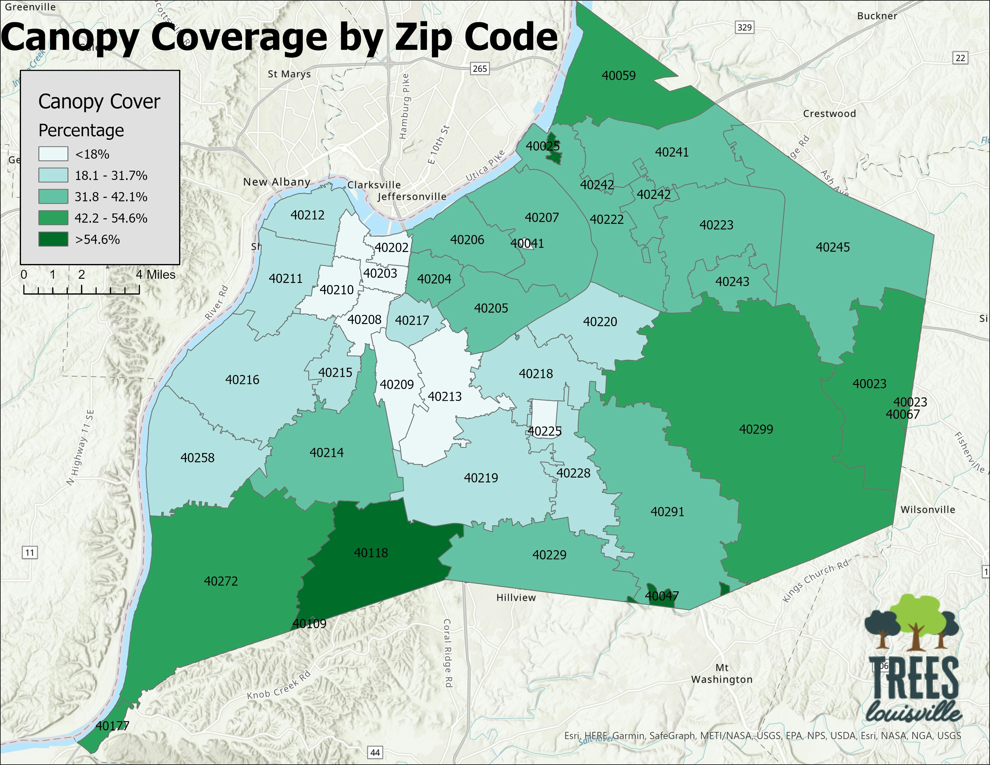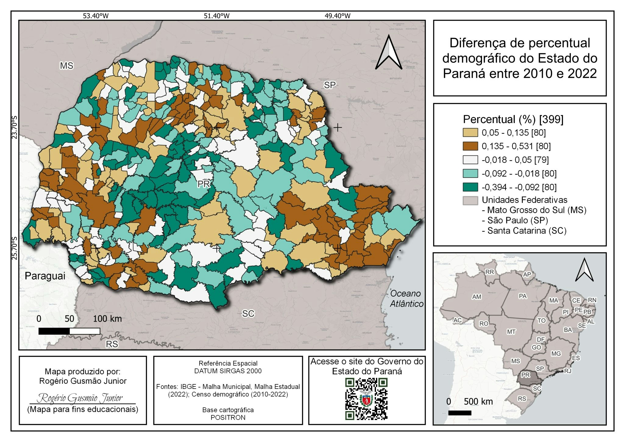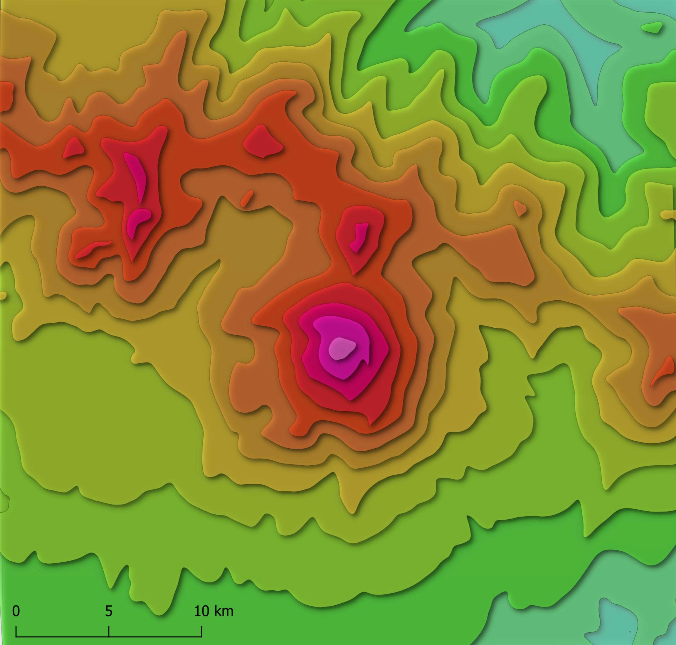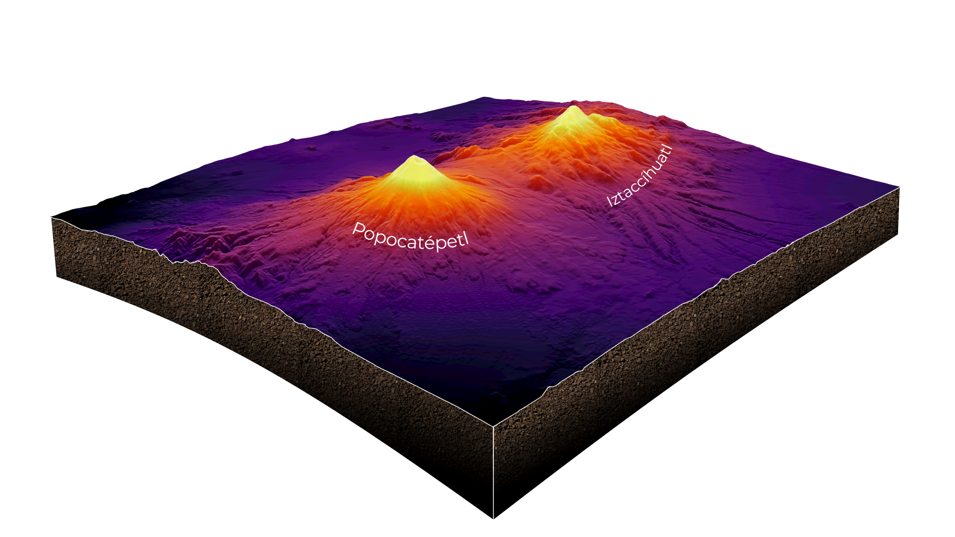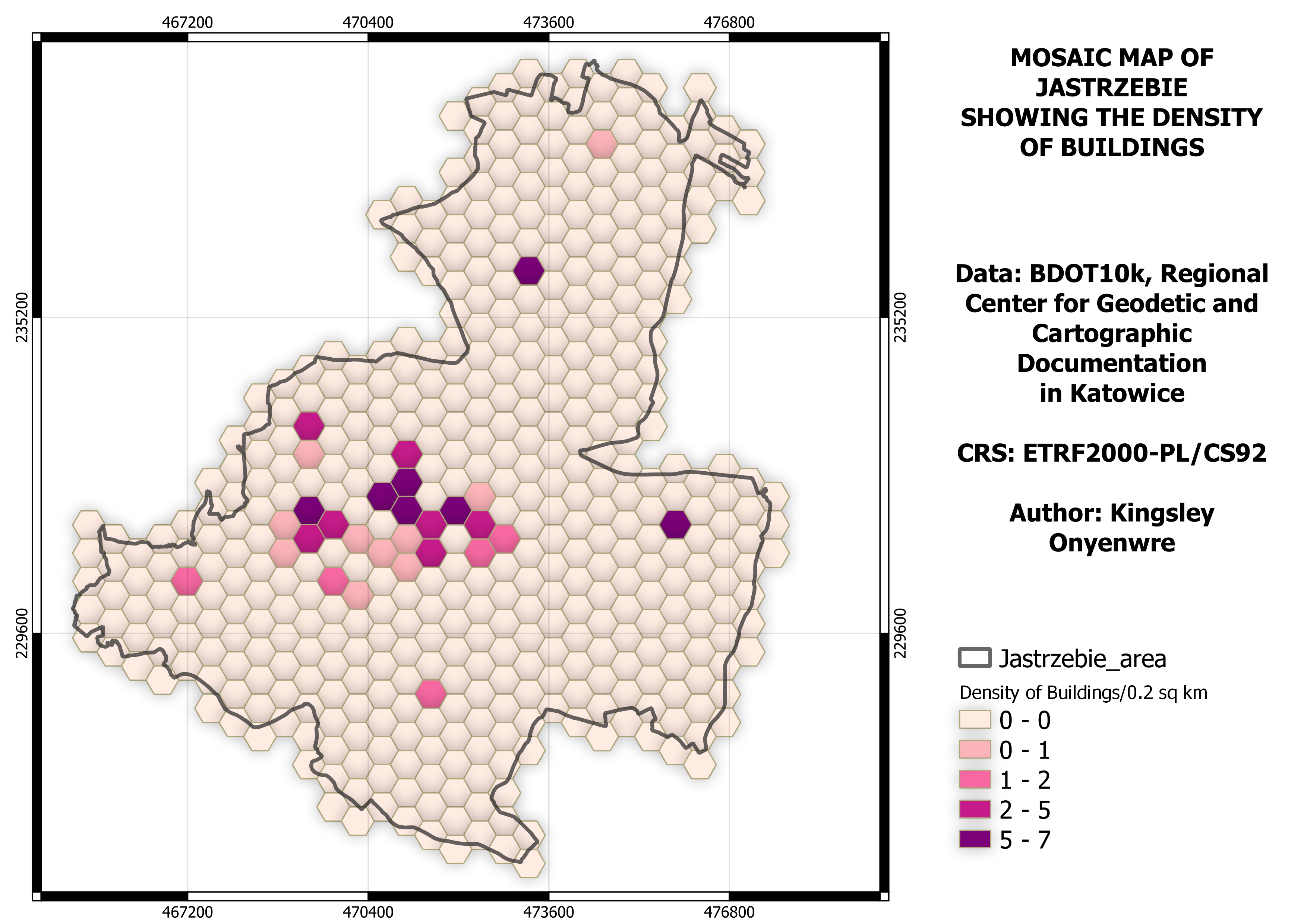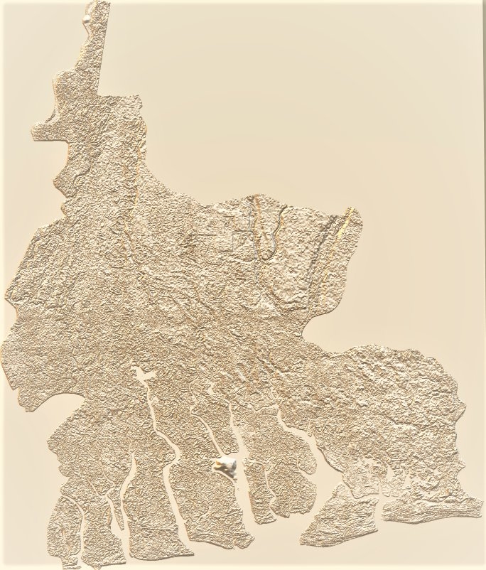
The map can be used to understand Delta terrain, the ranges of elevation from low lands to high land, and can be used to visualize the watersheds and different catchment zones within Delta state.
·
The map can be printed and used for aesthetic purposes
DATA USED
30meter SRTM Digital Elevation Model (DEM) acquired from https://earthexplorer.usgs.gov/
SOFTWARE/PLUGIN USED
· QGIS DEMto3D
· Microsoft Phot paint 3D
PROCESSING STAGES
· The data was acquired from https://earthexplorer.usgs.gov/.
· The data downloaded was in different tiles, to merge the data together, the data was mosaiced using QGIS raster tool.
· The boundary shapefile of the area was then used to clip out the state.
· The clipped data was set as input data for the tool (DEM23D)
· The scale was set to 1:5000 which automatically set the rest of the parameters, the recommended parameters generated were used to set the space
· The vertical exaggeration level was set to 50m
· The height was set to 1meter
· Then run.
· The output 3D object was opened and colorized using the Microsoft 3D photo paint
CHALLENGES FACED
· Picking the best color
· Setting the best scale and vertical exaggeration