
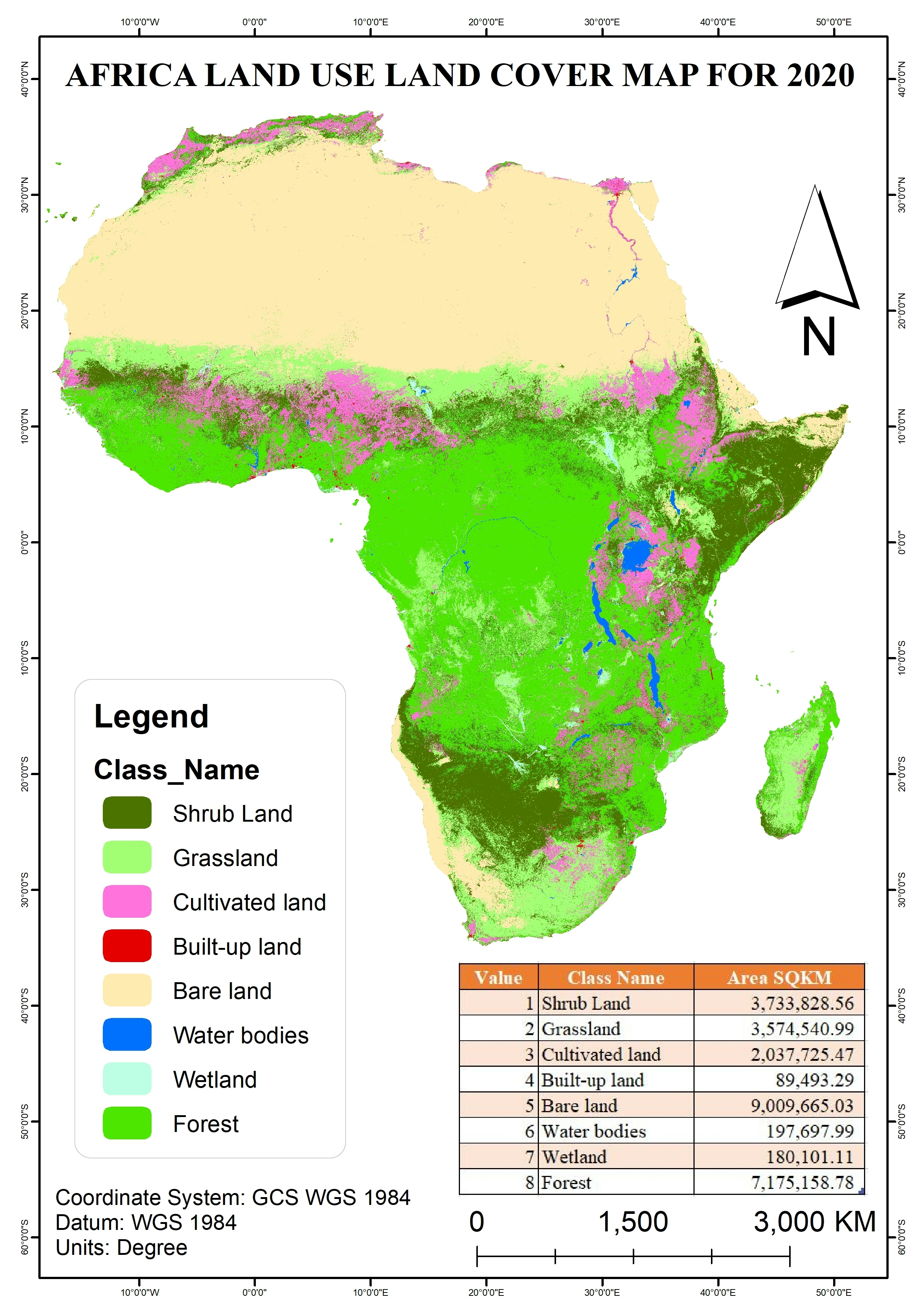
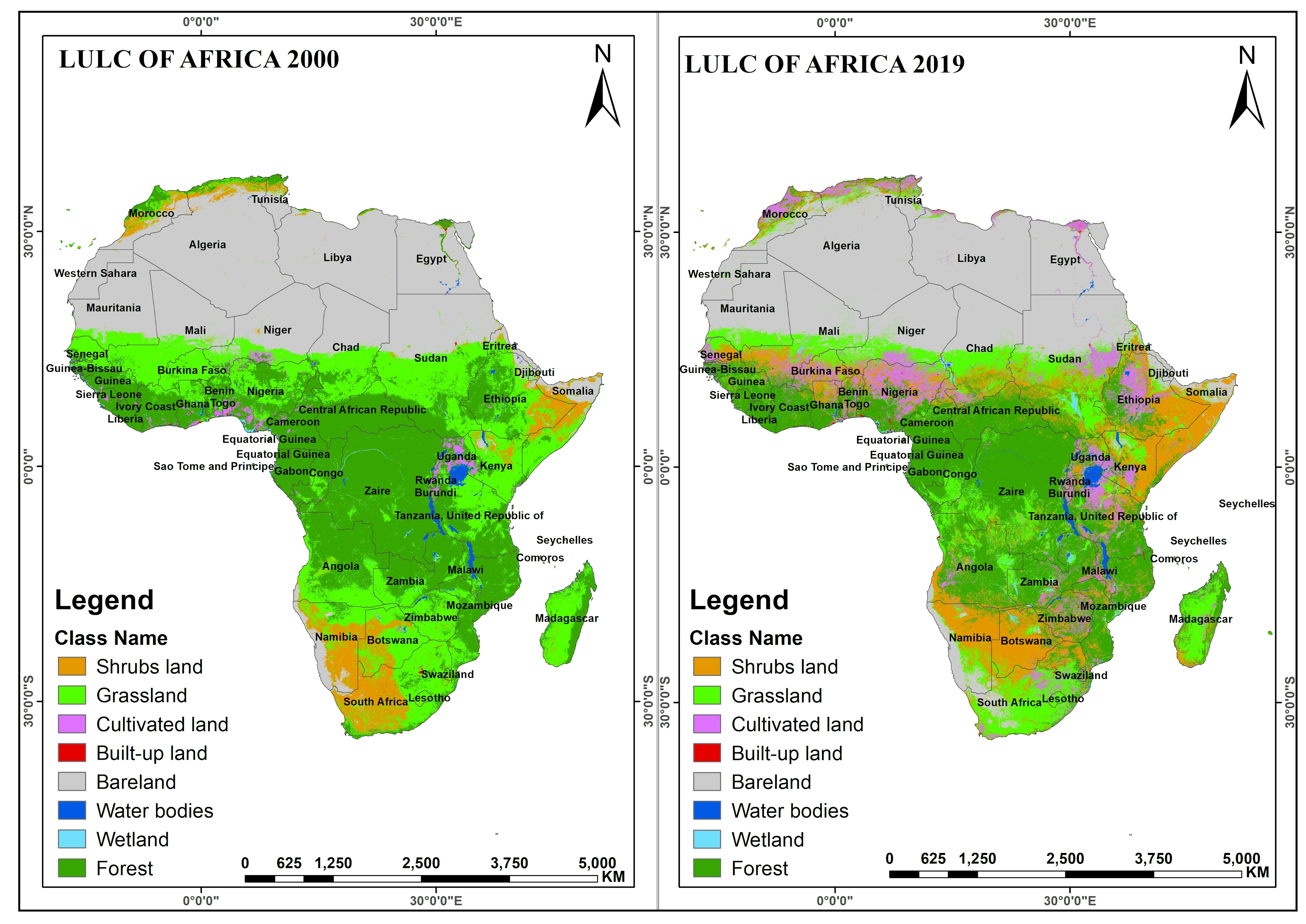
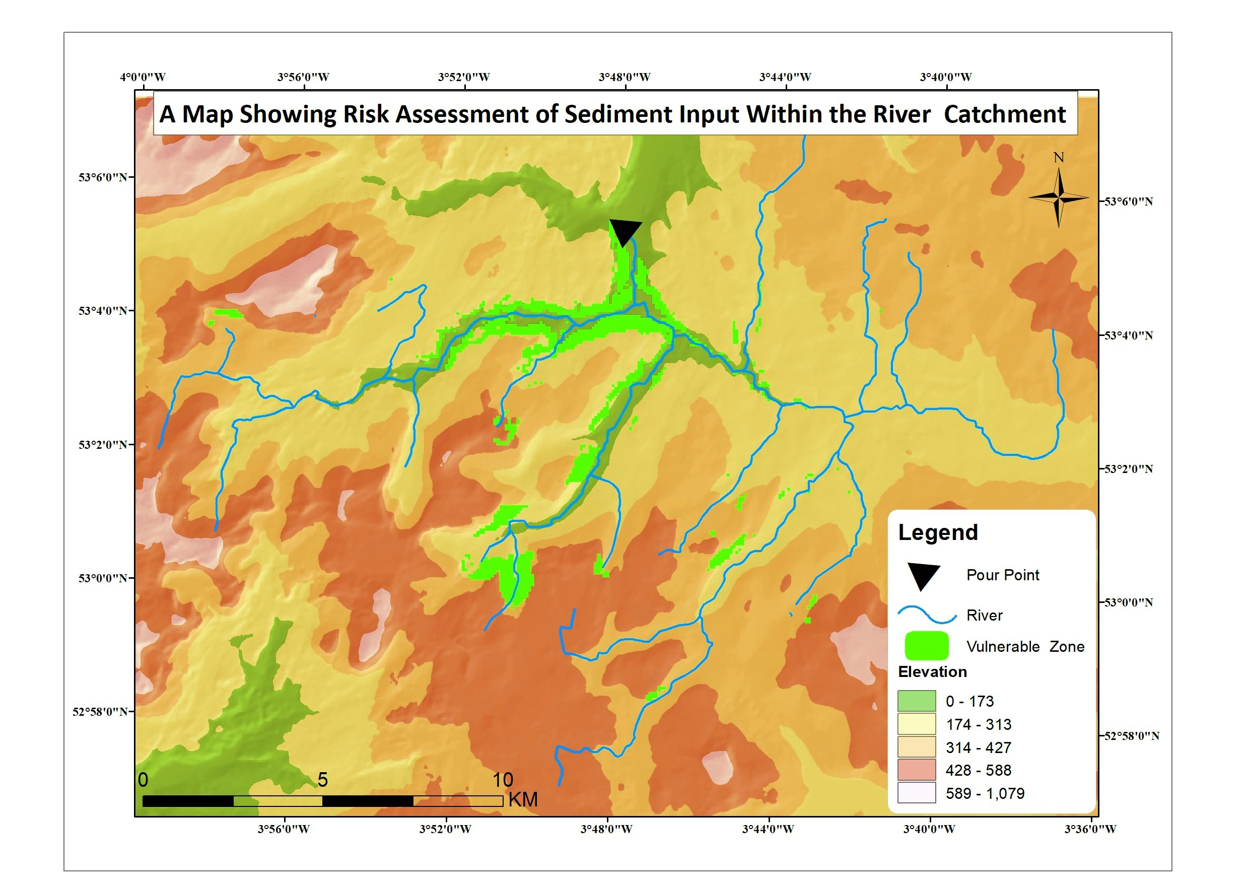
This map is created using the Copernicus Land Cover map data. the data was downloaded from https://land.copernicus.eu/global/products/lc. Arcpy scripting was used to do image processing functions such as clipping and mosaic because the dataset was downloaded in tiles, the image was reclassified into the appropriate classes. The final layout was styled and designed using ArcMap 10.7.1.
2020 Land Use Land Cover Map of Africa
More by Adedoyin Ajeyomi

You might also like


.svg "Keran Nkongolo")


Join the community!
We're a place where geospatial professionals showcase their works and discover opportunities.