
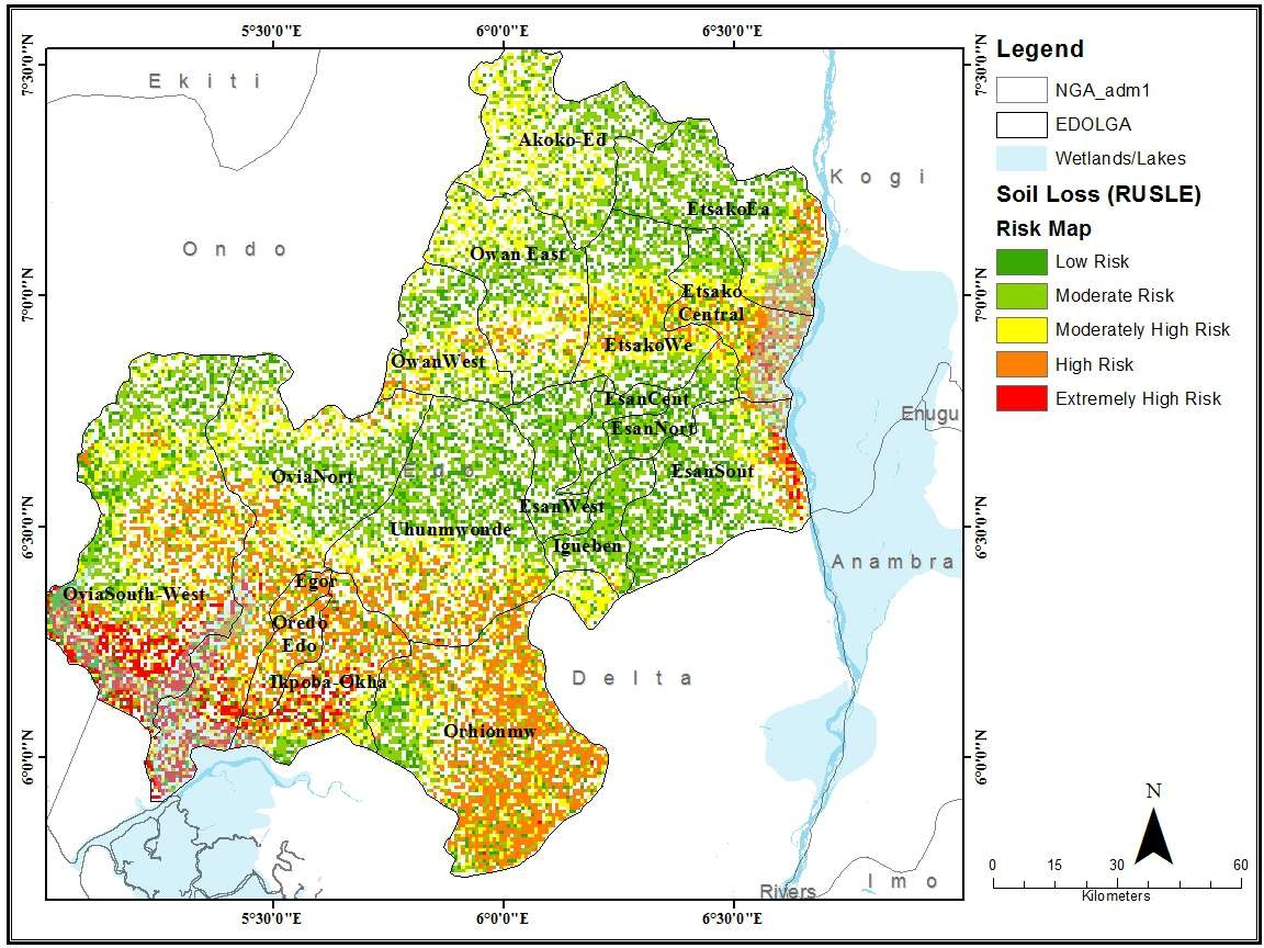
Soil loss is an incredible phenomenon, often due to a lot of interconnecting factors such as geology, slope, soil type, compaction ratio, rainfall amount and length of rainfall amongst others. This project utilises the Revised Universal Soil Loss Equation (RUSLE) which computes the average soil loss per unit area. The project was carried out for Edo State Nigeria using a combination of high-resolution satellite images, digital elevation models, soil and geologic data, rainfall data as well as soil conservation data among others. The project was carried out in 2017 using ArcGIS and Erdas Imagine
Soil Loss Estimation using RUSLE Moodel
Tools used
ArcGIS ProArcMapErdas ImagineR Studio
tags
ArcMapGISRasterR StudioSpatial Modelling
More by Joseph Aro


You might also like


_645201.jpg&w=48&q=40 "Eguagie-suyi Precious")


Join the community!
We're a place where geospatial professionals showcase their works and discover opportunities.