
Don't forget to comment or like this article at the end.
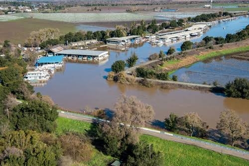
Construction engineers play a crucial role in managing floods and mitigating their effects. As cities and communities continue to grow, the risk of flooding increases, making it essential for engineers to create effective flood management strategies. One of the essential steps in achieving this goal is overlaying flood management engineering design on Digital Surface Models (DSM) and Digital Elevation Models (DEM). This article explores the importance of this process and how it is practically applied.
What are DSM and DEM?
DSM and DEM are vital tools for construction engineers as they help in creating accurate 3D models of the earth's surface. DSM is a representation of the earth's surface, including trees, buildings, and other above-ground features, while DEM represents the bare earth surface without any man-made or natural features. These models are created using various remote sensing technologies such as LiDAR, photogrammetry, and radar.
Flood Management Engineering Design
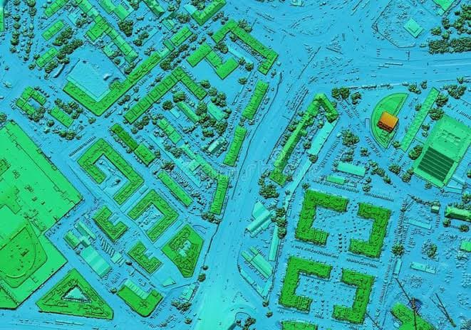
Flood management engineering design involves creating infrastructure and strategies to mitigate the impact of flooding. This process includes identifying areas that are prone to flooding and developing solutions to reduce their impact. Construction engineers use DSM and DEM to create accurate models of the land, which help in identifying the areas that are most vulnerable to flooding. This information is then used to create effective flood mitigation strategies, such as building flood walls, stormwater management systems, and other infrastructure. Overlaying flood management engineering design on DSM and DEM helps construction engineers to accurately identify and analyze areas that are prone to flooding. This process involves analyzing the elevation and slope of the land, water flow patterns, and the extent of the flood risk. By using DSM and DEM, engineers can create detailed flood maps that show the areas that are most vulnerable to flooding. This information can be used to create effective flood mitigation strategies.
Why is DEM and DSM Useful in Flood Management Engineering Design?
DEM is particularly useful in flood management engineering design because it provides a detailed elevation map of the land. Construction engineers can use DEM data to calculate the slope of the land and identify areas that are susceptible to flooding. This information is essential in designing drainage systems and other flood mitigation strategies that will help reduce the impact of floods.
DSM is also vital in flood management engineering design as it provides information on the above-ground features that can affect flooding. For example, DSM can show the height of buildings and other structures that may obstruct the flow of water during a flood. This information can be used to design flood walls that are tall enough to prevent floodwaters from entering these structures.
Overlaying Flood Management Engineering Design on DSM and DEM
In practical applications, overlaying flood management engineering design on DSM and DEM involves using specialized software to create 3D models of the earth's surface. This process starts with the collection of data from remote sensing technologies such as LiDAR or photogrammetry. The data is then processed to create accurate DSM and DEM models. Engineers can then overlay flood management engineering design on these models to create detailed flood maps and design flood mitigation strategies.
In conclusion, the importance of DEM and DSM to construction engineers in flood management cannot be overstated. By overlaying flood management engineering design on DSM and DEM, engineers can create detailed flood maps that help in the design of effective flood mitigation strategies. DEM is particularly useful in calculating the slope of the land and identifying areas that are susceptible to flooding, while DSM provides information on above-ground features that can affect flooding. With the help of specialized software, construction engineers can effectively manage floods and reduce their impact on communities.