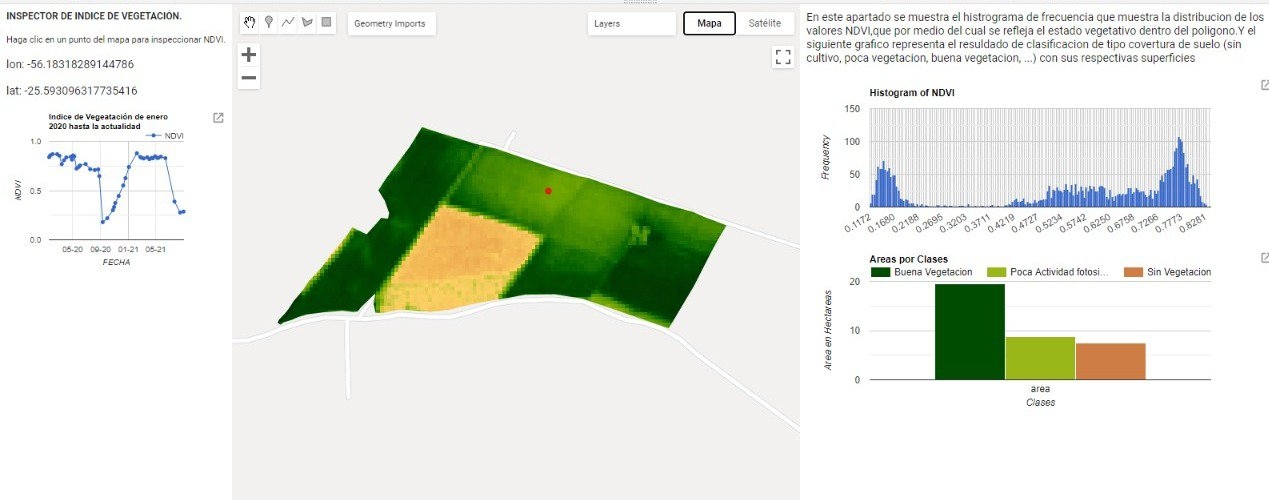
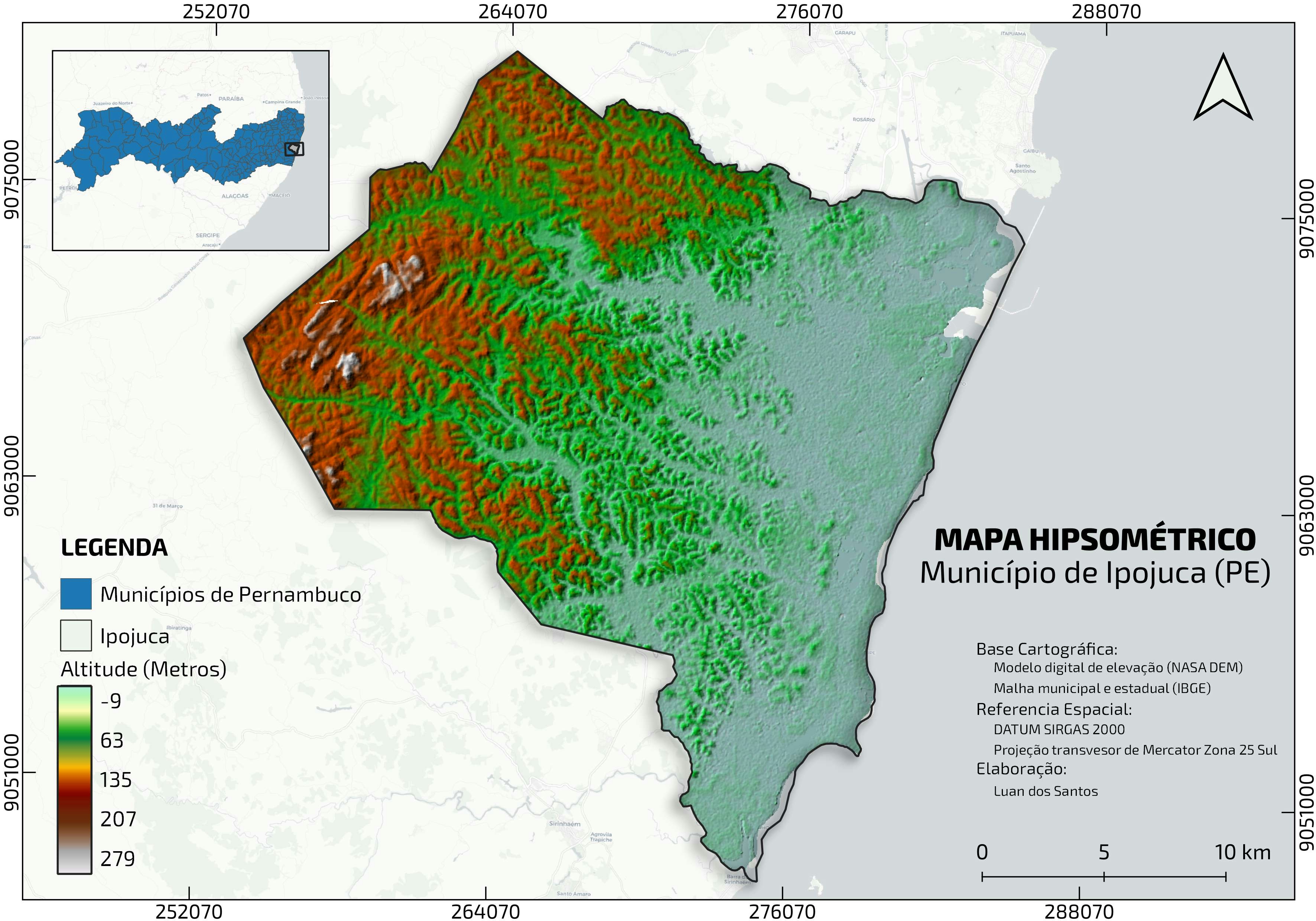
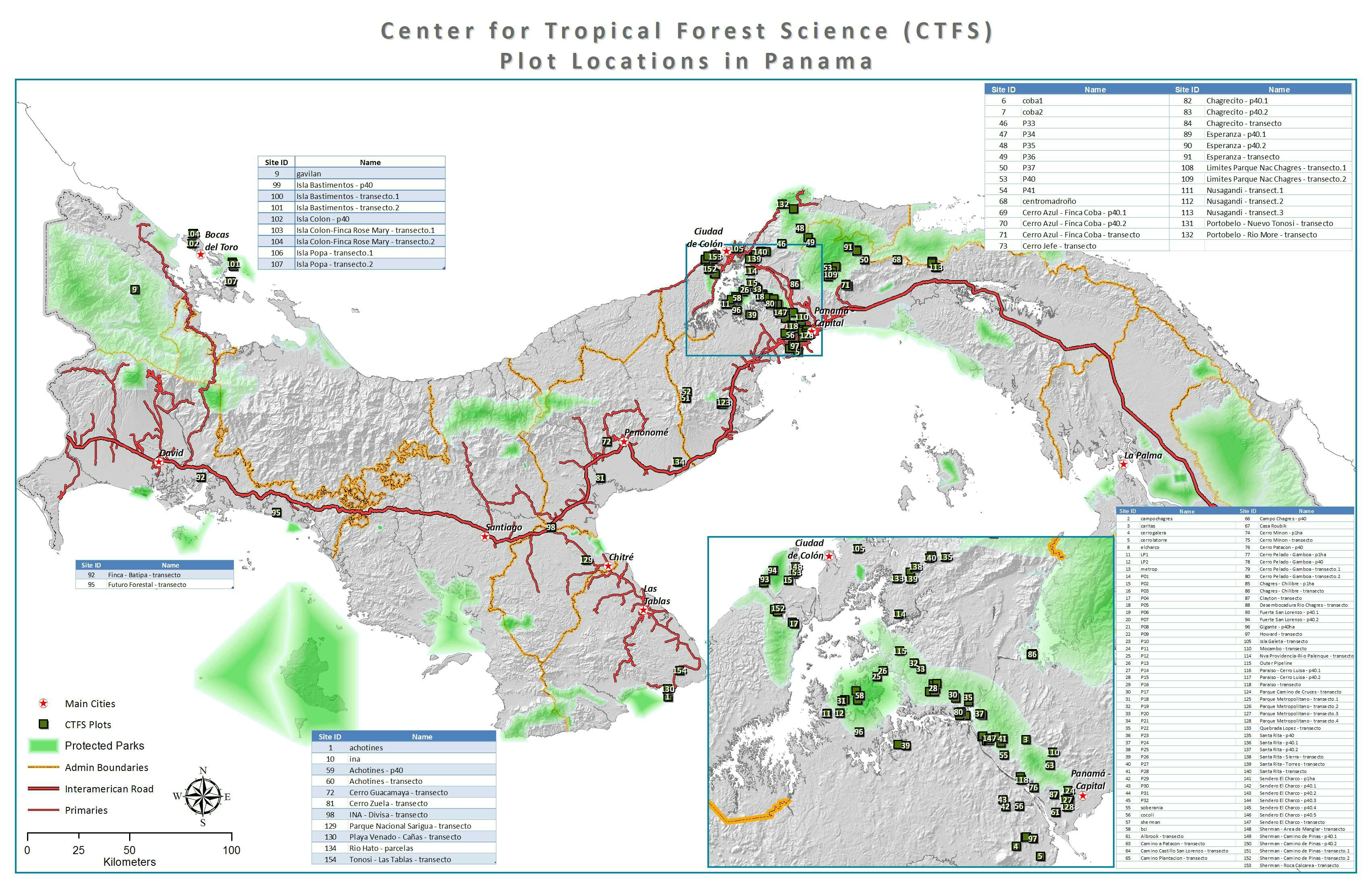
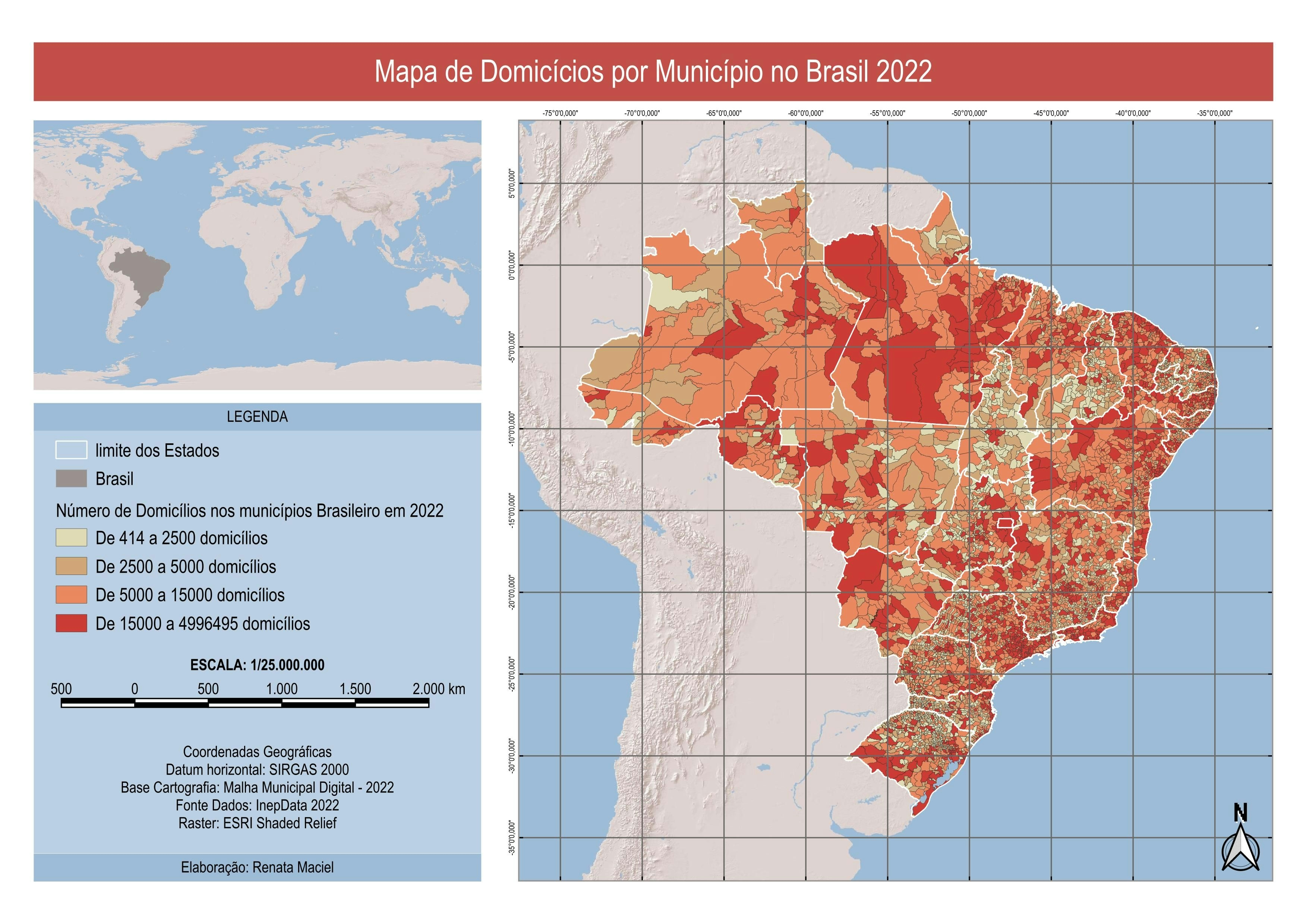
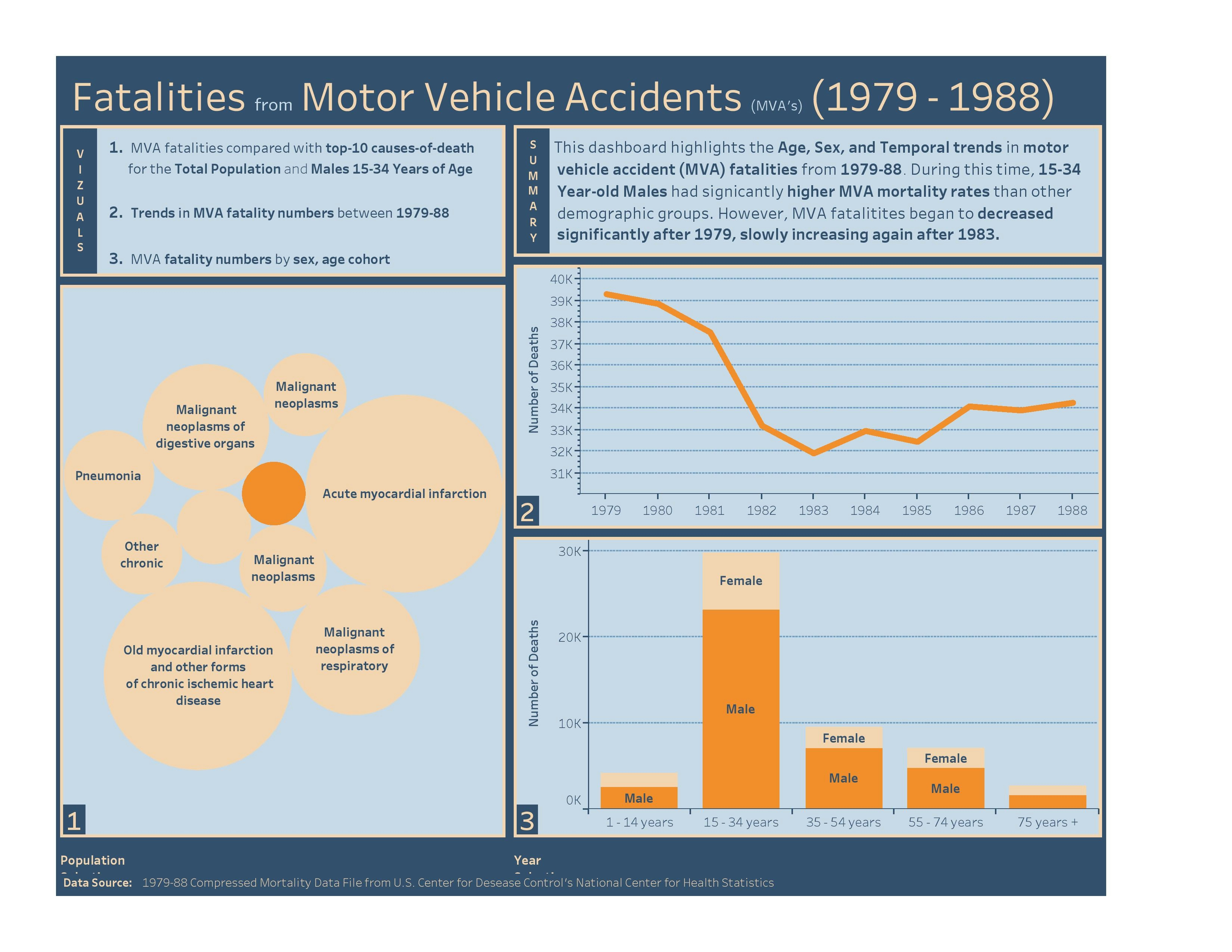
Análisis espacial de la parcela

Tools used
Google Earth Engine(GEE)Javascript
Plug-ins used
Javascript
tags
AgricultureRemote SensingSpatial analyst
You might also like


Join the community!
We're a place where geospatial professionals showcase their works and discover opportunities.