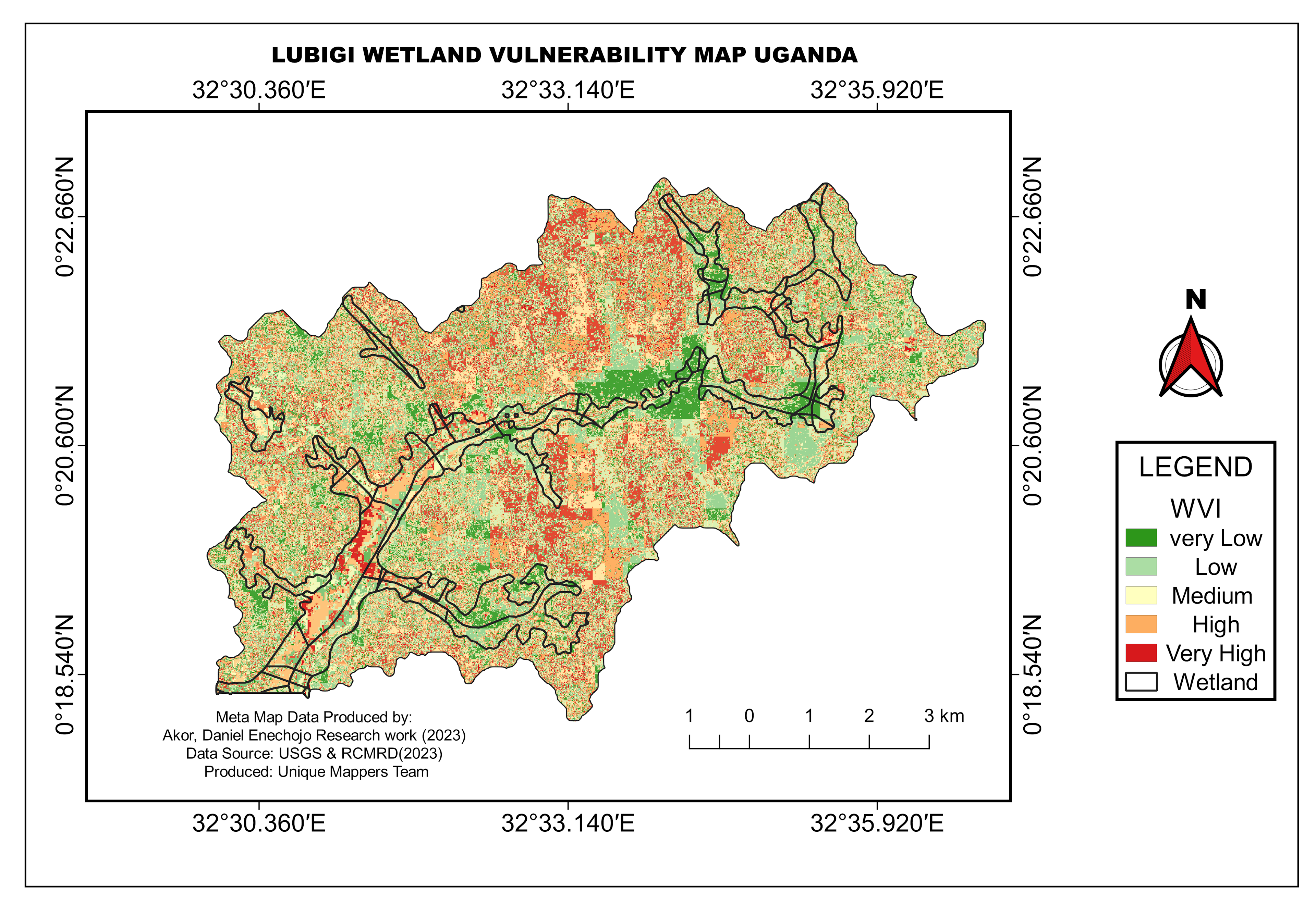
Lubigi Wetland is located in Uganda, the steps involved in this project includes,
Data collected for this research are Landsat 7-8 from USGS, shapefile from OSM, pre-processing tool using semi-automatic classification in QGIS, Raster calculation of different Satellite Band, spatial analysis of NDVI, LULC, NDBI, Degradation, MNDWI, Population, ecosystem dataset, and Raster clipping was employed. wetland vulnerability tool was used in QGIS to run the analysis and display results.