Sign up or log in to your Spatialnode account.

Takes less than a few seconds.

Cartographer

Oladeji Muhammed
Oladeji Muhammed•

September 29, 2022

Cartographer

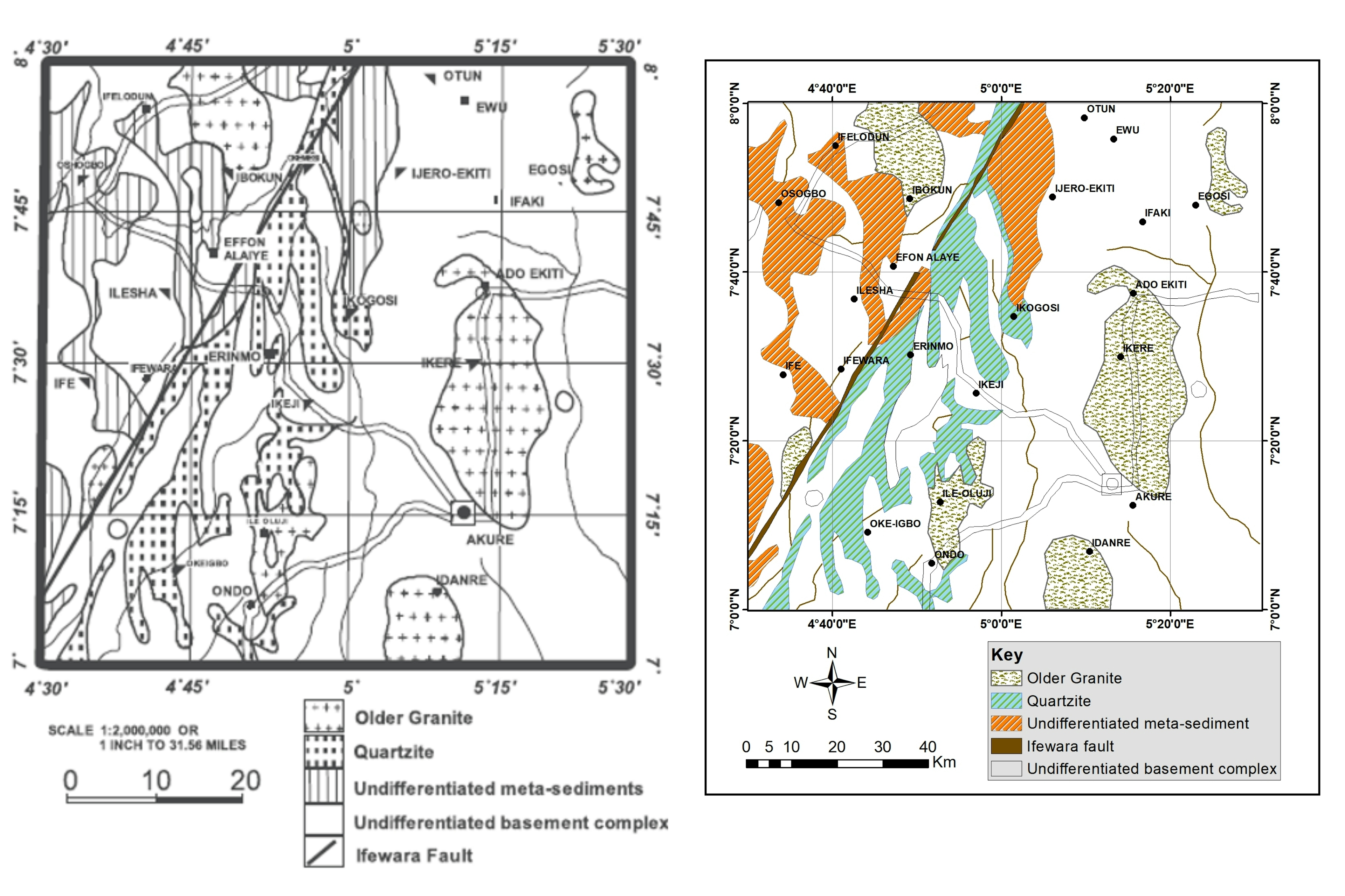
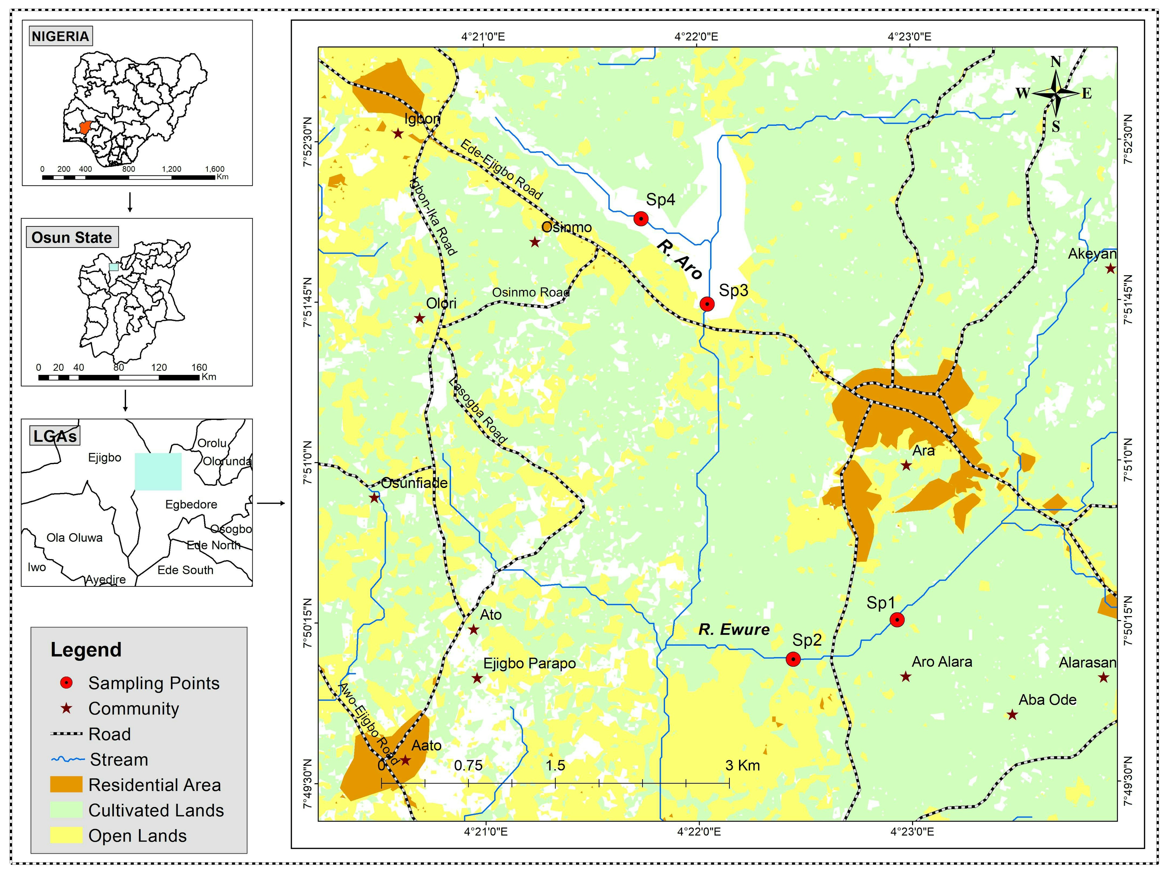
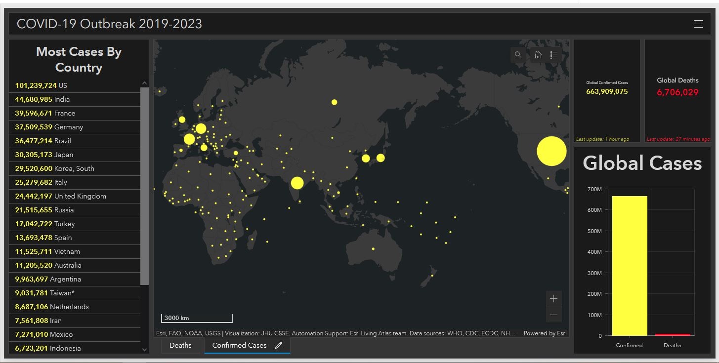
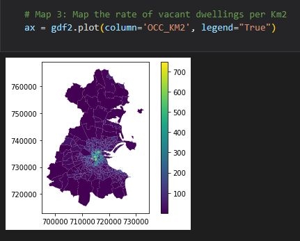
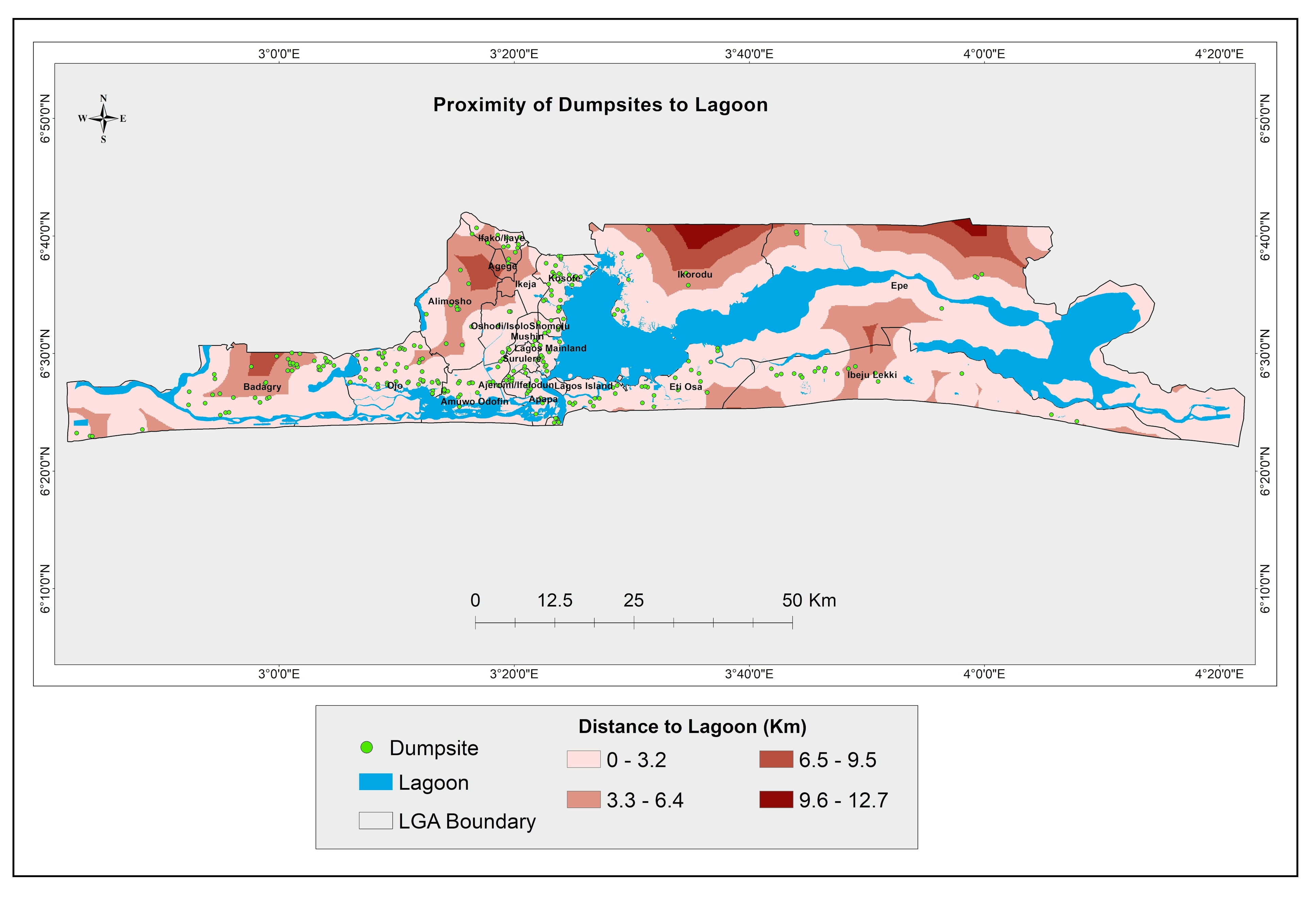
Submission to ESRI 2022 User Conference.


Tools used

ArcGIS

Plug-ins used

no plugins

tags

ArcGISArcMap

More by Oladeji Muhammed

Forest extent/types in some US location
23
Map Facelift
Map Facelift
33
Dublin vacant dwellings
39
Data Visualisation using Matplotlib
37
2019-2023 Global Covid-19 Dashboard
30
Map Re-draw/Facelift
56
Study area map
Study area map
139
Geology map of Oyo State facelift
161
Study area map
Study area map
15
ESRI Spatial Data Science Certification
38
LULLC Map of Ife South LGA
155
Proximity of dumpsite to lagoon in Lagos
14

You might also like

Other Countries HDI relative to Egypt
Hassan Yahia Hassan
Other Countries HDI relative to Egypt
Hassan Yahia Hassan
19
Habitat Suitability Model
Christopher DeGarmo
Habitat Suitability Model
Christopher DeGarmo
22
3D da carta de Igarapé Caxinduba
Jardel Estevam Barbosa dos Santos
3D da carta de Igarapé Caxinduba
Jardel Estevam...
2
Percentage of Mobility in The Workspace
Muhammad Rifqy
Percentage of Mobility in The Workspace
Muhammad Rifqy
16
CMS Analysis
alyle5@charlotte.edu
CMS Analysis
alyle5@charlotte.edu
9
Normalized Burn Ratio
Vitória Serra Bernardes
Normalized Burn Ratio
Vitória Serra Bernardes
165
Planta Georreferenciada - Estádio
Brenner Rodrigues
Planta Georreferenciada - Estádio
Brenner Rodrigues
9
Modelo Digital de Elevação 3D
Fenando Paulo Neto Alberto
Modelo Digital de Elevação 3D
Fenando Paulo...
20
Vista Iluminada do Pico da Bandeira
Vitória Serra Bernardes
Vista Iluminada do Pico da Bandeira
Vitória Serra Bernardes
469
CAR - Cadastro Ambiental Rural
Mauricio Matheus
CAR - Cadastro Ambiental Rural
Mauricio Matheus
33
Sentinel2 Band Combinations
Leonie Engemann
Sentinel2 Band Combinations
Leonie Engemann
73
Land Surface Temperature Analysis
Lawrence Akpoterai
Land Surface Temperature Analysis
Lawrence Akpoterai
104

Join the community!

We're a place where geospatial professionals showcase their works and discover opportunities.

Sign Up for free