Data Engineering
Data Analysis
Data Visualisation
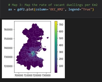
Data Visualisation using Matplotlib
Data Engineering
Data Analysis
Data Visualisation
More by Oladeji Muhammed
You might also like
We're a place where geospatial professionals showcase their works and discover opportunities.


.svg "Keran Nkongolo")


.jpg&w=3840&q=100)