Sign up or log in to your Spatialnode account.

Takes less than a few seconds.

LULLC Map of Ife South LGA

Oladeji Muhammed
Oladeji Muhammed•

August 25, 2022

LULLC Map of Ife South LGA

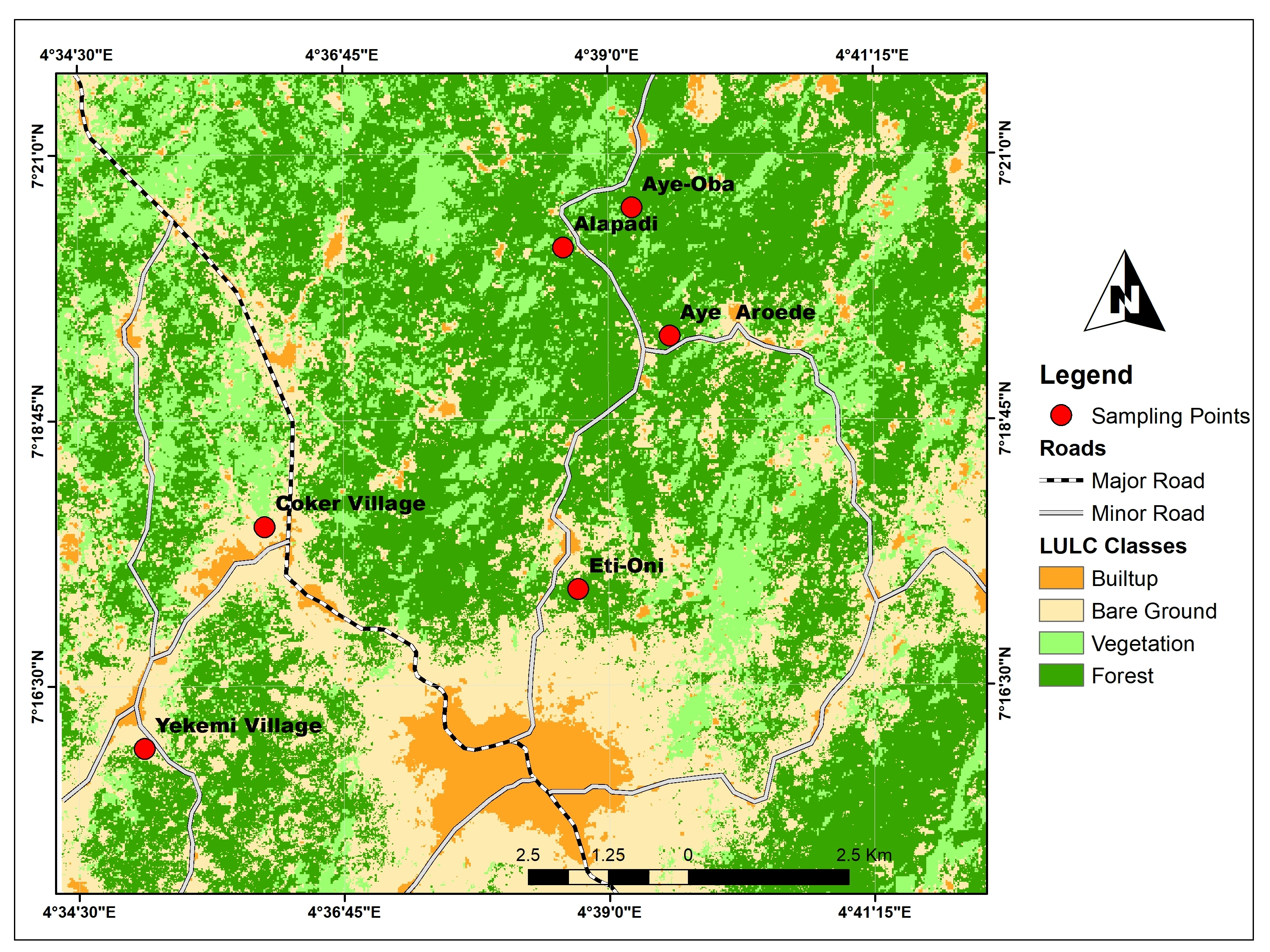
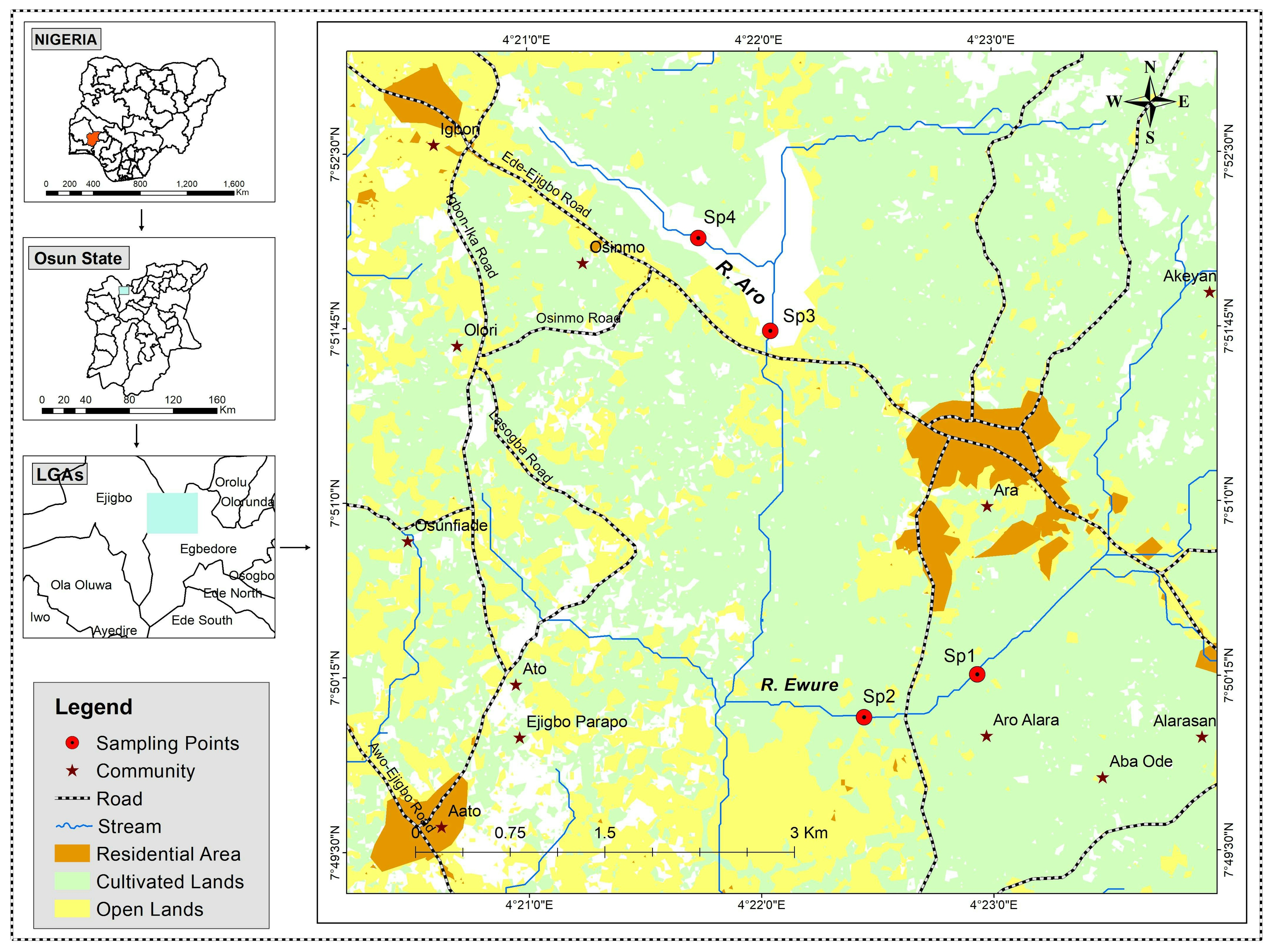
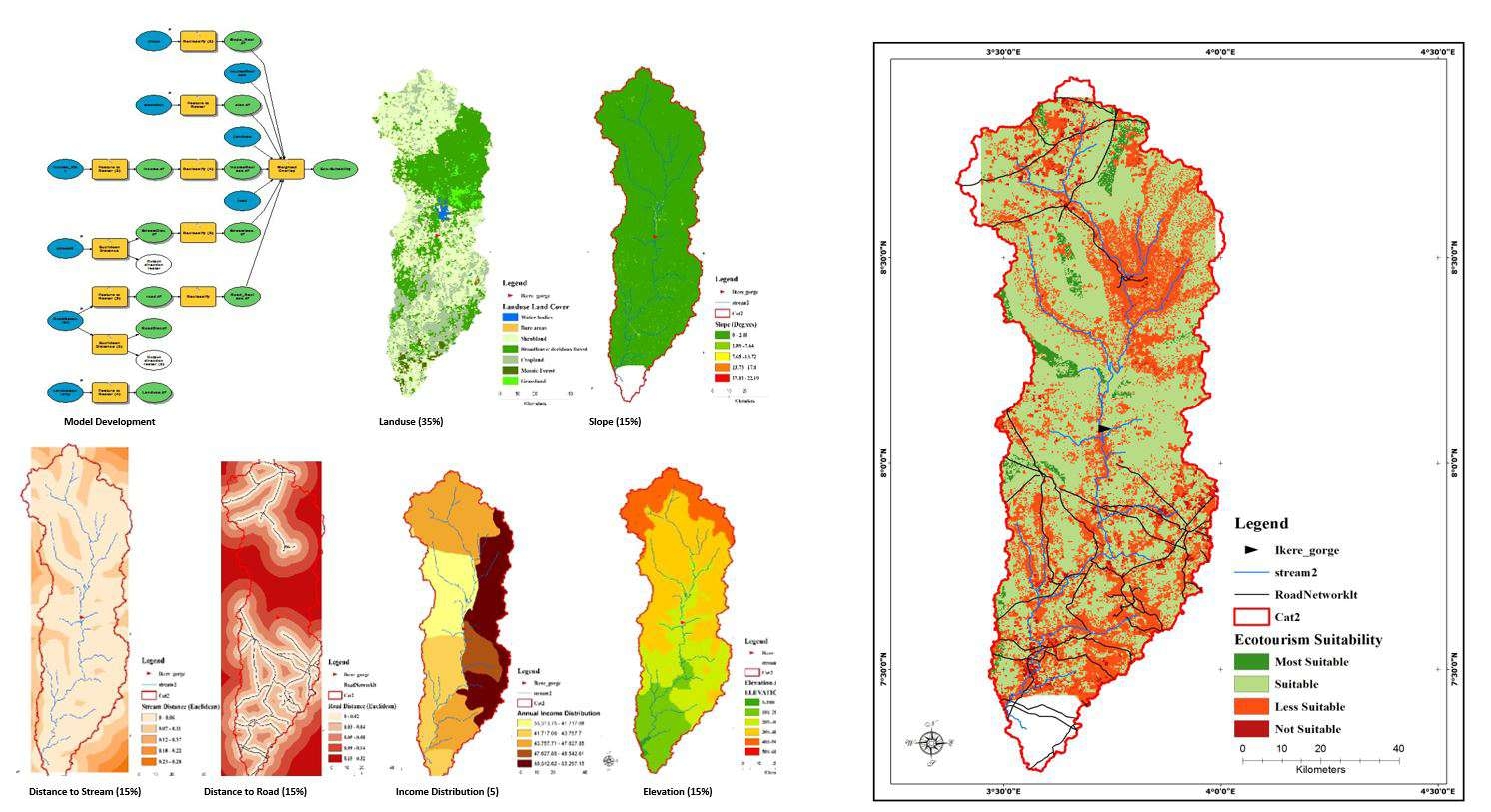
Remotely sensed images was classified using Idrisi Taiga, and showing the different land use classes. Roads and landmarks were identified using Google map service on QGIS. ArcMap was used for compiling the final output.


Plug-ins used

ArcMapQGIS

tags

GISGoogleRemote Sensing

More by Oladeji Muhammed

Forest extent/types in some US location
27
Geology map of Oyo State facelift
162
Data Visualisation using Matplotlib
37
2019-2023 Global Covid-19 Dashboard
30
Map Re-draw/Facelift
56
ESRI Spatial Data Science Certification
40
Cartographer
Cartographer
96
Proximity of dumpsite to lagoon in Lagos
14
Study area map
Study area map
15
Map Facelift
Map Facelift
33
Study area map
Study area map
144
Dublin vacant dwellings
39

You might also like

Saguling Microworld Diorama
Mohammad Farhan Fadillah
Saguling Microworld Diorama
Mohammad Farhan Fadillah
182
Mapa de Elevação
Thátila de Jesus Assis
Mapa de Elevação
Thátila de...
8
Zonas De Angola
Fenando Paulo Neto Alberto
Zonas De Angola
Fenando Paulo...
38
Vuyani Mondli Buthelezi
Land Cover
Vuyani Mondli Buthelezi
4
Industrial Sites in Urban Growth Rings
Cole Feyen
Industrial Sites in Urban Growth Rings
Cole Feyen
10
Displacements Analysis to test centers
Alexandre Dargains Auricchio de Oliveira
Displacements Analysis to test centers
Alexandre Dargains...
309
Patchouli Plant Land Suitability Map
Adhira Riza Muqtadir
Patchouli Plant Land Suitability Map
Adhira Riza Muqtadir
5
Sistema Hidrográfico Simplificado
Ariel Horst
Sistema Hidrográfico Simplificado
Ariel Horst
9
Collective land registry
Rayane Pacheco
Collective land registry
Rayane Pacheco
11
Erosion Susceptibility Modelling
Christina Nedo
Erosion Susceptibility Modelling
Christina Nedo
14
Mapa de Localização de São Lourenço (MG)
Gabriel Martins Corrêa
Mapa de Localização de São Lourenço (MG)
Gabriel Martins Corrêa
292
Caracterização fisionômica da Restinga
Hugo Pereira Lima
Caracterização fisionômica da Restinga
Hugo Pereira Lima
4

Join the community!

We're a place where geospatial professionals showcase their works and discover opportunities.

Sign Up for free