
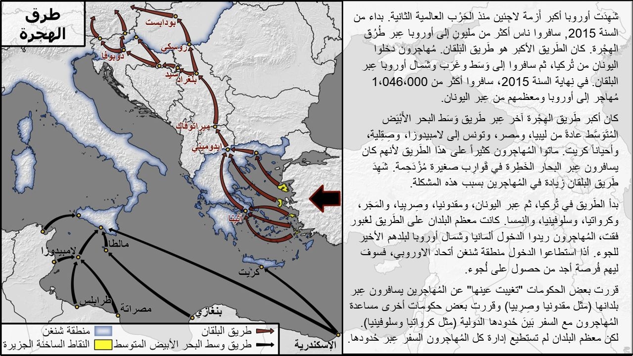
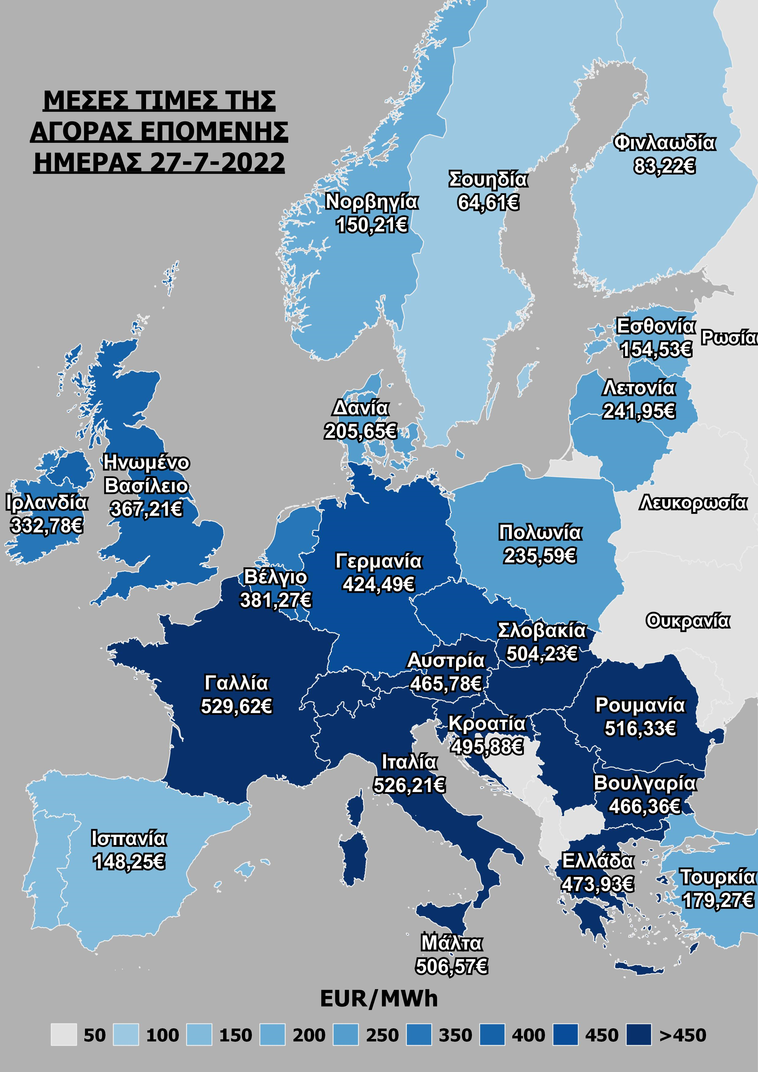
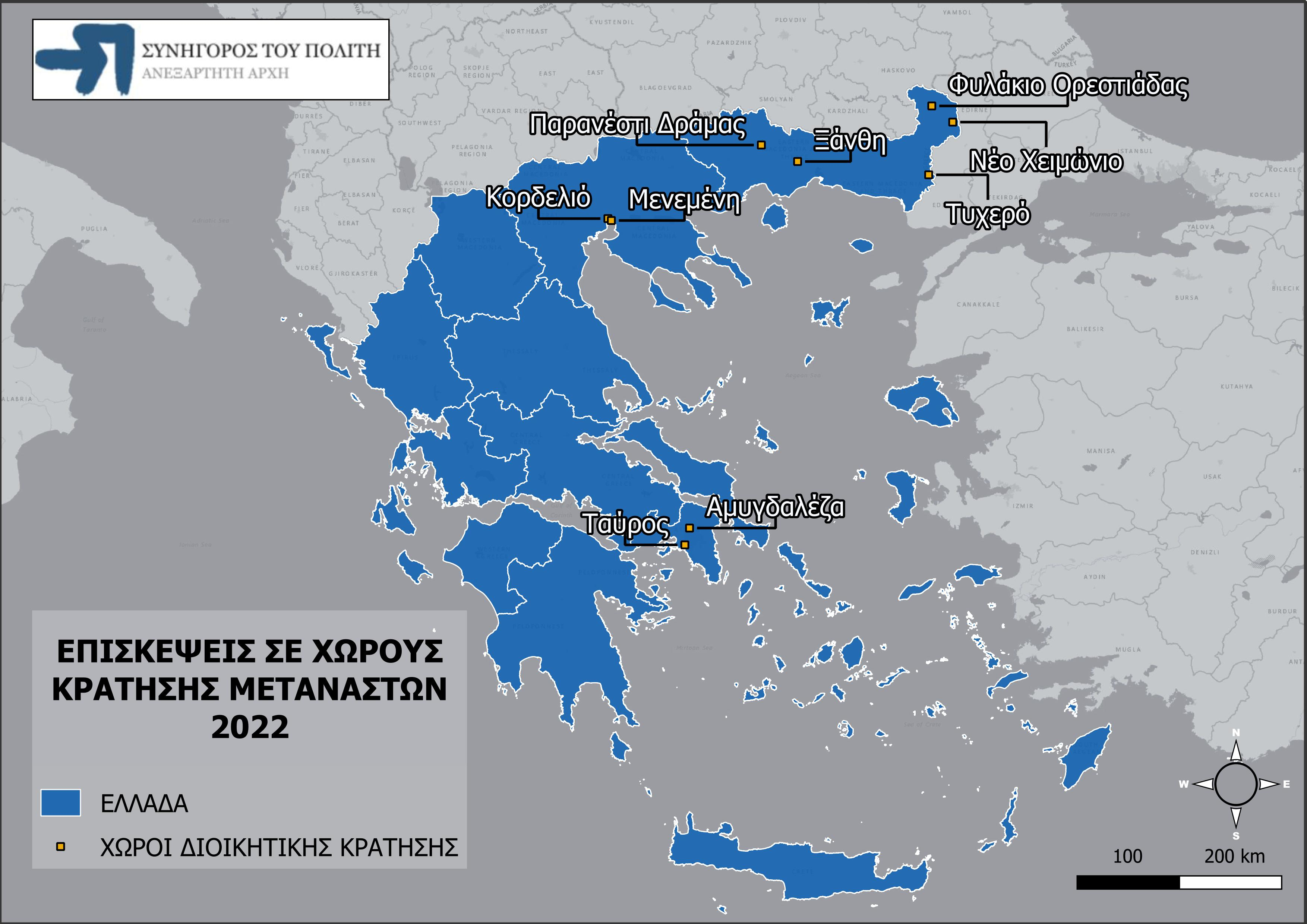
This map was created for one section of the final project for my Intermediate level Arabic class. The map symbolizes two major routes taken by refugees coming from the Middle East and Africa during the height of the refugee crisis. Symbolizing two distinct routes (red for the Balkan corridor over land, and black for the Mediterranean route over water), I wanted to paint abroad picture of stopping points and milestones that refugees faced along way. The Arabic text discusses problems along these routes, the goal of reaching the EU's Schengen area (shown in blue), and the special legal distinctions of Greek "Hot Spot" islands (symbolized in yellow). All of the route data was constructed by scratch by referencing reports made by the Greek Ombudsman and UNHCR. Although this project was focused on utilizing the Arabic Language, it was a great exercise in symbolizing broad population flows with little to no starting data.
Mapping Mediterranean Refugee Routes
Plug-ins used
Shape Tools
tags
Route Map
More by Konstantinos Gouzias


You might also like


Join the community!
We're a place where geospatial professionals showcase their works and discover opportunities.