EGNOS TRAN - The use of AIS (Automatic Identification System) as a local augmentation system for EGNOS in a maritime environment.
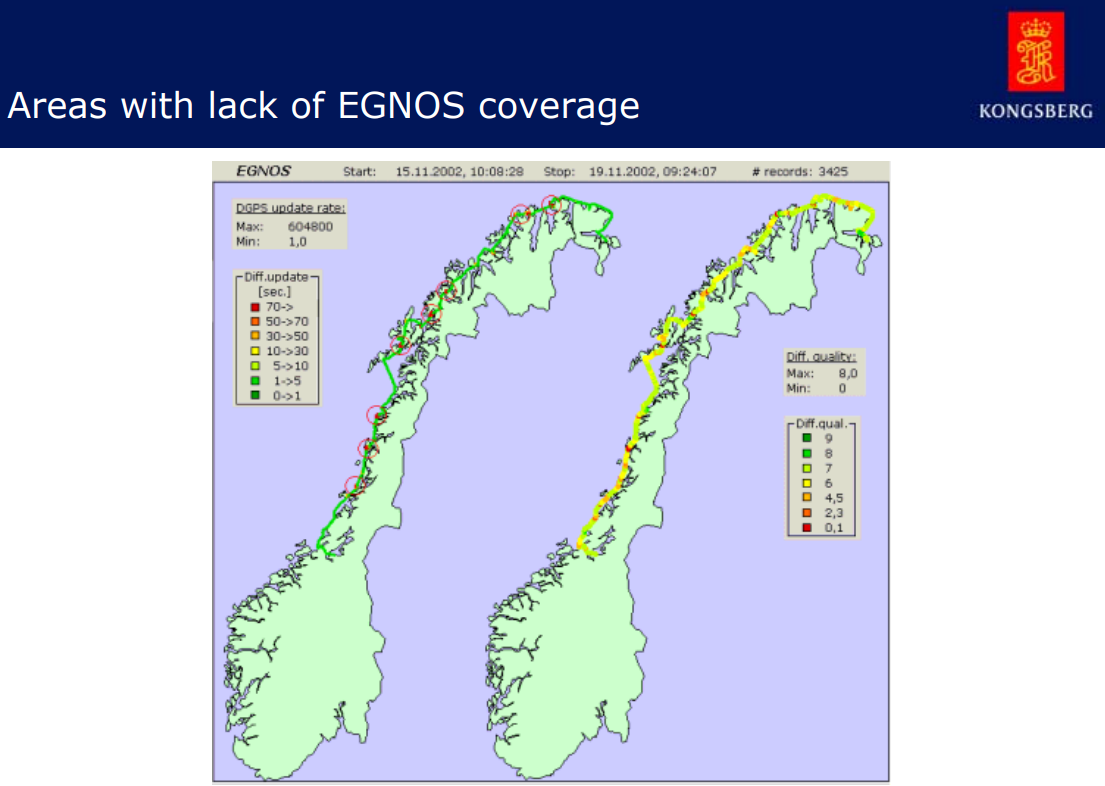
Due to the low elevation of the EGNOS satellites, their signal is difficult or sometimes impossible to receive in certain regions. Many present and also future applications require a high accuracy and also a high reliability of the position determination, which can easily be performed by European Geostationary Navigation Overlay Service (EGNOS). If the EGNOS signal cannot be received, the requirements of those applications can no longer be satisfied.
To lessen the problem the EGNOS Terrestrial Regional Augmentation Networks (EGNOS TRAN) - Maritime project team evaluated various technical methods to broadcast the EGNOS signal via terrestrial networks, like GSM/GPRS, Loran-C or Ground Regional Augmentation System (GRAS).
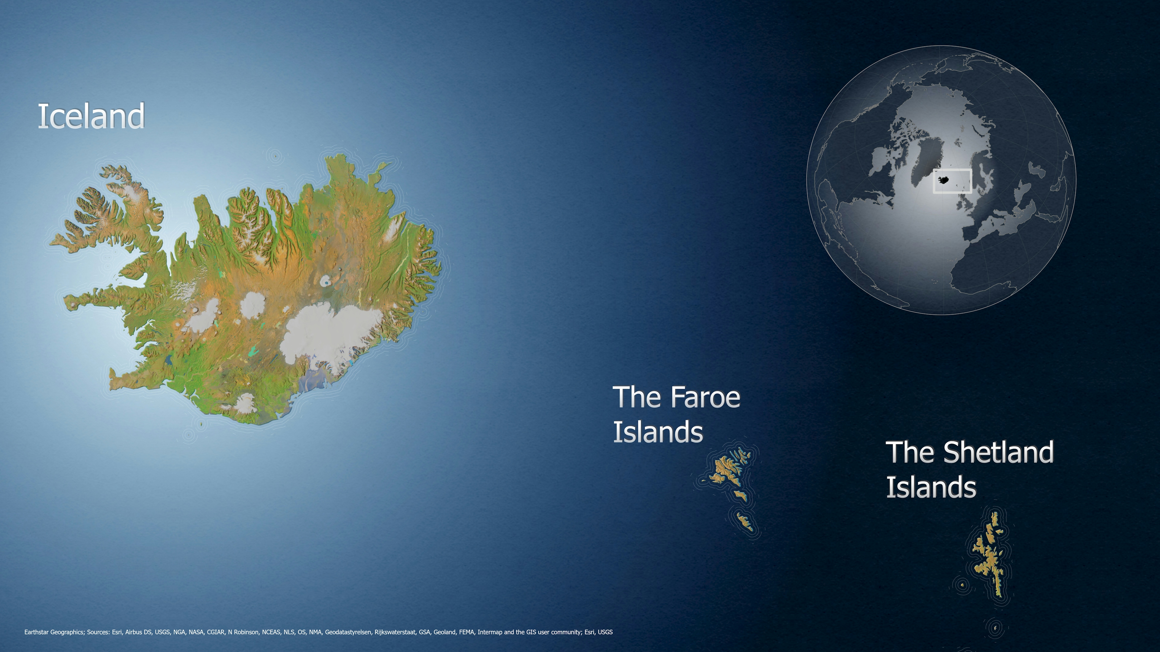
The EGNOS TRAN maritime project works by integrating EGNOS with a VHF link called Automatic Identification System (AIS) used by the maritime users for communications between vessels and communication with the shore. This system, set-up in the Fjords of Trondheim (Norway) proved to be a good complement to EGNOS in areas of non-visibility or poor reception of the EGNOS signal-in-space. In addition, the system proved to be a cost-effective alternative solution to the current positioning DGPS /IALA system.
The EGNOS-Tran Maritime project was initiated in October 2001 and was concluded in December 2003.
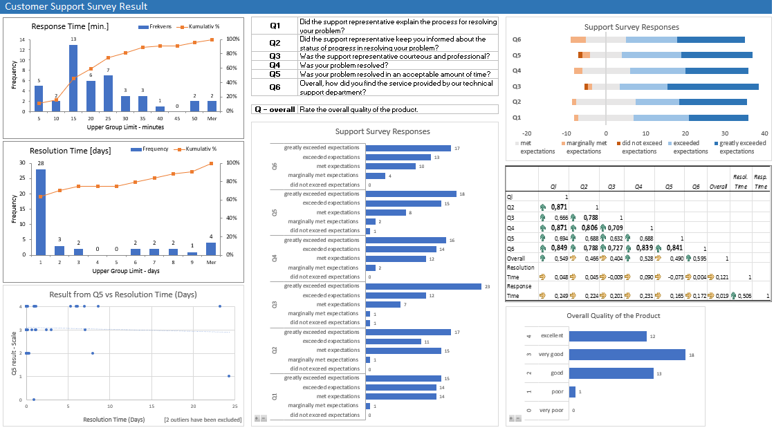
My part of the project was to analyze the data that was received onboard of the ship MS Nordlys (Hurtigruten) regarding coverage, accuracy, integrity, and availability. The result was presented in a graphic tool that facilitates the intepretation, comparison, and presentation of the received data. I worked on this project in 2002/2003.


 He")