MODIS satellite data
as a source for land cover mapping of Fennoscandia.
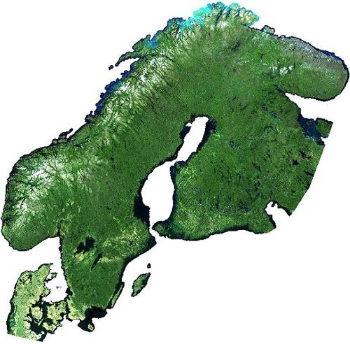
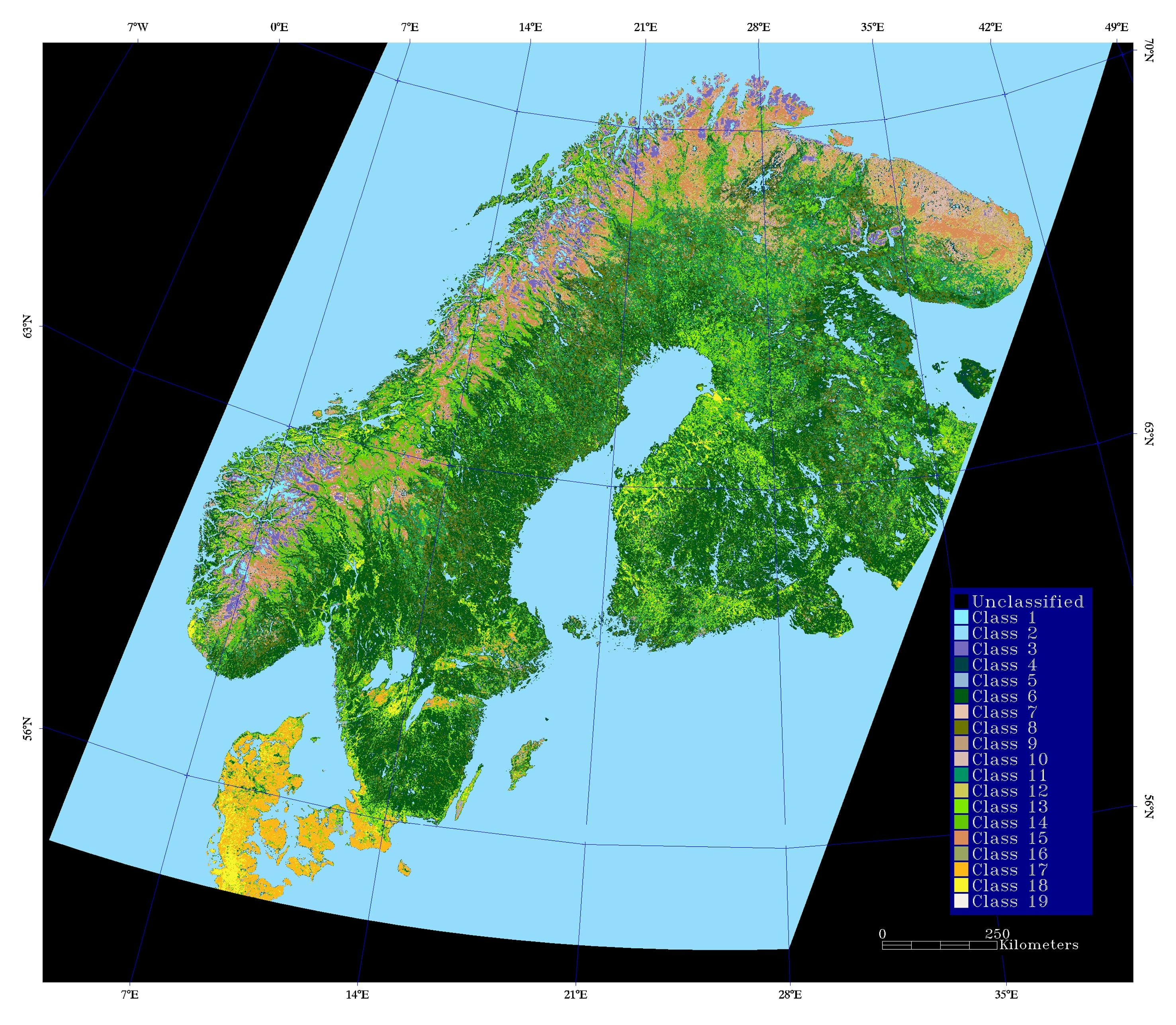
My Master of Science thesis at the Norwegian University of Science and Technology (NTNU) in 2003 was to explore the possibilities of developing a land cover map based on MODIS satellite data. The project was coordinated by the Norwegian research institute, NORUT IT. As a result of these explorations a land cover map over Fennoscandia and Kola Pensinsula was produced based on MODIS data. There are several MODIS data products, swath and grid data with different levels of data processing. Important parts of the processing of MODIS swath data include the correction for atmospheric effects and BRDF, georeferencing and bow-tie correction. The MODIS data product that was used for the resulting land cover map was MOD43B4, nadir BRDF-adjusted reflectance (NBAR).
This is a mosaic of MOD43 data corrected for atmospheric effects and BRDF. The data are mainly from 28.07. to 12.08.2003. In this period of time the weather for large parts of Norway was mainly cloudless and the snow coverage in the Norwegian mountains was at a minimum. NDVI values for the vegetation in the study area were at the highest level.
For more information, please visit:
- An article in Kart og plan, Vol. 64, pp. 104-120, ISSN 0047-3278
- The short description of the master thesis


.svg "Alec Soltes")