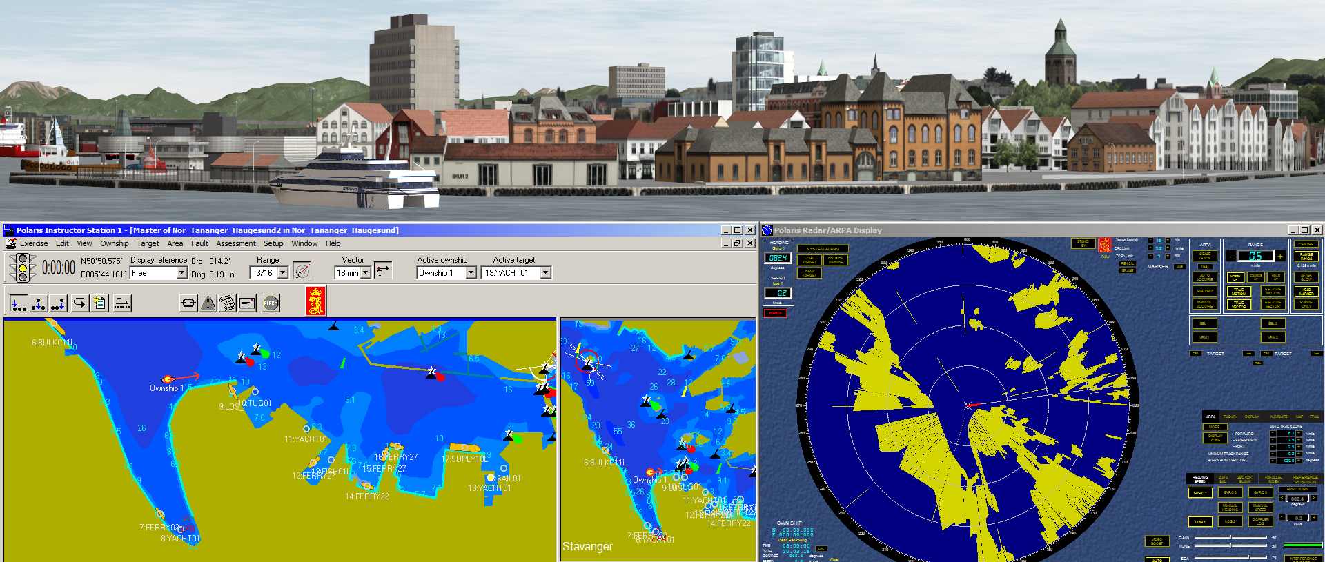
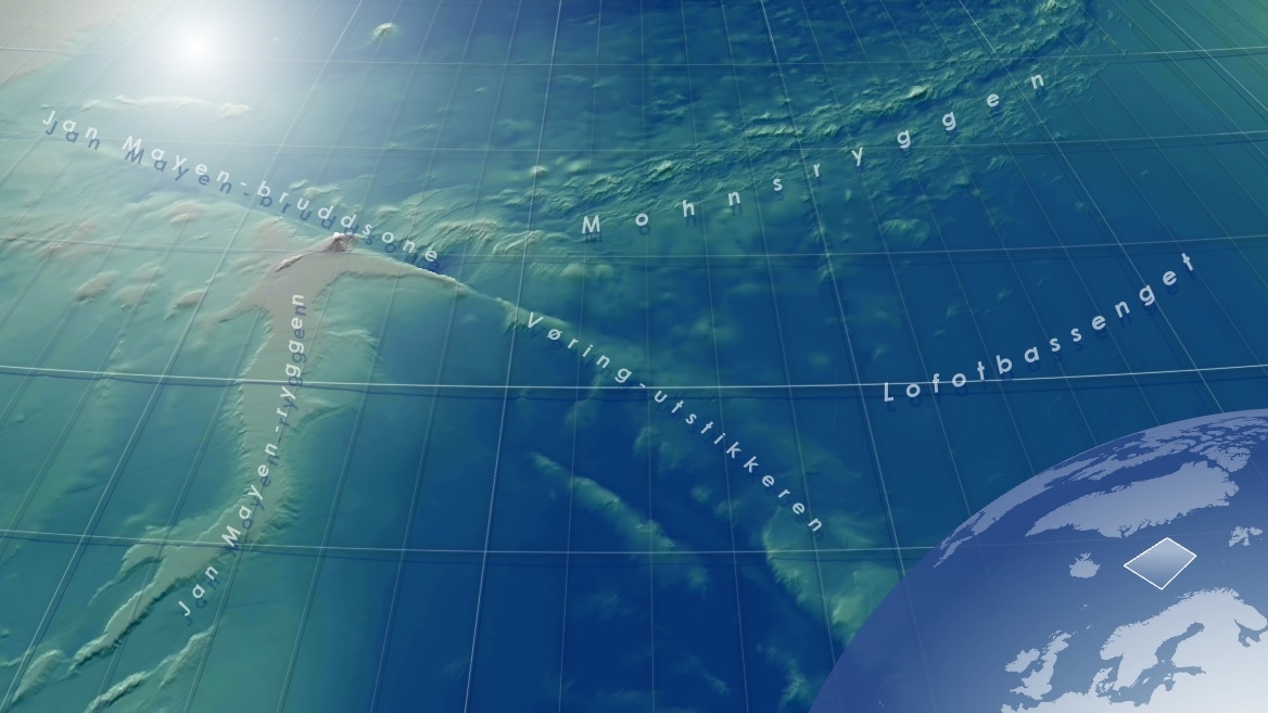
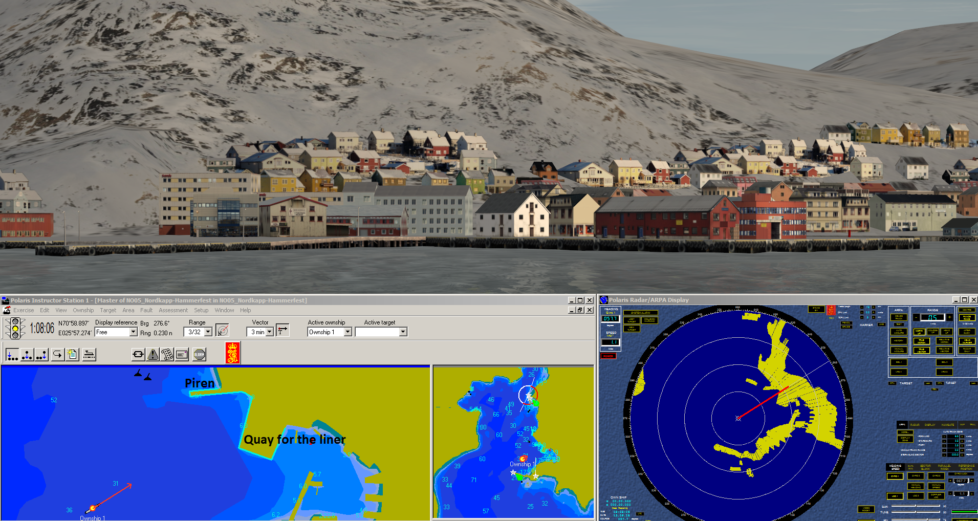
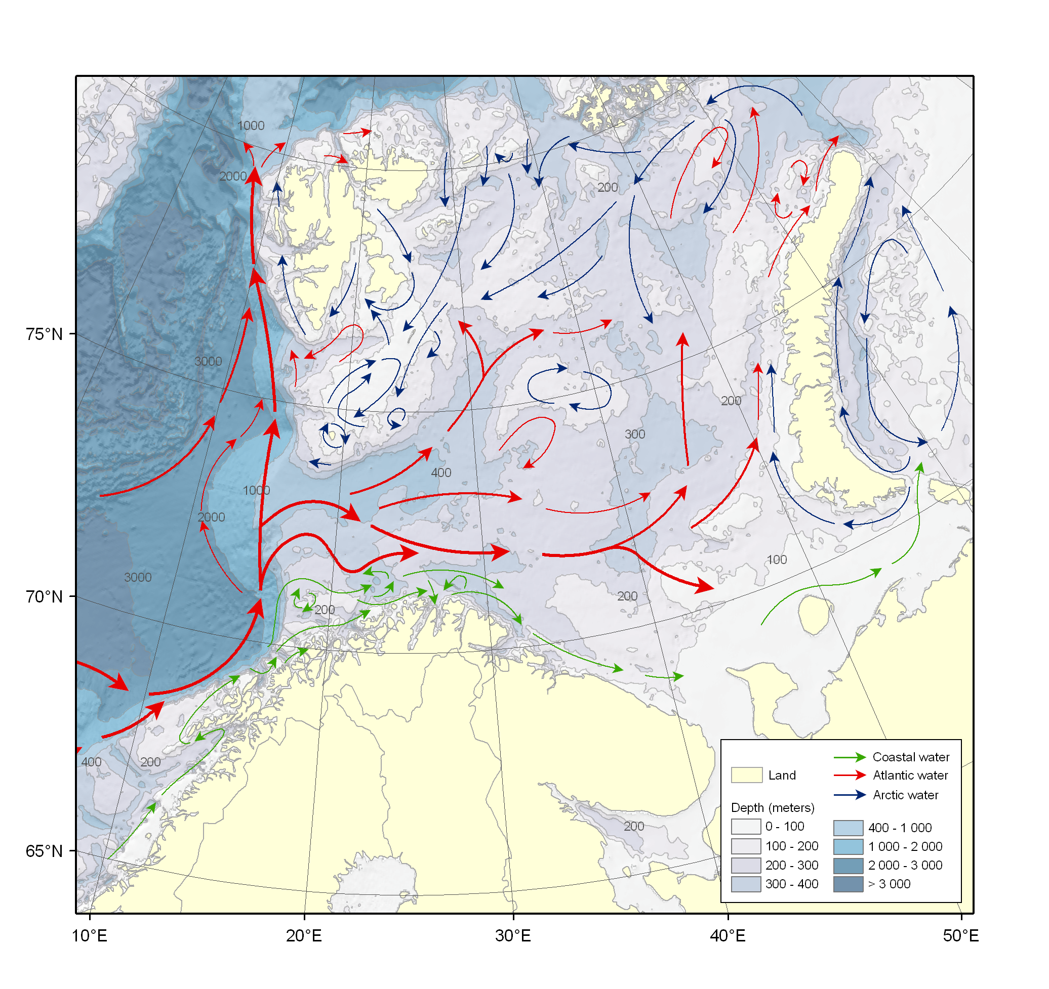
Visual 3D and radar database for Kongsberg Polaris and K-SIM Simulator for the area Haugesund - Tannanger in Norway. The picture shows the 3D modelled port of Stavanger. The database was created in 2015.
These simulator databases are part of the project Den Virtuelle Sjøveien which aim is to cover the entire Norwegian coast and Svalbard with simulator databases for navigation training. The project is a cooperation between:
- The Norwegian University of Science and Technology, NTNU
- The Arctic University of Norway, UiT
- The Western Norway University of Applied Sciences, HVL
- The University of South-Eastern Norway, USN
- Sjøkrigsskolen (SKSK)
- The Norwegian Coastal Administration, KV
For more information:
An article about Den Virtuelle Sjøveien i Skipsrevyen.


.svg "Keran Nkongolo")