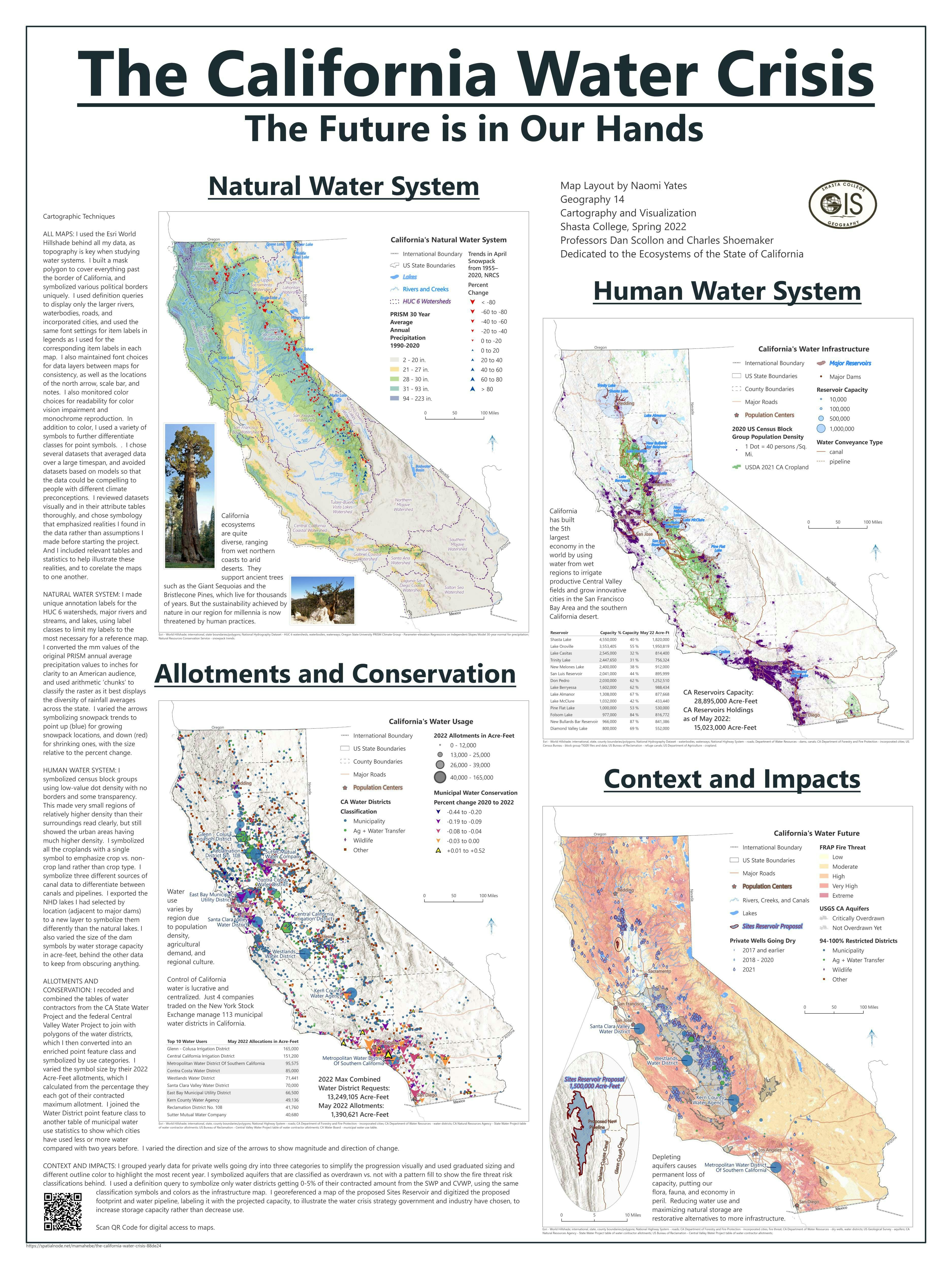
This is the QGIS final project I completed with partners Kathleen Mohla and Matt Paris in the Summer 2021 Geography 25 course at Shasta College.
It is a written project proposal for a hypothetical GIS project we designed for a real local problem, the effect of the drought on 8 existing and 1 proposed California reservoir.
My role on the student team was to:
- research the California water system and its constituent organizations,
- gather the data and metadata used for making the maps,
- write the text and format the report, with feedback from the team.
- I also digitized the proposed Sites Reservoir footprint in QGIS.


.svg "Keran Nkongolo")