

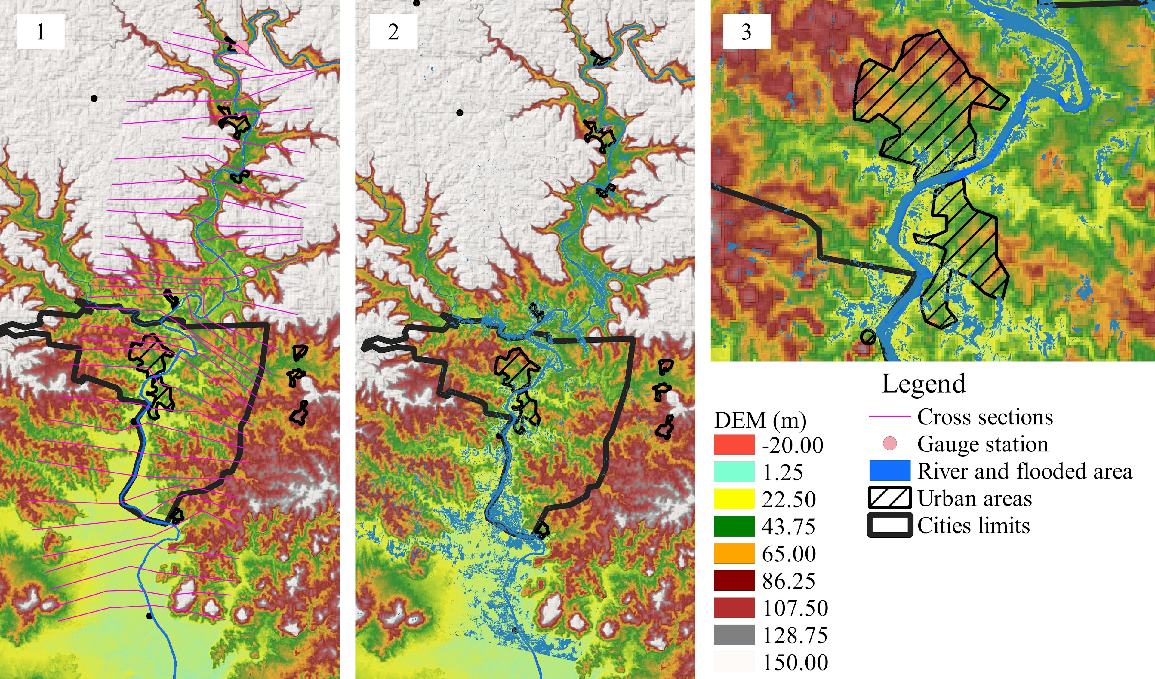
Flood inundation extents predicted using HEC-RAS. The results of the simulation performed using the no-channel method for the river channel, overlooking the bathymetry of the river channel and attenuating the hydrogram (1); When using the geomorphological relations method, the river bathymetry was adjusted in the DEM and then the flood inundation extent was generated, In comparison to the observed flood and the other results, GEO was the best threat score (2); For the Manning Equation method, the river was segmented in 10 km reaches. The maximum and minimum slope values are 0.0011 and 0.0001, while the widths vary between 150 and 240 m. From the widths and depths, estimated bathymetry for the river channel was adjusted in the DEM, from a visual analysis it can be inferred that the flood simulated by the MAN method was the best compared to the other methods used, but had the worst threat score metric (3).
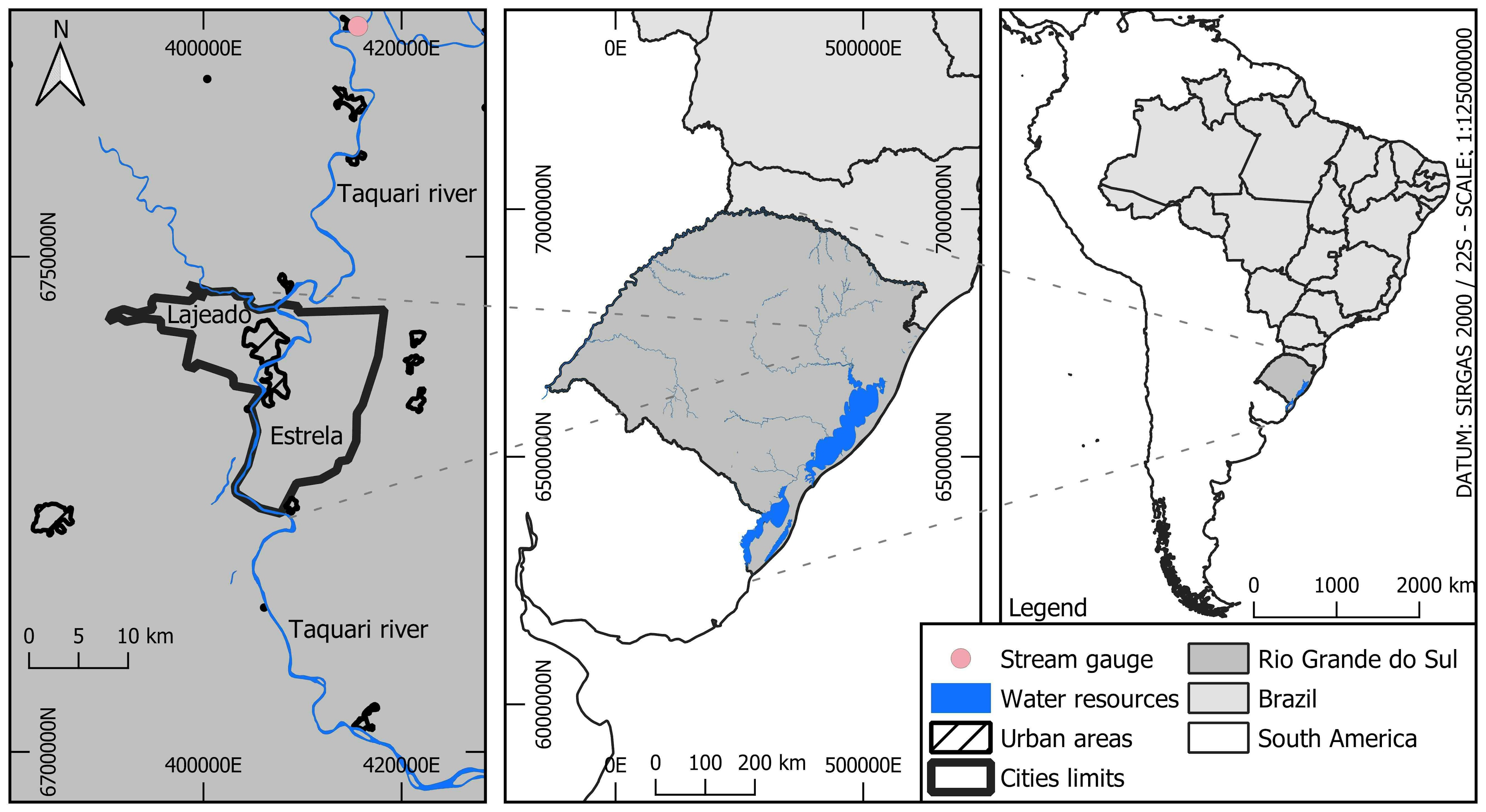
Comparing flood extents in Taquari River
Tools used
HECRAS QGIS
Plug-ins used
None
tags
floodHydrologyWater
More by Vinicius Kuchinski

You might also like


.svg "Keran Nkongolo")


Join the community!
We're a place where geospatial professionals showcase their works and discover opportunities.