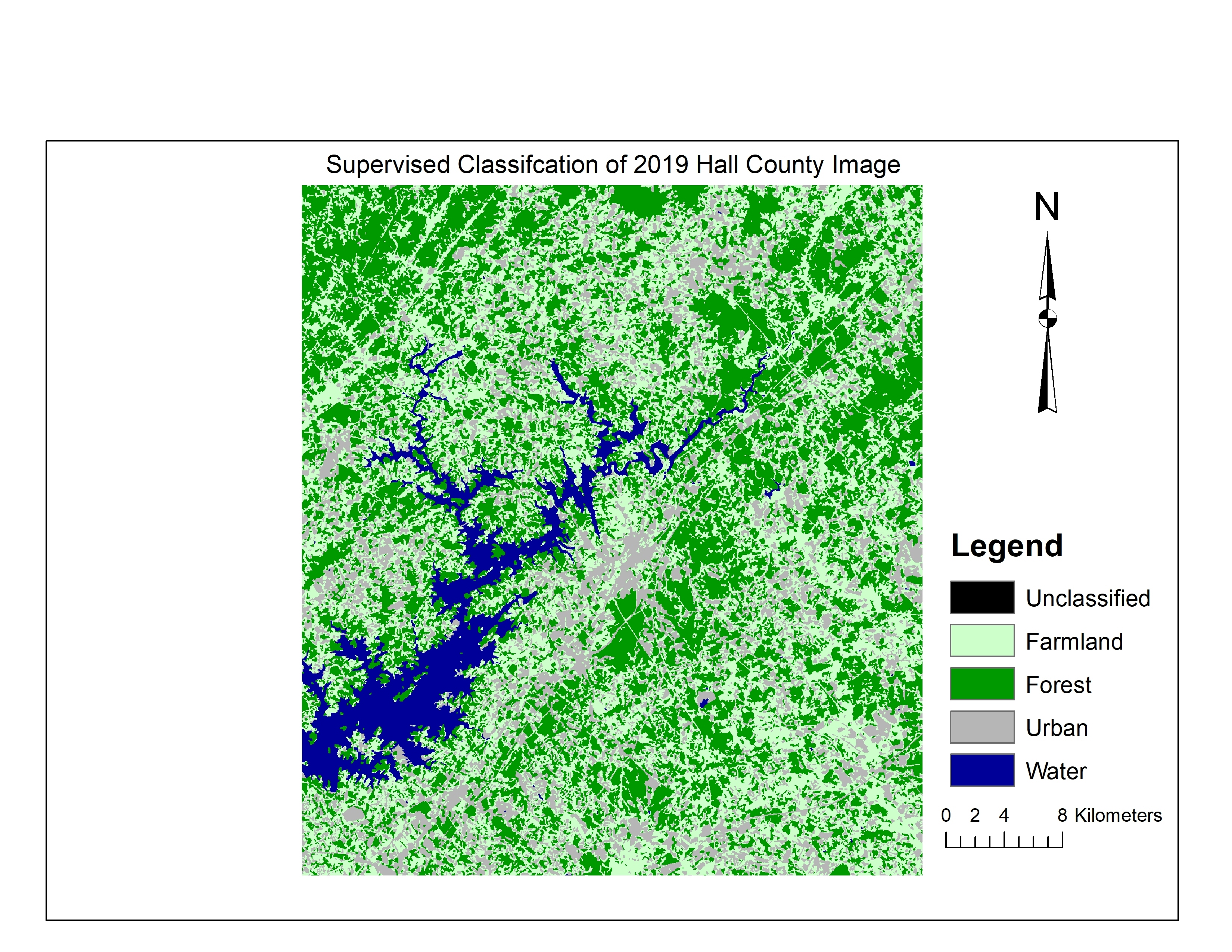
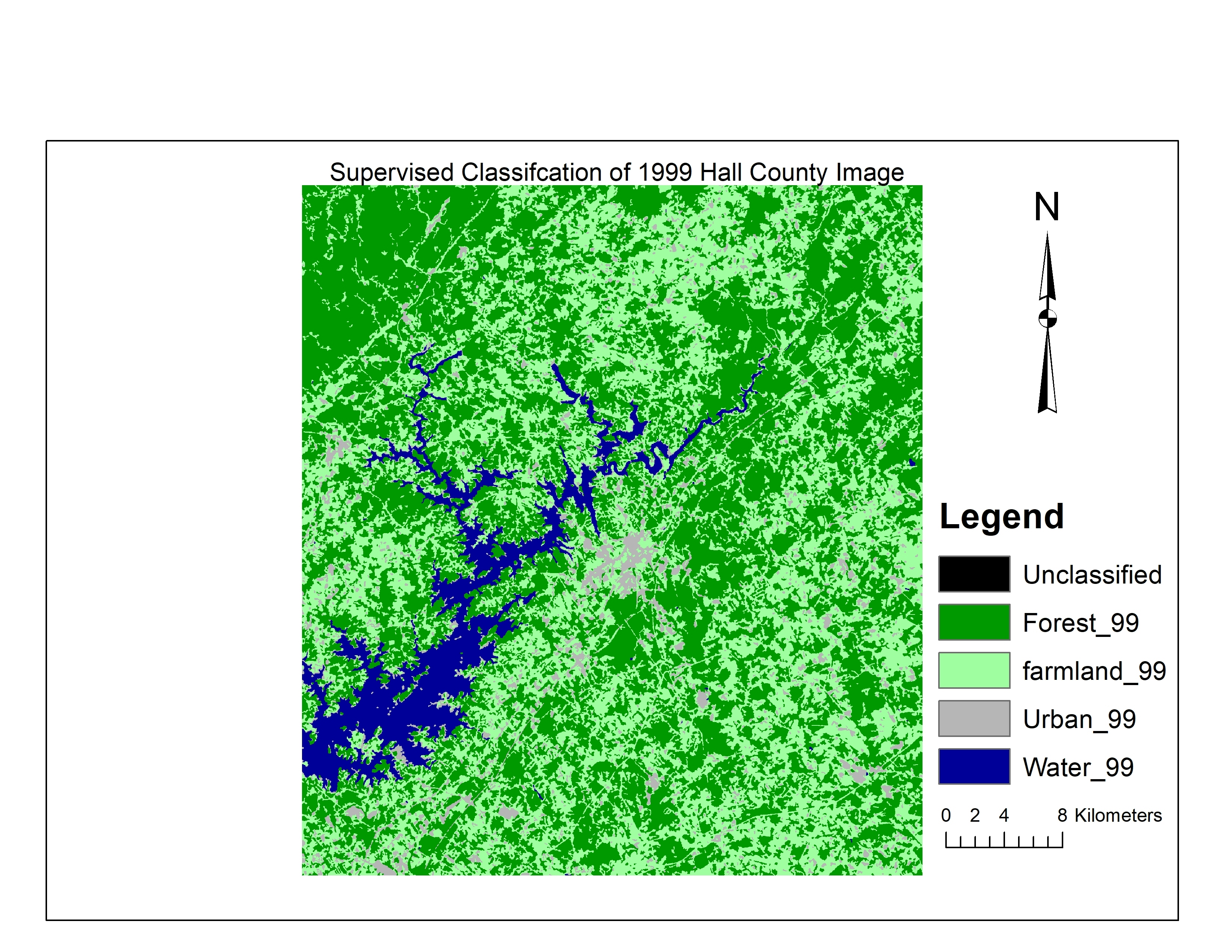
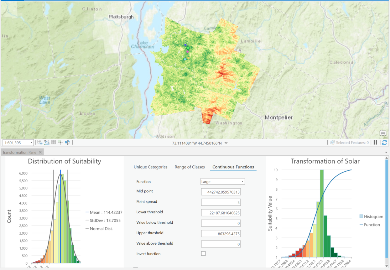
Supervised classification image of Hall County, Georgia

Tools used
ArcMapENVI
Plug-ins used
Esri
tags
ENVIEsri
More by Kolawole Arowoogun


You might also like


Join the community!
We're a place where geospatial professionals showcase their works and discover opportunities.