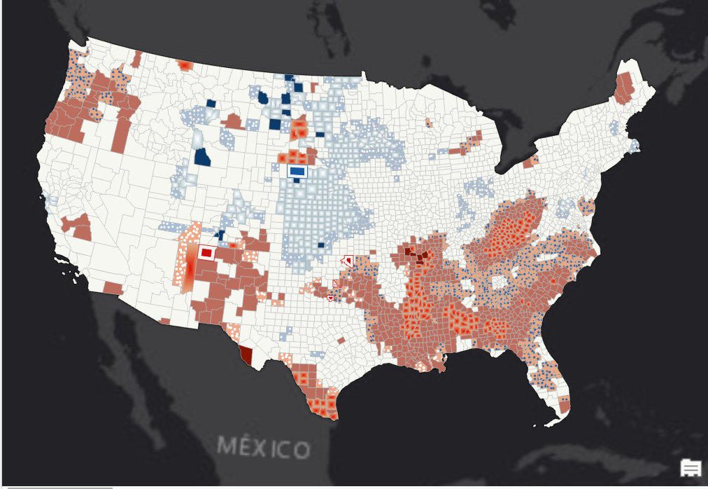
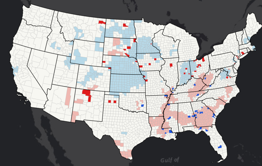
Visualizing 2016 US Election


Tools used
ArcGIS Pro
Plug-ins used
ArcGIS Pro
tags
Data Visualization


You might also like


Join the community!
We're a place where geospatial professionals showcase their works and discover opportunities.
Visualizing 2016 US Election
You might also like
We're a place where geospatial professionals showcase their works and discover opportunities.