
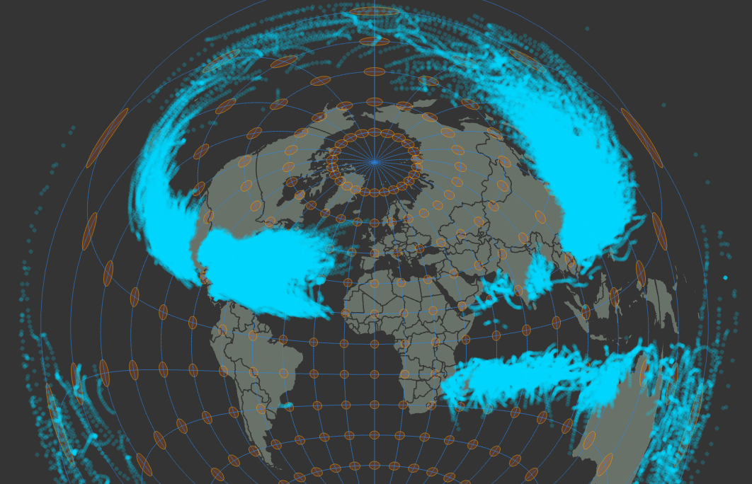
Since software does a lot of the math for us at this point in time, the job of a modern geospatial professional is about choosing an appropriate projection for the area of study's particular extent and purpose. In this project I explored various projections and their inherent distortions to choose a projection for mapping hurricane and tropical storm data. I reviewed popular projections such as Platte Carree, Mercator, and Albers Equal Area Conic to compare their effect on Tissot's indicatrix and see how they can affect the aesthetic and communication in the map.
Choosing Projections
Tools used
ArcGIS Pro
Plug-ins used
None
tags
Coordinate SystemsDistortionprojections
More by Zach Torres


You might also like


.svg "Maggie Zou")

.png&w=3840&q=100)


Join the community!
We're a place where geospatial professionals showcase their works and discover opportunities.