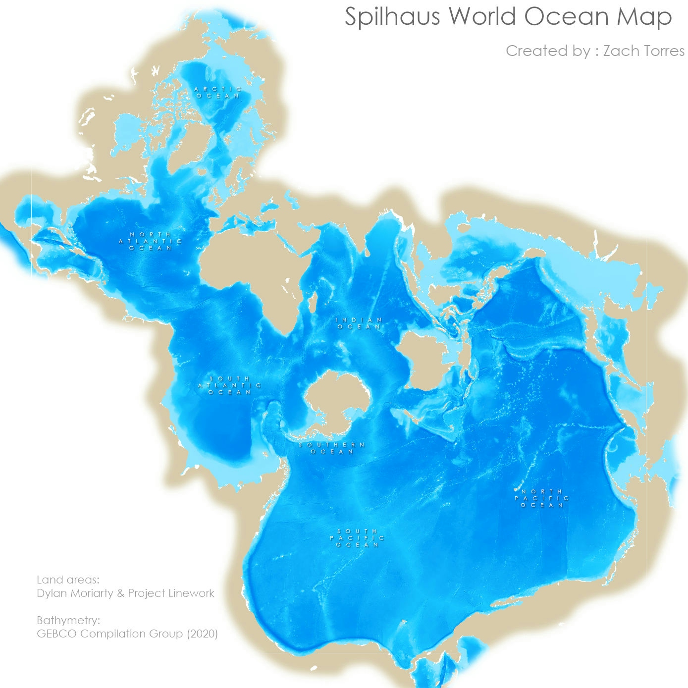
This project introduced me to a creative technique for seeing things from a new perspective! This project uses the "Spilhaus World Ocean map in a Square" projected coordinate system and repeatedly rotated map frames in a layout to communicate interconnectivity in an ocean-centric map. Bathymetric depth is symbolized by the shades of blue.
Click the demo link below to take a closer look.
Other tools used:
- Vignette overlay
- Bathymetric layer symbology