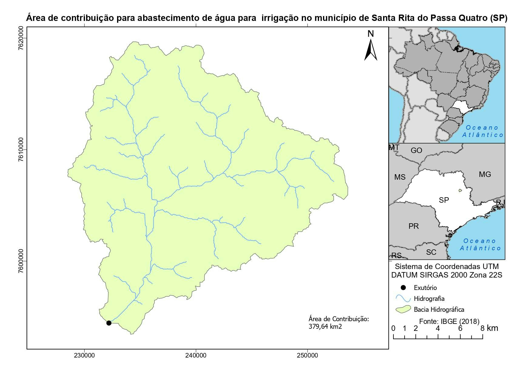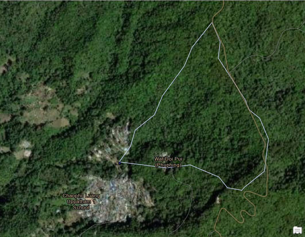
My wife and I recently visited a Hmong mountain village outside of Chiang Mai. After learning about the socio-agricultural calendar of hilltribes in Thailand and enjoying the waterfall that runs through the village, I thought to create this watershed delineation project.
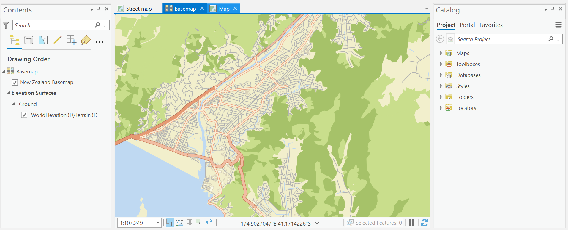
My workflow is described below:
- Download DEM file from USGS Earth Explorer
- In ArcGIS Pro, change basemap to Hybrid Imagery and zoom to area of interest
- Using Hydrology tools in the Spatial Analyst toolbox, run the Fill tool.
- Run the Flow Direction tool with parameters set to D8
- Run the Flow Accumulation tool
- Classify the flow accumulation raster to two classes and adjust Upper Value for threshold between the two classes
- Create a point feature class for the Pour Point
- Use the Point tool to add the point feature within an accumulation pixel at the area of study
- Run the Watershed tool using previous outputs
- Run the Raster to Polygon tool
- Run the Polygon to Line tool


.svg "RONEIDE DOS SANTOS SOUSA")