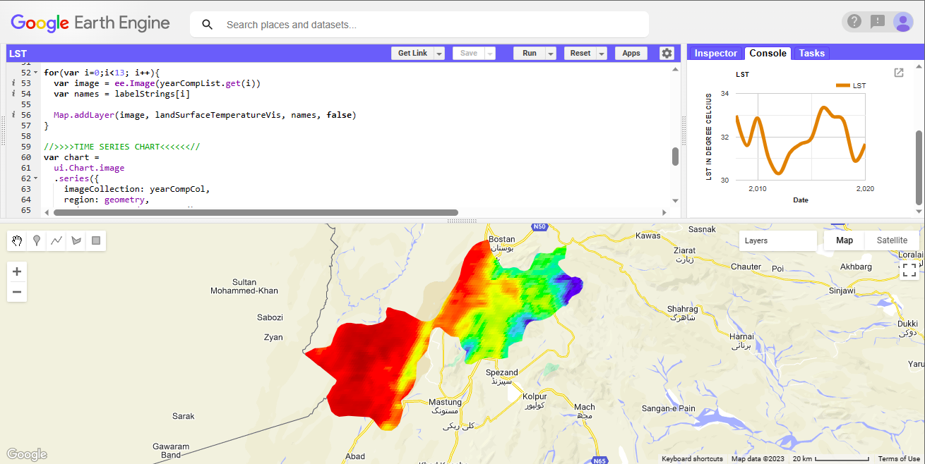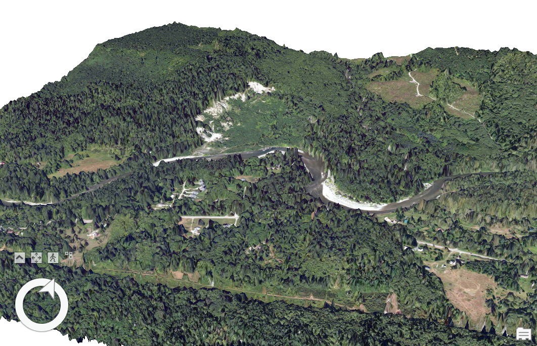
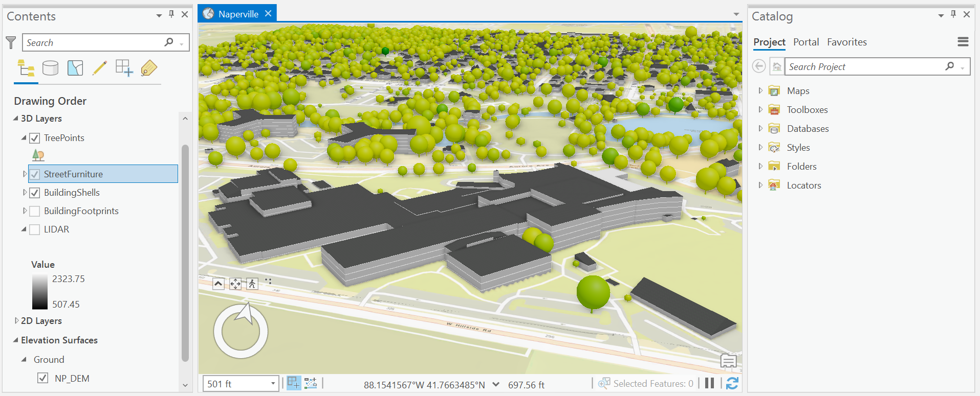
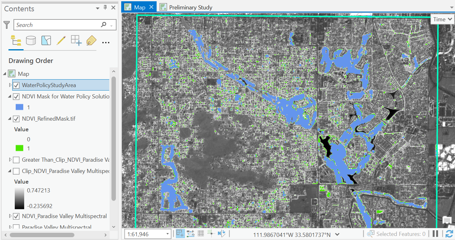
This project uses combined elevation surfaces with matching imagery layers in a scene to better visualize the environmental impact of a 2014 landslide. I opted to use a DSM for improving spatial resolution in elevation values rather than a DEM because the above-ground elevation surface model displayed land change between two moments of time better than a bare-earth elevation surface for this event. I enjoyed learning how to assign specific 2D content to render in 3D. To create the fly-through animation, I appended numerous keyframes to move between before and after states of the topography.
Other tools used:
- Clipping scenes to an area of study
- Storytelling with content visibility and text overlays
- Using transparency to fade between two layers in an animation
Check out the completed animation in the demo link below. Orange columns represent locations of homes destroyed by the mudslide. Export properties were defined for compatibility with a GIF.


.jpg&w=3840&q=100)