
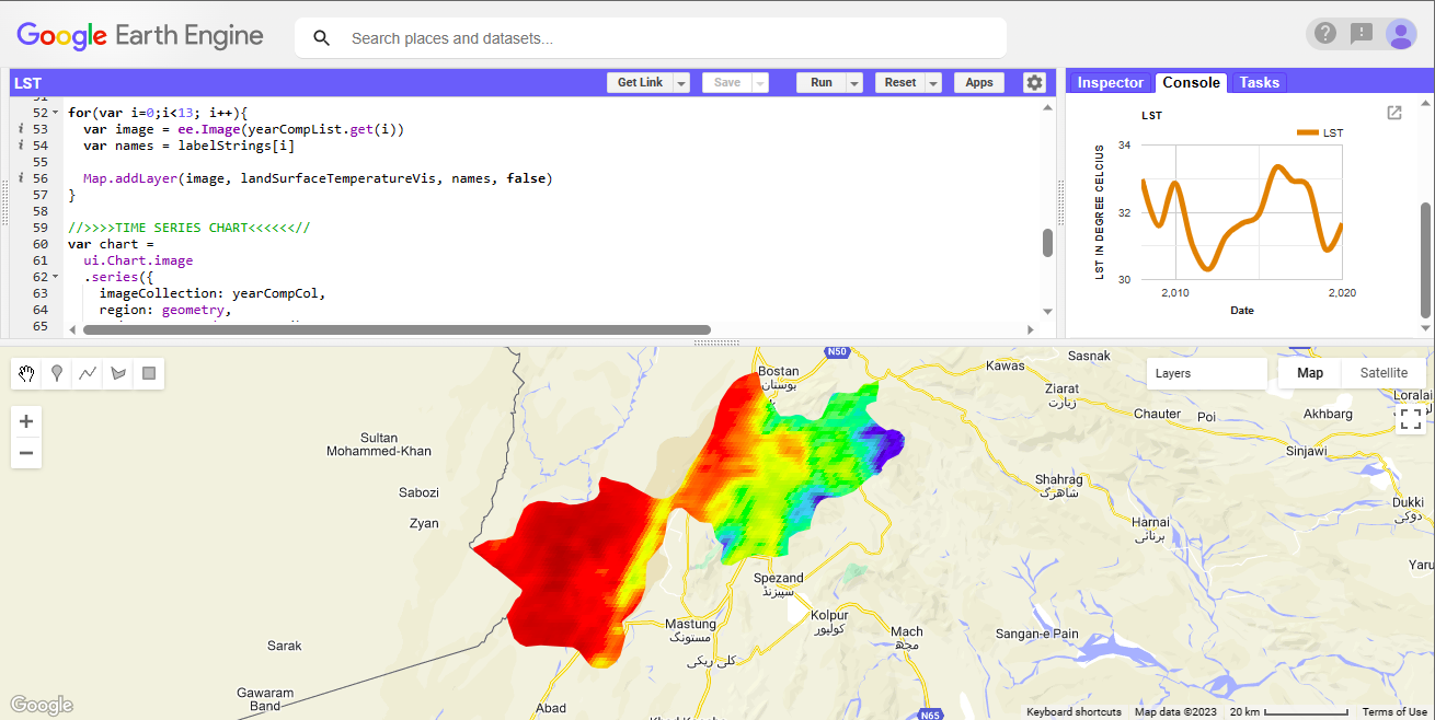
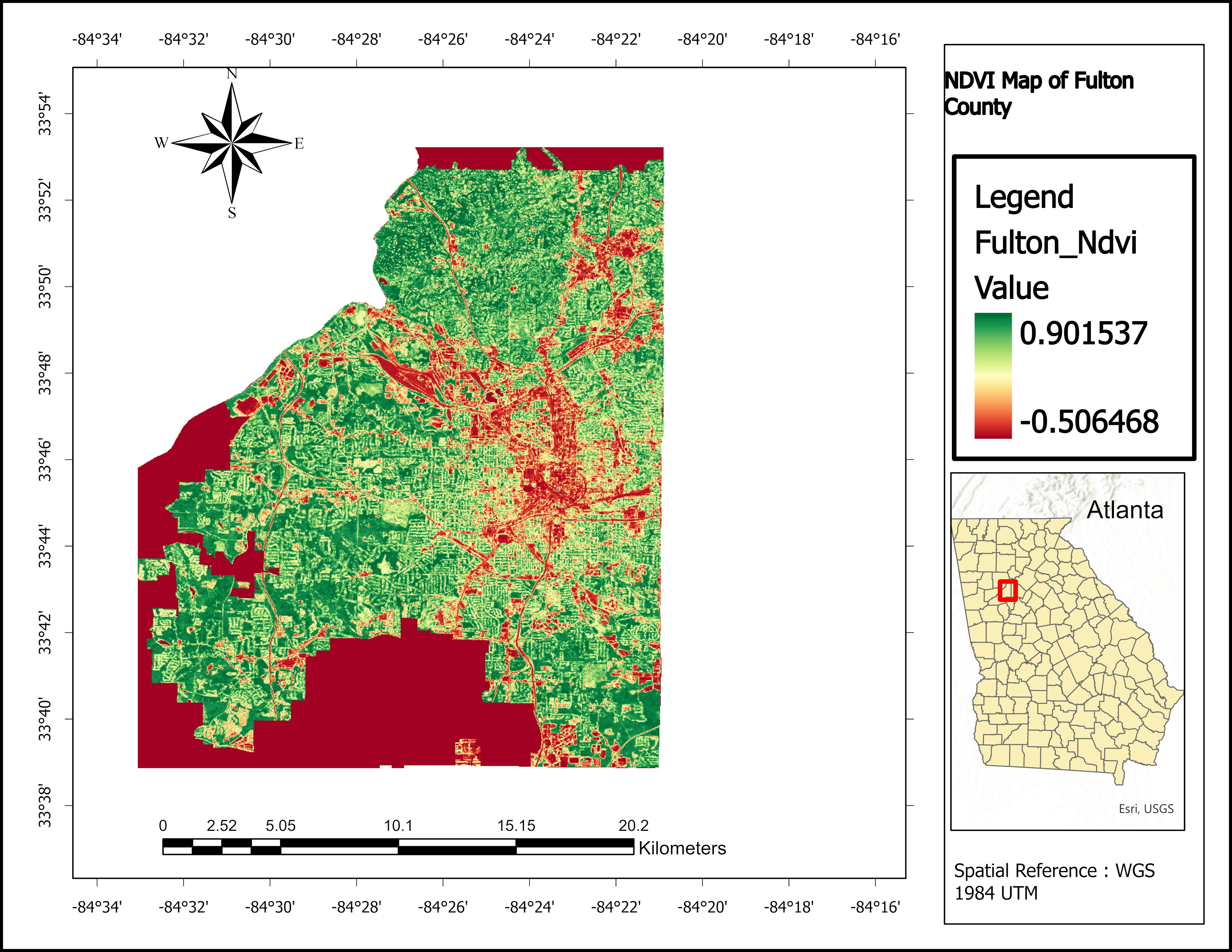
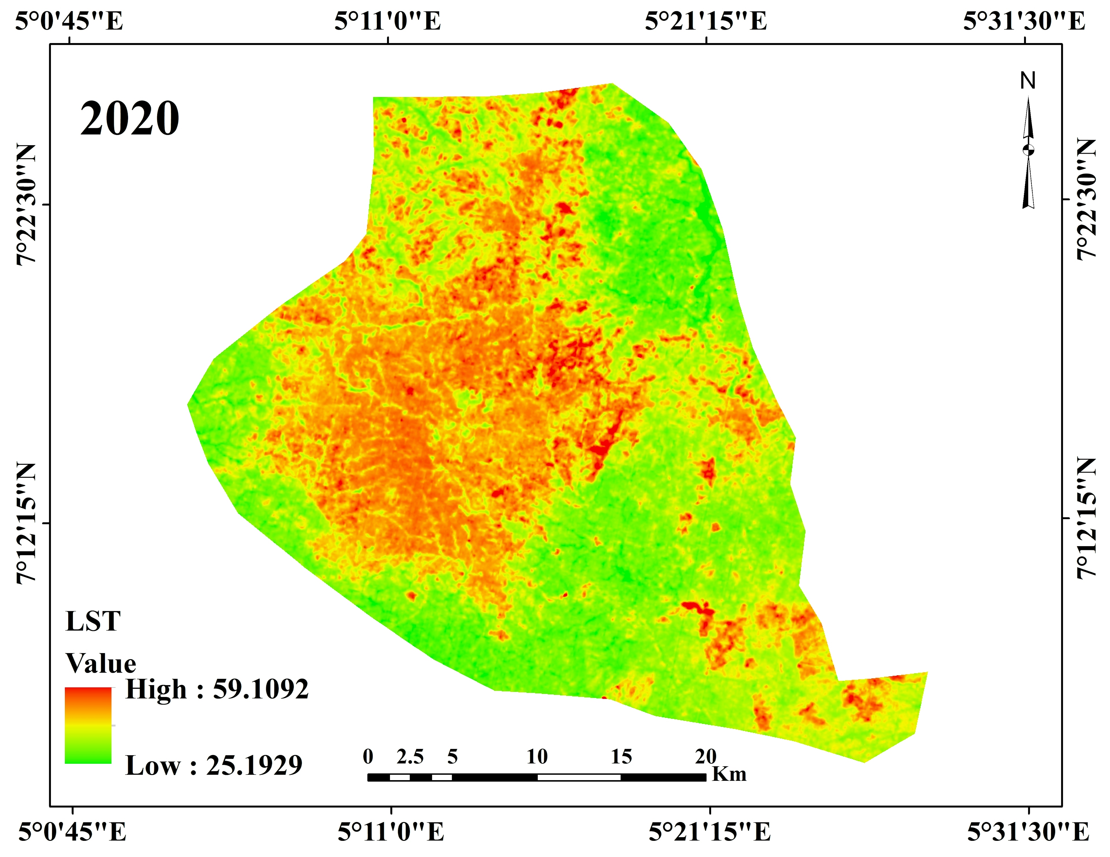
Time series analysis of land surface temperature in Quetta District, Pakistan
Land Surface Temperature
Tools used
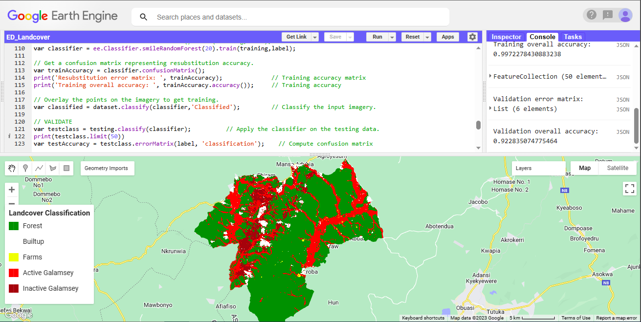
Google Earth Engine(GEE)
Plug-ins used
Google Chartstime series analysis
tags
Google Earth Engine(GEE)Spatial Analysis
More by Marvin Ayeh


You might also like
.gif&w=3840&q=100)


.svg "Keran Nkongolo")


Join the community!
We're a place where geospatial professionals showcase their works and discover opportunities.