
- Satellite Imagery
- Study Area Classification
- Field Calculation on ArcMap
- Map Embellishment
- Data Analysis (Excel)
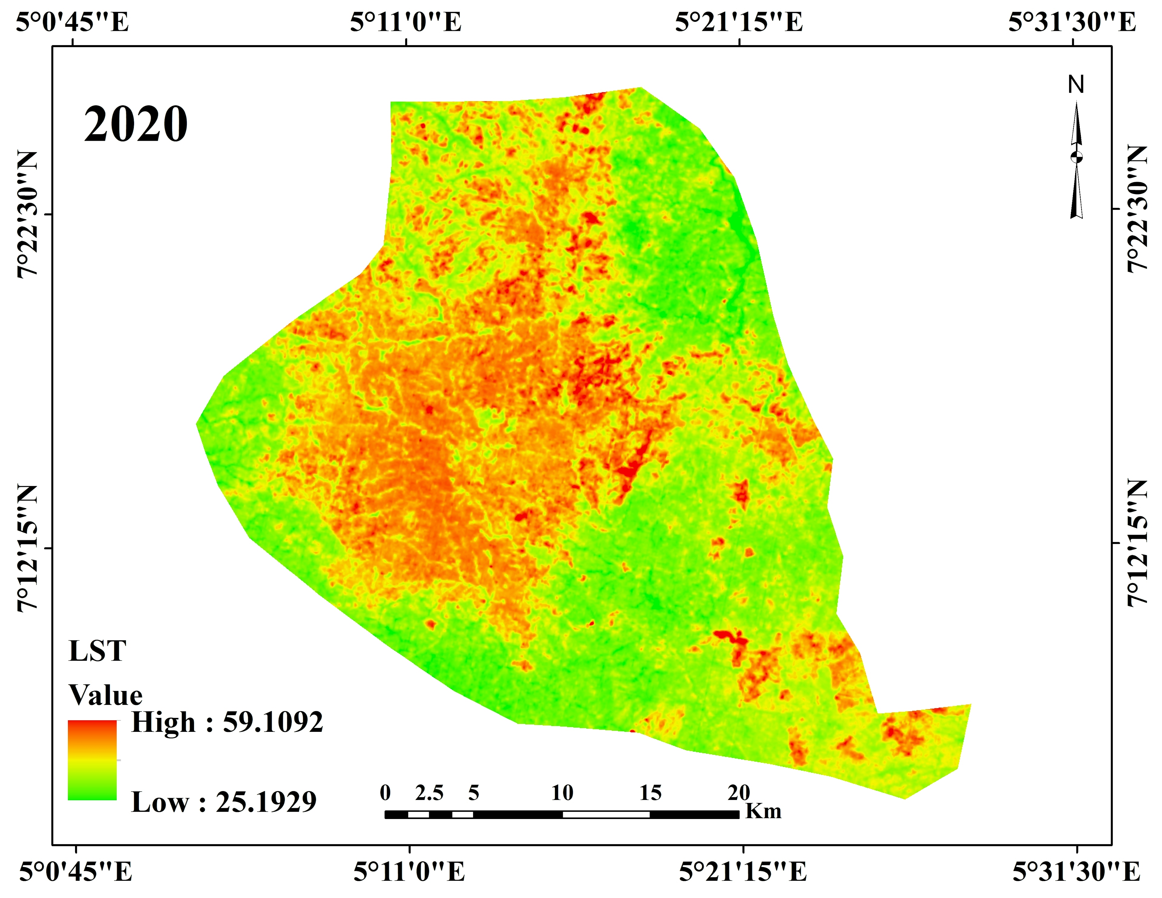
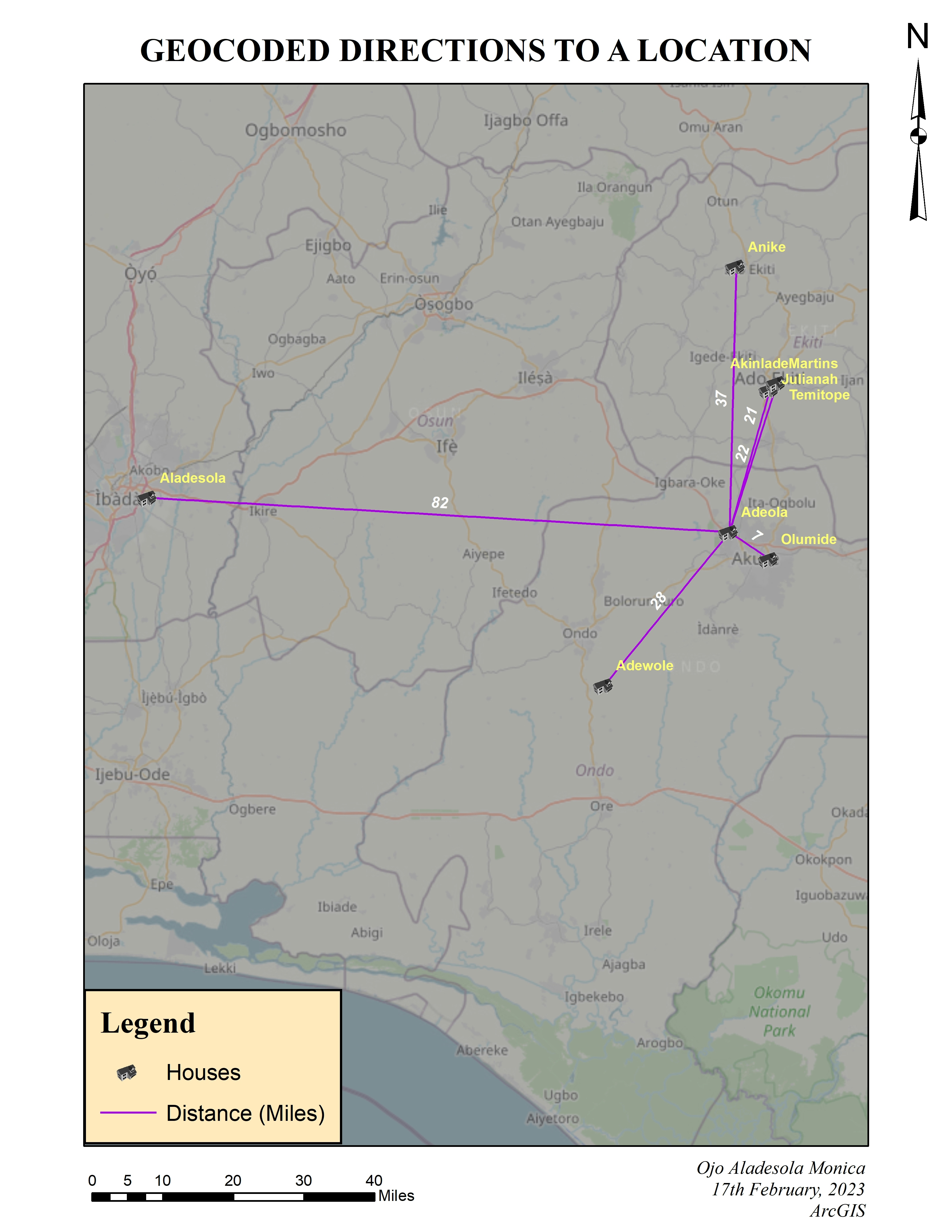
LST Map of Akure (North and South), 2020
Tools used
ArcMapclassification toolsGoogle Earth Engine(GEE)raster calculator USGS Earth Explorer
Plug-ins used
ArcGISArcMapExcelLandsat 8Spatial Analyst Toolbox
tags
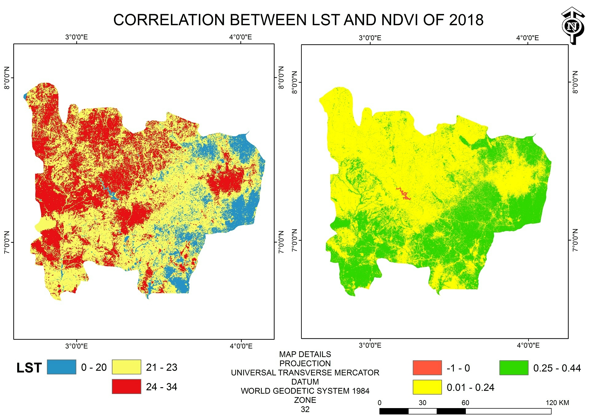
ArcGISArcMapLand surface temperatureNDVI Nigeria
More by Ojo Aladesola Monica


You might also like


.svg "Keran Nkongolo")
Join the community!
We're a place where geospatial professionals showcase their works and discover opportunities.