

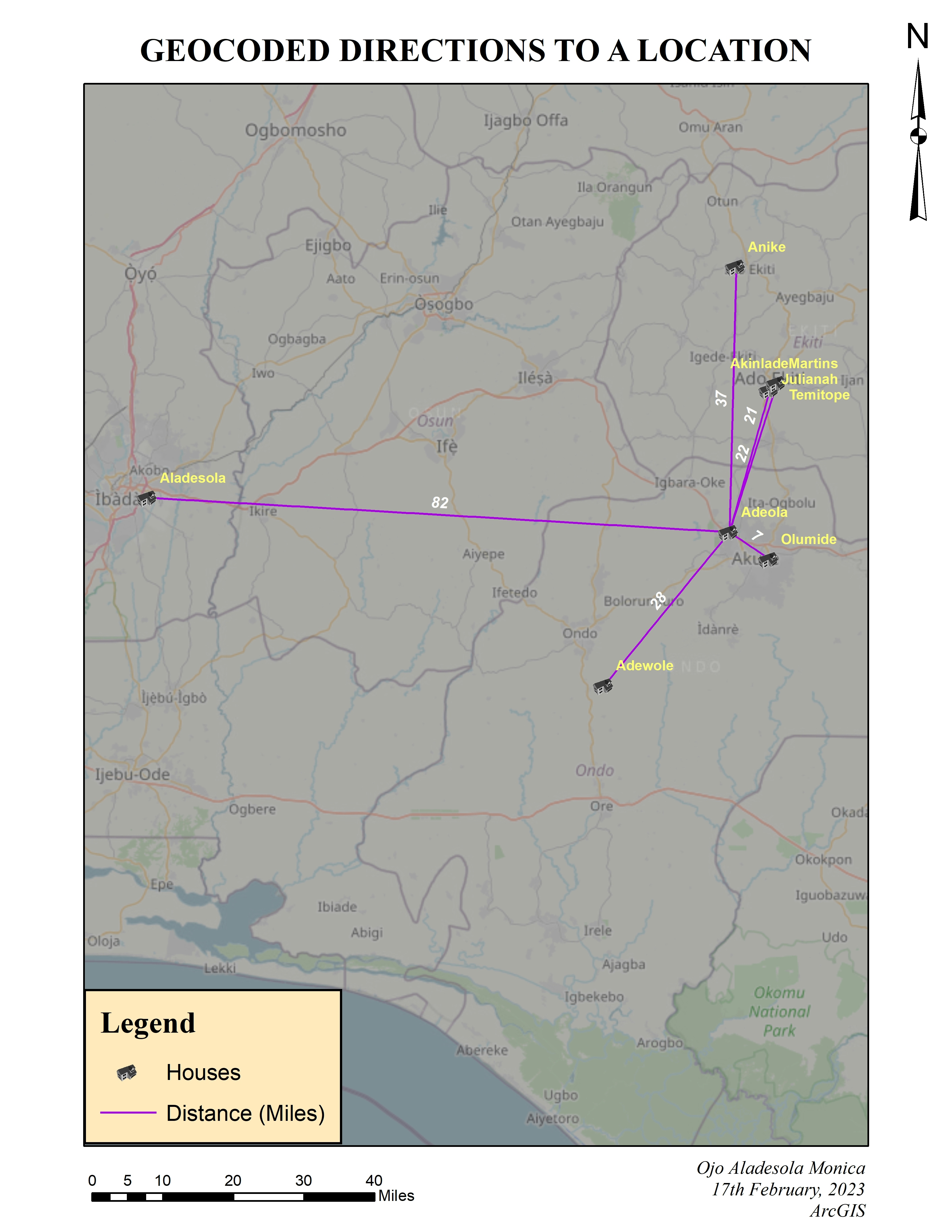
The study area was clipped from the Nigeria Boundary Map, and further embellished and exported. All done using ArcMap. Microsoft Office extension on ArcMap was used for the arrows.
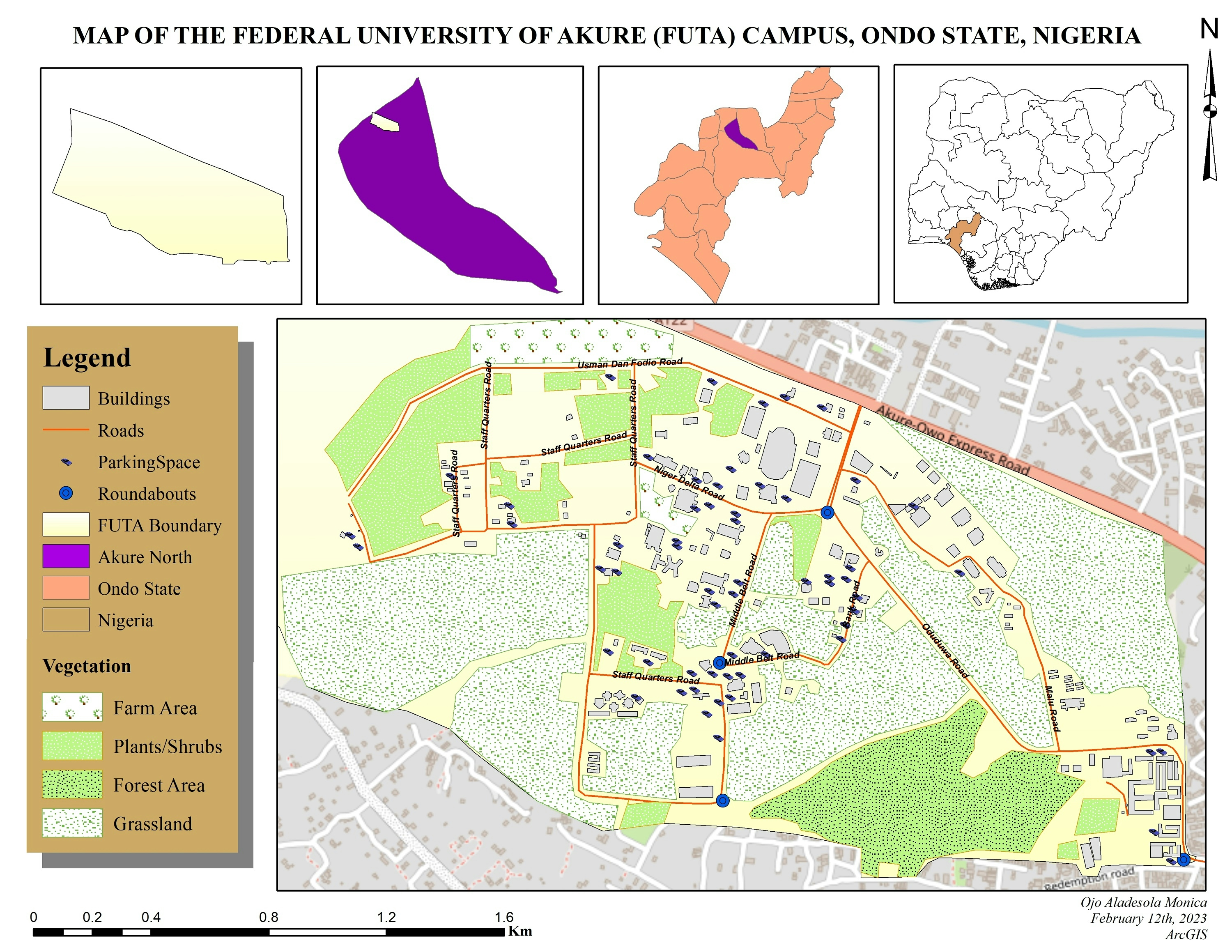
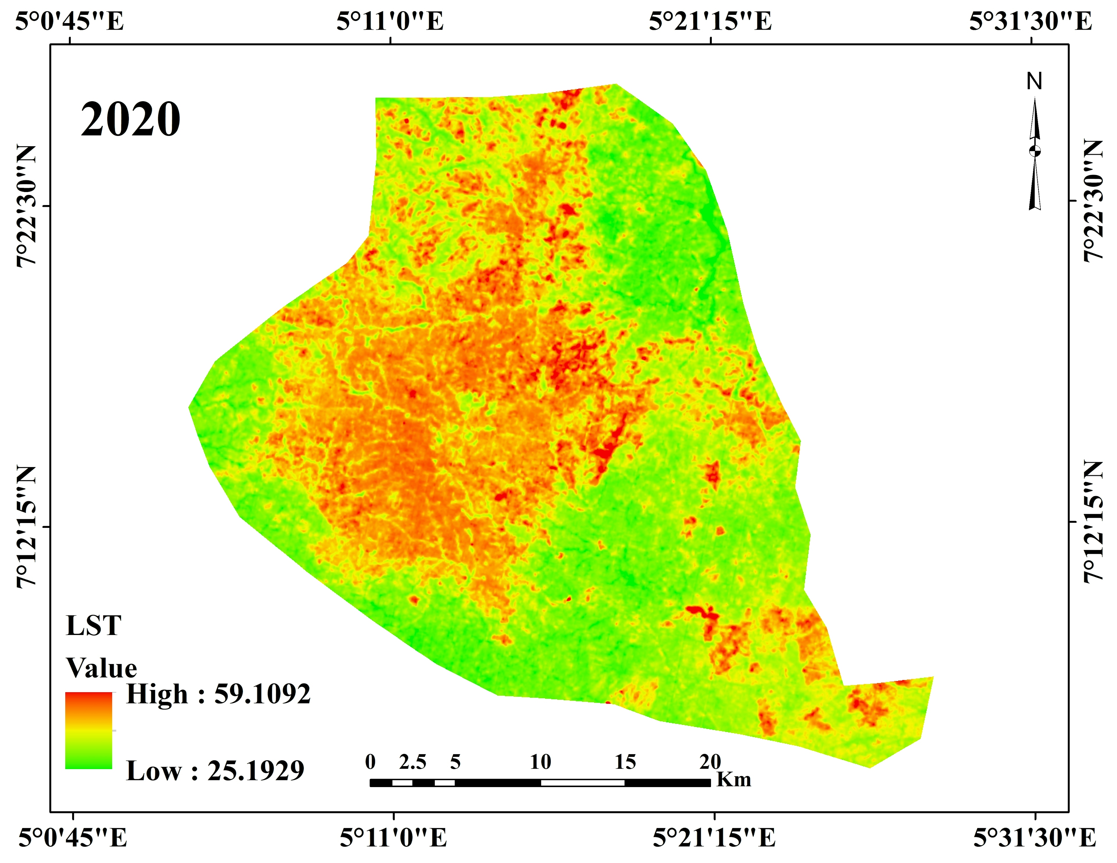
Akure, Ondo State, Nigeria
Tools used
ArcMapeditor toolsMicrosoft Access
Plug-ins used
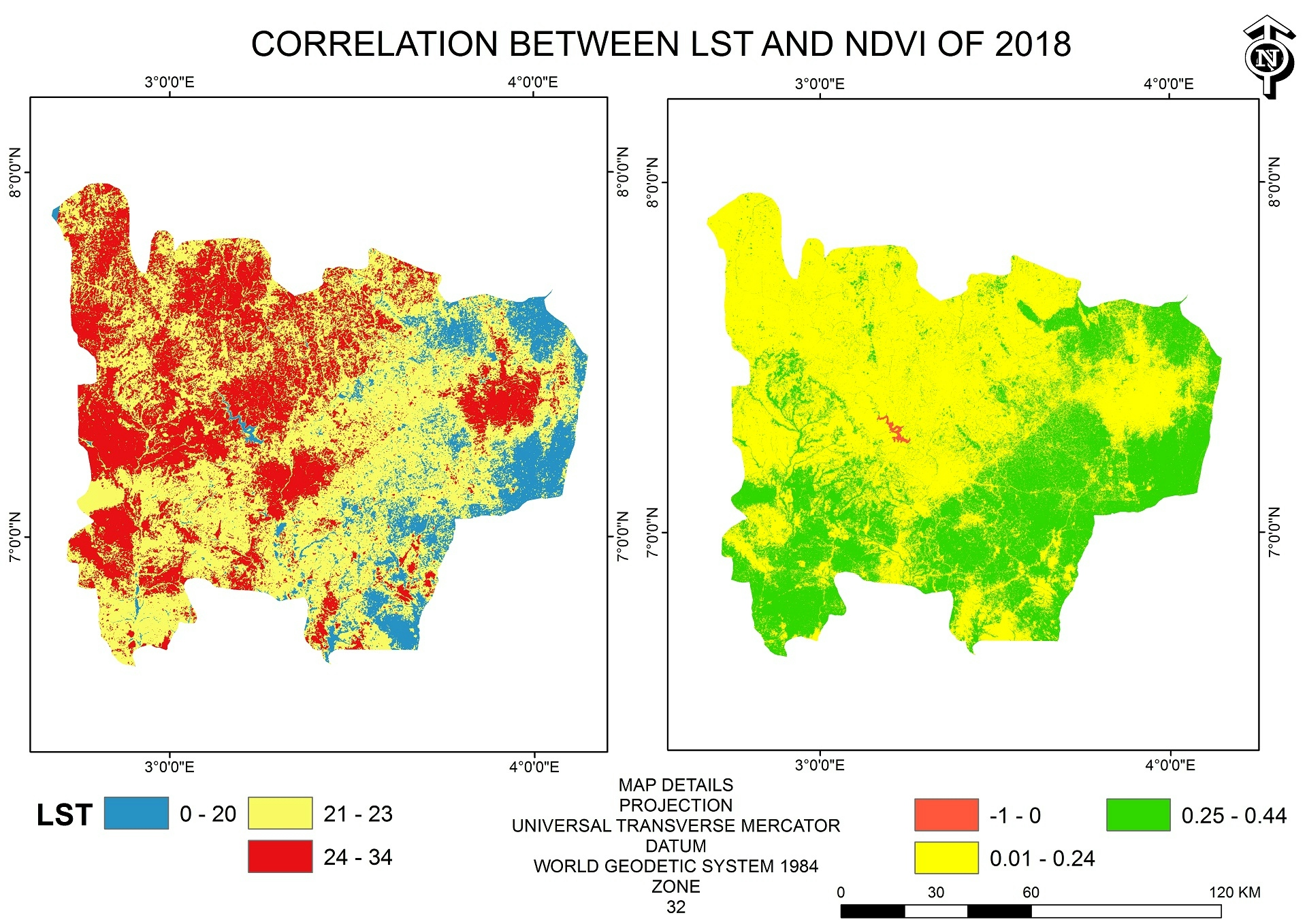
ArcGISArcMapData ManagementLayout ExportSpatial Analyst Toolbox
tags
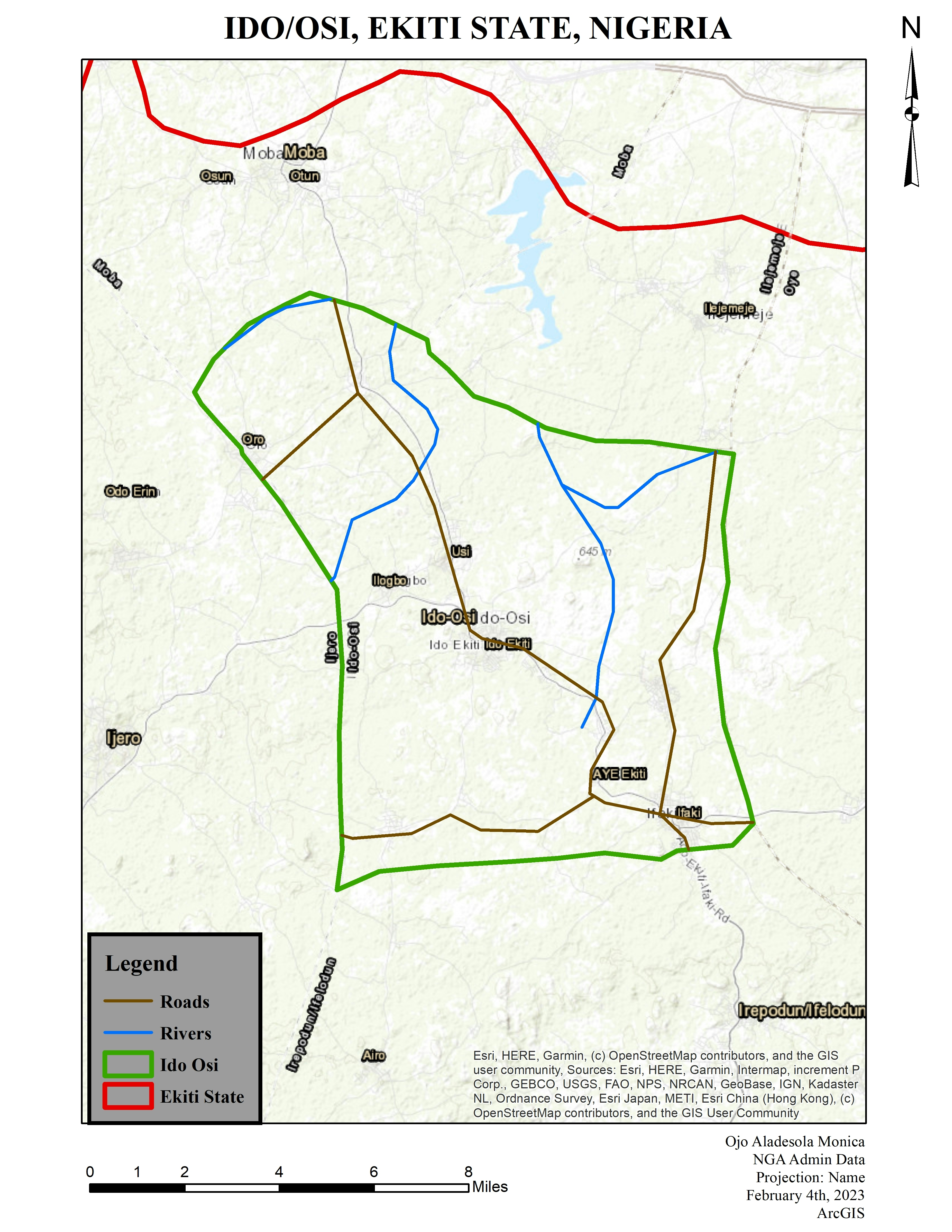
ArcGISArcMapMultiple map Frames Nigeria
More by Ojo Aladesola Monica

You might also like


.svg "Keran Nkongolo")


Join the community!
We're a place where geospatial professionals showcase their works and discover opportunities.